3,527 ft
Distance
11 ft
Climb
-177 ft
Descent
00:03:45
Avg time
Fire Line Details
-
Activities
- Mountain Bike
- E-Bike
-
Riding AreaColer Mountain Bike Preserve
Bentonville, Arkansas -
Difficulty Rating
-
Trail TypeSingletrack
-
Bike TypeAM, Adaptive MTB
-
DirectionDownhill OnlyPopular direction shown
-
Climb DifficultyGreen
-
Physical RatingModerate
-
Trail VisibilityAlways easy to follow
-
Dogs AllowedYes
-
eBike AllowedYes up to Class 1
-
TTFs on TrailBerm, Drop, Jump, Roller Coaster
-
Global Ranking
-
Local Popularity95 in Mountain Biking [+]
- 100 in E-Biking
-
OSM Way
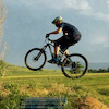
This directional intermediate downhill flow/jump trail starts at the Hub and ends at the northeast end of Coler. The trail includes many rollers, jumps and berms. It is great fun for all ages that are moderately skilled on a mountain bike.
Adaptive Bike Info
aMTB 1 Rating: No obstacles exist. Wide enough. Can be ridden confidently solo.
aMTB1x - wide open but advanced features exist
Local Trail Association
-

-

-
Please consider joining or donating to the local trail association to supportdonate to earn trail karma!
trail development & maintenance.
Traditionally Indigenous Territory
More Stats for Fire Line mountain bike trail trail
-
Altitude change-166 ft
-
Altitude min1,092 ft
-
Altitude max1,259 ft
-
Altitude start1,259 ft
-
Altitude end1,093 ft
-
Grade-4.7%
-
Grade max-29.4%
-
Grade min5.3%
-
Distance climb427 ft
-
Distance down2,562 ft
-
Distance flat535 ft
-
Avg time00:03:45
-
Avg reverse time00:16:55
- view trail stats
close
Trail Conditions
- Unknown
- Snow Groomed
- Snow Packed
- Snow Covered
- Snow Cover Inadequate
- Freeze/thaw Cycle
- Icy
- Prevalent Mud
- Wet
- Variable
- Ideal
- Dry
- Very Dry
Trail Flow (Ridden Direction)
Trailforks scans users ridelogs to determine the most popular direction each trail is ridden. A good flowing trail network will have most trails flowing in a single direction according to their intension.
The colour categories are based on what percentage of riders are riding a trail in its intended direction.
The colour categories are based on what percentage of riders are riding a trail in its intended direction.
- > 96%
- > 90%
- > 80%
- > 70%
- > 50%
- < 50%
- bi-directional trail
- no data
Trail Last Ridden
Trailforks scans ridelogs to determine the last time a trail was ridden.
- < 2 days
- < 1 week
- < 2 weeks
- < 1 month
- < 6 months
- > 6 months
Trail Ridden Direction
The intended direction a trail should be ridden.
- Downhill Only
- Downhill Primary
- Both Directions
- Uphill Primary
- Uphill Only
- One Direction
Contribute Details
Colors indicate trail is missing specified detail.
- Description
- Photos
- Description & Photos
- Videos
Trail Popularity ?
Trailforks scans ridelogs to determine which trails are ridden the most in the last 9 months.
Trails are compared with nearby trails in the same city region with a possible 25 colour shades.
Think of this as a heatmap, more rides = more kinetic energy = warmer colors.
- most popular
- popular
- less popular
- not popular
ATV/ORV/OHV Filter
Max Vehicle Width
inches
Radar Time
x
Activity Recordings
Trailforks users anonymized public ridelogs from the past 6 months.
- mountain biking recent
- mountain biking (>6 month)
- hiking (1 year)
- moto (1 year)
Activity Recordings
Trailforks users anonymized public skilogs from the past 12 months.
- Downhill Ski
- Backcountry Ski
- Nordic Ski
Jump Magnitude Heatmap
Heatmap of where riders jump on trails. Zoom in to see individual jumps, click circles to view jump details.
Trails Deemphasized
Trails are shown in grey.
Only show trails with NO bikes.
Save the current map location and zoom level as your default home location whenever this page is loaded.
Save
Directions to fire-line-85161 trailhead
(36.391590, -94.236100)
update trails status or condition
Fire Line Trail Reports
view all reports »
4 social media mentions
Recent Ridelog Activity on Trail
Past Week
- 65 rides
- 13 miles avg distance
6 Months
- 1,376 rides
- 15 miles avg distance
All
- 6,793 rides
Photos
more »
Routes with this trail
more »
-
+ 1
 Moonie2123
IDK if Bentonville is the MTB capital of the World, but Coler has certainly become the Ebike capital of world. Vroom vroom, no bueno.
[Reply]
jokermac
(Aug 14, 2020 at 15:02)
Fantastic trail! Worth the climb on Oscar. Pure joy riding downhill!
[Reply]
 provin1327
This trail is great! Jumps for days all very well built. A great jump progression trail.
[Reply]
Hhedges4
 (Jun 30, 2018 at 11:19)
Top of Fireline closed for trail work. Disappointed, but I’m sure it’ll be worth it.
[Reply]
JWBorchardt
(Jan 16, 2018 at 12:20)
My favorite trail in Northwest Arkansas. Starting at the hub and riding downhill, Fire Line has amazing flow.
[Reply]
Videos
more »


Nearby Trails
- Cease And Desist 0 ft
- Oscar's Loop 0 ft
- Rock Solid 0 ft
- Oscar's Loop (upper) 0 ft
- The Ridge Line 16 ft
Coler Mountain Bike Preserve
- embed Fire Line trail on your website
- By WanderingMan BSMTB & contributors
- #85161 - 5,186 views
- subscribe
- login to download gpx or kml files.