close
Trail Conditions
- Unknown
- Snow Groomed
- Snow Packed
- Snow Covered
- Snow Cover Inadequate
- Freeze/thaw Cycle
- Icy
- Prevalent Mud
- Wet
- Variable
- Ideal
- Dry
- Very Dry
Trail Flow (Ridden Direction)
Trailforks scans users ridelogs to determine the most popular direction each trail is ridden. A good flowing trail network will have most trails flowing in a single direction according to their intension.
The colour categories are based on what percentage of riders are riding a trail in its intended direction.
The colour categories are based on what percentage of riders are riding a trail in its intended direction.
- > 96%
- > 90%
- > 80%
- > 70%
- > 50%
- < 50%
- bi-directional trail
- no data
Trail Last Ridden
Trailforks scans ridelogs to determine the last time a trail was ridden.
- < 2 days
- < 1 week
- < 2 weeks
- < 1 month
- < 6 months
- > 6 months
Trail Ridden Direction
The intended direction a trail should be ridden.
- Downhill Only
- Downhill Primary
- Both Directions
- Uphill Primary
- Uphill Only
- One Direction
Contribute Details
Colors indicate trail is missing specified detail.
- Description
- Photos
- Description & Photos
- Videos
Trail Popularity ?
Trailforks scans ridelogs to determine which trails are ridden the most in the last 9 months.
Trails are compared with nearby trails in the same city region with a possible 25 colour shades.
Think of this as a heatmap, more rides = more kinetic energy = warmer colors.
- most popular
- popular
- less popular
- not popular
ATV/ORV/OHV Filter
Max Vehicle Width
inches
Radar Time
x
Activity Recordings
Trailforks users anonymized public ridelogs from the past 6 months.
- mountain biking recent
- mountain biking (>6 month)
- hiking (1 year)
- moto (1 year)
Activity Recordings
Trailforks users anonymized public skilogs from the past 12 months.
- Downhill Ski
- Backcountry Ski
- Nordic Ski
Jump Magnitude Heatmap
Heatmap of where riders jump on trails. Zoom in to see individual jumps, click circles to view jump details.
Trails Deemphasized
Trails are shown in grey.
Only show trails with NO bikes.
Save the current map location and zoom level as your default home location whenever this page is loaded.
SaveThe New Coler Preserve Just finished in November of 2016 features a little bit of everything from base mountain green all the way to double black diamond jump trails and black diamond rock trails.
Primary Trail Type: All-Mountain & Downhill
AKA: Coler Mountain Bike Preserve, Pumpkin Hollow
Land Status: City Managed
 google parking directions
 Access Info:
Either side of the mountain at the two main parking lots. one on the east side of the mountain is mainly used for trail maintenance but you can use it if nothing is going on. The other main one most people go to is the cement parking lot on the west side of the mountain that is the official parking lot for this place. has the main trail head and maps.
Activities Click to view
- Mountain Bike
49 trails
- E-Bike
49 trails
- Hike
34 trails
- Trail Running
34 trails
Region Details
- 6
- 2
- 12
- 12
- 8
- 6
Region Status
Open as of Jun 1, 2022Stats
- Avg Trail Rating
- Trails (view details)
- 46
- Trails Mountain Bike
- 49
- Trails E-Bike
- 49
- Trails Hike
- 34
- Trails Trail Running
- 34
- Total Distance
- 22 miles
- Total Descent Distance
- 9 miles
- Total Descent
- 2,413 ft
- Total Vertical
- 181 ft
- Highest Trailhead
- 1,263 ft
- Reports
- 534
- Photos
- 126
- Ridden Counter
- 38,419
Popular Coler Mountain Bike Preserve Trails
Mountain Bike Routes
| title | rating | distance |
|---|---|---|
| Coler Wet Weather Route | 7 miles | |
| Coler MTB Preserve North Parking Lot Start | 7 miles | |
| Phat Tire Route 2 | 6 miles | |
| aMTB1 Coler Route | 7 miles | |
| Coler BTB Park | 5 miles |
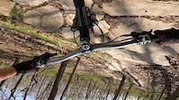
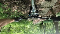
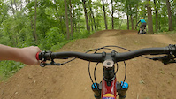
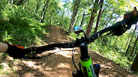
Photos of Coler Mountain Bike Preserve Mountain Bike
trail: Cease and Desist
25 |
Jun 28, 2022 @ 6:12am
Jun 28, 2022
trail: Good Vibrations
15 |
May 20, 2022 @ 7:04am
May 20, 2022
trail: Hardway to Cafe
44 |
May 20, 2022 @ 6:49am
May 20, 2022
trail: Esthers
14 |
May 11, 2022 @ 8:03am
May 11, 2022
trail: Oscar's Loop
45 |
May 11, 2022 @ 7:37am
May 11, 2022
trail: Drop the Hammer
55 |
Apr 29, 2022 @ 9:37pm
Apr 29, 2022
trail: Drop the Hammer
111 |
Apr 29, 2022 @ 9:37pm
Apr 29, 2022
trail: Family Flow
47 |
Apr 25, 2022 @ 7:50pm
Apr 25, 2022Videos of Coler Mountain Bike Preserve Mountain Bike
trail: Hardway to Cafe
44 |
Jun 9, 2022

trail: Rock Solid
22 |
Jun 9, 2022
trail: Rock Soft
14 |
Jun 9, 2022

trail: Fire Line
60 |
May 16, 2022
trail: Thunder Dome
272 |
Jun 18, 2021

trail: Water Tower Access
81 |
Nov 18, 2020

trail: Fire Line
2:08 |
186 |
Sep 3, 2020
trail: Cease and Desist
0:28 |
443 |
Jun 14, 2020
Current Trail Warnings
| status | trail | date | condition | user | info |
|---|---|---|---|---|---|
| Here's Johnny | Jun 19, 2022 @ 5:42am Jun 19, 2022 | Dry | ICUJeremy | E-Bike Large tree down about 3/5’s of the way... |
Recent Trail Reports
| status | trail | date | condition | info | user |
|---|---|---|---|---|---|
| Fire Line | Jul 2, 2022 @ 8:02am Jul 2, 2022 | Dry | kmphill84 | ||
| Service Road | Jul 2, 2022 @ 8:02am Jul 2, 2022 | Dry | kmphill84 | ||
| Family Flow Return | Jul 2, 2022 @ 8:02am Jul 2, 2022 | Dry | kmphill84 | ||
| Family Flow | Jul 2, 2022 @ 8:02am Jul 2, 2022 | Dry | kmphill84 | ||
| Thunder Dome Pathway | Jul 2, 2022 @ 8:02am Jul 2, 2022 | Dry | kmphill84 | ||
| Oscar's Loop (Upper) | Jun 21, 2022 @ 9:57pm Jun 21, 2022 | Ideal | Ampfrog | ||
| Oscar's Loop | Jun 19, 2022 @ 5:42am Jun 19, 2022 | Dry | ICUJeremy | ||
| Hardway to Cafe | Jun 19, 2022 @ 5:42am Jun 19, 2022 | Dry | ICUJeremy | ||
| Oscar's Loop | Jun 19, 2022 @ 5:42am Jun 19, 2022 | Dry | ICUJeremy | ||
| Pedal Assist | Jun 19, 2022 @ 5:42am Jun 19, 2022 | Dry | ICUJeremy |
Activity Feed
| username | action | type | title | date | |
|---|---|---|---|---|---|
 | meyerpigott | ridden | trail | Family Flow | Jul 3, 2022 @ 8:14am 3 days |
| tculp | wishlist | route | Coler Wet Weather Route | Jul 3, 2022 @ 6:25am 3 days |
 | kmphill84 | add | report | Fire Line and 4 more | Jul 3, 2022 @ 3:32am Jul 3, 2022 |
| HammerstoneMTB | vote | trail | Rock Solid | Jun 30, 2022 @ 7:24am Jun 30, 2022 |
| dbirdtheword | wishlist | trail | Thunder Dome | Jun 29, 2022 @ 9:50pm Jun 29, 2022 |
Recent Comments
| username | type | title | comment | date | |
|---|---|---|---|---|---|
 | trail | So much fun! Probably want to do a mellow... | Jun 24, 2022 @ 1:50am Jun 24, 2022 | ||
| trail | Rode northbound, good warm-up on the way to... | Jun 21, 2022 @ 9:58pm Jun 21, 2022 | ||
| trail | Rode northbound, fun sections of tech along... | Jun 21, 2022 @ 9:56pm Jun 21, 2022 | ||
 | trail | Lots of people hit and clear all these small... | Jun 9, 2022 @ 1:15pm Jun 9, 2022 | ||
 | trail | IDK if Bentonville is the MTB capital of the... | May 30, 2022 @ 7:26am May 30, 2022 |
Nearby Areas
| name | distance | ||||
|---|---|---|---|---|---|
| Park Spring Park | 9 | 9 | 3 | 1.4 km | |
| Crystal Bridges | 5 | 4 | 1.7 km | ||
| Slaughter Pen Trails | 21 | 42 | 11 | 7 | 1.8 km |
| Bentonville Greenways and Access Paths | 1 | 2.4 km | |||
| HandCut Hollow | 1 | 12 | 9 | 3.5 km |
Local Badges
-

Completionist0 awarded
Activity Type Stats
| activitytype | trails | distance | descent | descent distance | total vertical | rating | global rank | state rank | photos | reports | routes | ridelogs |
|---|---|---|---|---|---|---|---|---|---|---|---|---|
| Mountain Bike | 49 | 22 miles | 2,415 ft | 9 miles | 180 ft | #130 | #52 | 125 | 529 | 5 | 13,307 | |
| E-Bike | 49 | 22 miles | 2,415 ft | 9 miles | 180 ft | #47 | #13 | 484 | 1 | 540 | ||
| Hike | 34 | 16 miles | 1,371 ft | 6 miles | 180 ft | #200 | #108 | 1 | 480 | 141 | ||
| Trail Running | 34 | 16 miles | 1,371 ft | 6 miles | 180 ft | #199 | #105 | 480 | 214 |
- By Hotrod4989
 & contributors
 - Admins: FAST, Bentonville, jpmcghee, CMBP
- #17174 - 45,659 views
- coler mountain bike preserve activity log | embed map of Coler Mountain Bike Preserve mountain bike trails | coler mountain bike preserve mountain biking points of interest
Downloading of trail gps tracks in kml & gpx formats is enabled for Coler Mountain Bike Preserve.
You must login to download files.