340 ft
Distance
-40 ft
Descent
00:00:15
Avg time
Supporters, Builders, Maintainers & Land Managers of Empress Bypass Exit Trail

Dave ClendenanBuilder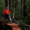
Patrick PodolskiBuilder
Empress Bypass Exit Details
-
Activities
- Mountain Bike
-
Riding AreaMount Seymour
North Vancouver, British Columbia -
Difficulty Rating
-
Trail TypeMachine Groomed
-
Bike TypeDH, AM, XC, Adaptive MTB
-
DirectionDownhill OnlyPopular direction shown
-
Family FriendlyYes
-
Dogs AllowedYes
-
TTFs on TrailBerm
-
Ride in RainYes
-
Global Ranking#393 in Mountain Biking
-
Local Popularity90 in Mountain Biking
-
Land ManagerBC Parks
Bonus section added to Empress Bypass as part of the Seymour Adaptive MTB Loop work in 2019. Also a great place for younger riders to practice their cornering
Local Trail Association
-

-

-
Please consider joining or donating to the local trail association to supportdonate to earn trail karma!
trail development & maintenance.
Traditionally Indigenous Territory
More Stats for Empress Bypass Exit mountain bike trail trail
-
Altitude change-40 ft
-
Altitude min412 ft
-
Altitude max452 ft
-
Altitude start452 ft
-
Altitude end412 ft
-
Grade-11.668%
-
Grade max-13.727%
-
Grade min-7.351%
-
Distance down340 ft
-
Avg time00:00:15
-
Avg reverse time00:00:47
- view trail stats
close
Trail Conditions
- Unknown
- Snow Groomed
- Snow Packed
- Snow Covered
- Snow Cover Inadequate
- Freeze/thaw Cycle
- Icy
- Prevalent Mud
- Wet
- Variable
- Ideal
- Dry
- Very Dry
Trail Flow (Ridden Direction)
Trailforks scans users ridelogs to determine the most popular direction each trail is ridden. A good flowing trail network will have most trails flowing in a single direction according to their intension.
The colour categories are based on what percentage of riders are riding a trail in its intended direction.
The colour categories are based on what percentage of riders are riding a trail in its intended direction.
- > 96%
- > 90%
- > 80%
- > 70%
- > 50%
- < 50%
- bi-directional trail
- no data
Trail Last Ridden
Trailforks scans ridelogs to determine the last time a trail was ridden.
- < 2 days
- < 1 week
- < 2 weeks
- < 1 month
- < 6 months
- > 6 months
Trail Ridden Direction
The intended direction a trail should be ridden.
- Downhill Only
- Downhill Primary
- Both Directions
- Uphill Primary
- Uphill Only
- One Direction
Contribute Details
Colors indicate trail is missing specified detail.
- Description
- Photos
- Description & Photos
- Videos
Trail Popularity ?
Trailforks scans ridelogs to determine which trails are ridden the most in the last 9 months.
Trails are compared with nearby trails in the same city region with a possible 25 colour shades.
Think of this as a heatmap, more rides = more kinetic energy = warmer colors.
- most popular
- popular
- less popular
- not popular
ATV/ORV/OHV Filter
Max Vehicle Width
inches
Radar Time
x
Activity Recordings
Trailforks users anonymized public ridelogs from the past 6 months.
- mountain biking recent
- mountain biking (>6 month)
- hiking (1 year)
- moto (1 year)
Activity Recordings
Trailforks users anonymized public skilogs from the past 12 months.
- Downhill Ski
- Backcountry Ski
- Nordic Ski
Jump Magnitude Heatmap
Heatmap of where riders jump on trails. Zoom in to see individual jumps, click circles to view jump details.
Trails Deemphasized
Trails are shown in grey.
Only show trails with NO bikes.
Save the current map location and zoom level as your default home location whenever this page is loaded.
Save
Directions to empress-bypass-exit trailhead
(49.324030, -122.972980)
update trails status or condition
Empress Bypass Exit Trail Reports
view all reports »
Recent Ridelog Activity on Trail
Past Week
- 35 rides
- 8 miles avg distance
6 Months
- 991 rides
- 8 miles avg distance
All
- 12,338 rides
Photos
no photos have been added for Empress Bypass Exit yet, add a photo.
Routes with this trail
more »
Trail Products
Videos
more »

15:16 |
25 |
Jan 25, 2022 , North Vancouver
Nearby Trails
- Empress Bypass Connector 272 ft
- Perimeter Trail 574 ft
- Old Buck 646 ft
- Old Buck Parking Lot 728 ft
- Parkgate Gravel Path 889 ft
- embed Empress Bypass Exit trail on your website
- By brenthillier
 NSMBA TRAILFORKS & contributors
 - #178138 - 860 views
- subscribe
- login to download gpx or kml files.