Supporters, Builders, Maintainers & Land Managers of Crestino Pt. 1 Trail

Finale Outdoor RegionLand Manager
Crestino Pt. 1 Details
-
Activities
- Mountain Bike
-
Riding AreaFinale Outdoor Region
Finale Ligure -
Ref Number#95
-
AKABase Nato - Cravarezza/Crestino
-
Difficulty Rating
-
Voted DifficultyGreen (3 votes)
-
Trail TypeSingletrack
-
Bike TypeAM, XC, Adaptive MTB, Gravel
-
DirectionOne DirectionPopular direction shown
-
Climb DifficultyGreen
-
Physical RatingEasy
-
Trail VisibilityAlways easy to follow
-
SeasonAll-year round
-
Dogs AllowedYes
-
eBike AllowedYes up to Class 1
-
Global Ranking#683 in Mountain Biking
-
Local Popularity95 in Mountain Biking
-
Land ManagerFinale Outdoor Region
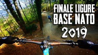
This first part of Crestino trail comprises of many different sections. Is the main access not only to the area of Vezzi and the east but also to the Mallare Area. After the first traverse that ends to Colla Cravarezza and 5 minutes of riding uphill, arguably the easiest trail in Finale starts. Flowy, with some banks and a few roots every here and there, it is a great section to start your day with.
Access Info
Nato Base Area is reachable from the E80 highway accessing Orco Feglino, then drive north on the SP23 until the windmills under the Base.
Disclaimer
The first part can be technical in some sections. After a short climb, the easier section starts. Given its nature, the trail can change after weather happenings and season changes. Always pay attention.
Local Trail Association
-
-
Please consider joining or donating to the local trail association to supportdonate to earn trail karma!
trail development & maintenance.
More Stats for Crestino Pt. 1 mountain bike trail trail
-
Altitude change-649 ft
-
Altitude min2,696 ft
-
Altitude max3,356 ft
-
Altitude start3,345 ft
-
Altitude end2,697 ft
-
Grade-5.6%
-
Grade max-52%
-
Grade min24%
-
Distance climb2,201 ft
-
Distance down2 miles
-
Distance flat591 ft
-
Avg time00:21:33
-
Avg reverse time00:22:42
- view trail stats
- Unknown
- Snow Groomed
- Snow Packed
- Snow Covered
- Snow Cover Inadequate
- Freeze/thaw Cycle
- Icy
- Prevalent Mud
- Wet
- Variable
- Ideal
- Dry
- Very Dry
The colour categories are based on what percentage of riders are riding a trail in its intended direction.
- > 96%
- > 90%
- > 80%
- > 70%
- > 50%
- < 50%
- bi-directional trail
- no data
- < 2 days
- < 1 week
- < 2 weeks
- < 1 month
- < 6 months
- > 6 months
- Downhill Only
- Downhill Primary
- Both Directions
- Uphill Primary
- Uphill Only
- One Direction
- Description
- Photos
- Description & Photos
- Videos
- most popular
- popular
- less popular
- not popular
- mountain biking recent
- mountain biking (>6 month)
- hiking (1 year)
- moto (1 year)
- Downhill Ski
- Backcountry Ski
- Nordic Ski
Save the current map location and zoom level as your default home location whenever this page is loaded.
SaveCrestino Pt. 1 Trail Reports
Recent Ridelog Activity on Trail
Past Week
- 6 rides
- 33 miles avg distance
6 Months
- 258 rides
- 25 miles avg distance
All
- 4,323 rides
Photos
Routes with this trail
Videos


Nearby Trails
- Base Nato 0 ft
- 115 361 ft
- Madre Natura 361 ft
- H Trail 1,470 ft
- Variante Per La Base Nato 5,240 ft
Finale Outdoor Region
- embed Crestino Pt. 1 trail on your website
- By denitopia
 TRAILFORKS & contributors
 - #37032 - 9,016 views
- subscribe
- login to download gpx or kml files.