close
Trail Conditions
- Unknown
- Snow Groomed
- Snow Packed
- Snow Covered
- Snow Cover Inadequate
- Freeze/thaw Cycle
- Icy
- Prevalent Mud
- Wet
- Variable
- Ideal
- Dry
- Very Dry
Trail Flow (Ridden Direction)
Trailforks scans users ridelogs to determine the most popular direction each trail is ridden. A good flowing trail network will have most trails flowing in a single direction according to their intension.
The colour categories are based on what percentage of riders are riding a trail in its intended direction.
The colour categories are based on what percentage of riders are riding a trail in its intended direction.
- > 96%
- > 90%
- > 80%
- > 70%
- > 50%
- < 50%
- bi-directional trail
- no data
Trail Last Ridden
Trailforks scans ridelogs to determine the last time a trail was ridden.
- < 2 days
- < 1 week
- < 2 weeks
- < 1 month
- < 6 months
- > 6 months
Trail Ridden Direction
The intended direction a trail should be ridden.
- Downhill Only
- Downhill Primary
- Both Directions
- Uphill Primary
- Uphill Only
- One Direction
Contribute Details
Colors indicate trail is missing specified detail.
- Description
- Photos
- Description & Photos
- Videos
Trail Popularity ?
Trailforks scans ridelogs to determine which trails are ridden the most in the last 9 months.
Trails are compared with nearby trails in the same city region with a possible 25 colour shades.
Think of this as a heatmap, more rides = more kinetic energy = warmer colors.
- most popular
- popular
- less popular
- not popular
ATV/ORV/OHV Filter
Max Vehicle Width
inches
Radar Time
x
Activity Recordings
Trailforks users anonymized public ridelogs from the past 6 months.
- mountain biking recent
- mountain biking (>6 month)
- hiking (1 year)
- moto (1 year)
Activity Recordings
Trailforks users anonymized public skilogs from the past 12 months.
- Downhill Ski
- Backcountry Ski
- Nordic Ski
Jump Magnitude Heatmap
Heatmap of where riders jump on trails. Zoom in to see individual jumps, click circles to view jump details.
Trails Deemphasized
Trails are shown in grey.
Only show trails with NO bikes.
Save the current map location and zoom level as your default home location whenever this page is loaded.
Save
No description for Glenwild has been added yet!
Login or register to submit one.
 google parking directions
google parking directions Activities Click to view
- Mountain Bike
31 trails
- Hike
26 trails
- Trail Running
26 trails
Region Details
- 2
- 3
- 24
- 2
Region Status
Caution as of Jun 19, 2022Stats
- Avg Trail Rating
- Trails (view details)
- 31
- Trails Mountain Bike
- 31
- Trails E-Bike
- 2
- Trails Hike
- 26
- Trails Trail Running
- 26
- Trails Nordic Ski
- 1
- Total Distance
- 48 miles
- Total Descent
- 6,719 ft
- Total Vertical
- 1,956 ft
- Highest Trailhead
- 7,766 ft
- Reports
- 1,187
- Photos
- 201
- Ridden Counter
- 29,209
Popular Glenwild Mountain Biking Trails
Glenwild Mountain Bike Routes
| title | rating | distance |
|---|---|---|
| Short Flying Dog | 8 miles | |
| Short Flying Dog + Ant Farm | 14 miles | |
| Flying Dog Loop from Bad Apple | 19 miles | |
| Extended Flying Dog | 22 miles | |
| Glenwild Lunch Loop | 5 miles | |
| JHS: PC - Glenwild (Beginners) | 5 miles | |
| Mormon Sheep | 19 miles | |
| 17 mile Glenwild Ride | popular ridelog | 17 miles |
| 20 mile Glenwild Ride | popular ridelog | 20 miles |
| 15 mile Glenwild Ride | popular ridelog | 15 miles |
Photos of Glenwild Mountain Bike
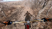
trail: Flying Dog
25 |
May 23, 2022 @ 7:04am
May 23, 2022
trail: The Drop Out
32 |
Sep 1, 2021 @ 11:51am
Sep 1, 2021
trail: Jeremy Ranch Road
64 |
Jun 19, 2021 @ 12:52pm
Jun 19, 2021
trail: Jeremy Ranch Road
48 |
Jun 19, 2021 @ 12:52pm
Jun 19, 2021
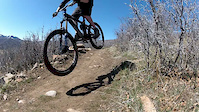
trail: Flying Dog
67 |
May 27, 2021 @ 8:02am
May 27, 2021
trail: Flying Dog
80 |
May 27, 2021 @ 8:02am
May 27, 2021
trail: Flying Dog
63 |
May 27, 2021 @ 8:02am
May 27, 2021
trail: Flying Dog
54 |
May 27, 2021 @ 8:01am
May 27, 2021Videos of Glenwild Mountain Bike
trail: Flying Dog
0:13 |
232 |
Oct 18, 2020
trail: Team Cutthroat DH
1:14 |
817 |
Apr 4, 2012

trail: Flying Dog
5:44 |
554 |
May 31, 2010

trail: Team Cutthroat DH
10:35 |
153 |
Jul 16, 2021 , Park City

trail: Ant Farm
10:35 |
119 |
Jul 16, 2021 , Park City

trail: Bad Apple
10:35 |
101 |
Jul 16, 2021 , Park City

trail: Ant Farm
3:51 |
377 |
Mar 21, 2021 , Park City

trail: The Drop Out
3:51 |
372 |
Mar 21, 2021 , Park City
Current Trail Warnings
| status | trail | date | condition | user | info |
|---|---|---|---|---|---|
| Sunrise Drive | Jun 7, 2022 @ 8:37am Jun 7, 2022 | Prevalent Mud | tinypip | Horrendously muddy, much more than all... |
Recent Trail Reports
| status | trail | date | condition | info | user |
|---|---|---|---|---|---|
| Bad Apple | Jun 30, 2022 @ 1:06pm Jun 30, 2022 | Ideal | A-Pex-USA | ||
| Fink Again | Jun 30, 2022 @ 1:06pm Jun 30, 2022 | Ideal | A-Pex-USA | ||
| 24-7 | Jun 30, 2022 @ 1:06pm Jun 30, 2022 | Variable | A-Pex-USA | ||
| 24-7 Access | Jun 30, 2022 @ 1:06pm Jun 30, 2022 | Ideal | A-Pex-USA | ||
| The Avenue | Jun 26, 2022 @ 9:09am Jun 26, 2022 | Dry | Leondaniel | ||
| Jeremy Ranch Road | Jun 19, 2022 @ 12:02pm Jun 19, 2022 | Ideal | A-Pex-USA | ||
| The Drop Out | Jun 19, 2022 @ 11:13am Jun 19, 2022 | Dry | A-Pex-USA | ||
| Drop Out | Jun 19, 2022 @ 11:13am Jun 19, 2022 | Dry | A-Pex-USA | ||
| The Graduate | Jun 19, 2022 @ 11:13am Jun 19, 2022 | Dry | A-Pex-USA | ||
| Ant Farm | Jun 18, 2022 @ 6:30am Jun 18, 2022 | Dry | smokingtires |
Activity Feed
| username | action | type | title | date | |
|---|---|---|---|---|---|
 | Leondaniel | vote | trail | Upper Avenues | Jul 5, 2022 @ 9:58pm 6 hours |
| Leondaniel | ridden | trail | Upper Avenues | Jul 5, 2022 @ 9:58pm 6 hours |
| barnold99 | ridden | trail | Glenwild and 6 more | Jul 4, 2022 @ 8:01pm 1 day |
 | bdard | wishlist | region | Glenwild | Jul 4, 2022 @ 6:29am 2 days |
| Mdahud | ridden | trail | Flying Dog | Jul 3, 2022 @ 4:26pm 2 days |
Recent Comments
| username | type | title | comment | date | |
|---|---|---|---|---|---|
 | trail | I went faster than you ;) | Jun 20, 2022 @ 8:43am Jun 20, 2022 | ||
| trail | Try more speed :) | Jun 20, 2022 @ 8:15am Jun 20, 2022 | ||
| trail | This is arguably the best of the 3 "freeride"... | Jun 20, 2022 @ 7:55am Jun 20, 2022 | ||
| trail | The fact that this is the most popular of the... | Jun 20, 2022 @ 7:54am Jun 20, 2022 | ||
| trail | This could be a really cool trail, has some... | Jun 20, 2022 @ 7:53am Jun 20, 2022 |
Nearby Areas
| name | distance | ||||
|---|---|---|---|---|---|
| Woodward Park City | 5 | 3 | 1 | 1 | 2.3 km |
| Utah Olympic Park | 7 | 15 | 5 | 2.4 km | |
| Trailside Park | 18 | 10 | 3 | 3.1 km | |
| North Basin | 1 | 8 | 2 | 4 km | |
| Promontory | 3 | 5.2 km |
Local Badges
-

Completionist1 awarded
Bike & Skill Parks
| name | type | city | rating |
|---|---|---|---|
| East Canyon Pumptrack | skill park | Park City |
Upcoming Local Events
Local Products
Local Products
Activity Type Stats
| activitytype | trails | distance | descent | descent distance | total vertical | rating | global rank | state rank | photos | reports | routes | ridelogs |
|---|---|---|---|---|---|---|---|---|---|---|---|---|
| Mountain Bike | 31 | 48 miles | 6,719 ft | 24 miles | 1,955 ft | #132 | #54 | 201 | 1,183 | 7 | 16,859 | |
| E-Bike | 2 | 3 miles | 26 ft | 2,848 ft | 75 ft | 884 | 112 | |||||
| Hike | 26 | 45 miles | 5,751 ft | 21 miles | 1,955 ft | #129 | #65 | 1,136 | 1 | 260 | ||
| Trail Running | 26 | 45 miles | 5,751 ft | 21 miles | 1,955 ft | #130 | #64 | 1,136 | 1 | 513 | ||
| Nordic Ski | 1 | 1 mile | 148 ft | 2,779 ft | 144 ft | 18 |
- By todd
 Trailforks & contributors
 - Admins: MTF, todd
- #4808 - 11,385 views
- glenwild activity log | embed map of Glenwild mountain bike trails | glenwild mountain biking points of interest
Downloading of trail gps tracks in kml & gpx formats is enabled for Glenwild.
You must login to download files.