close
Trail Conditions
- Unknown
- Snow Groomed
- Snow Packed
- Snow Covered
- Snow Cover Inadequate
- Freeze/thaw Cycle
- Icy
- Prevalent Mud
- Wet
- Variable
- Ideal
- Dry
- Very Dry
Trail Flow (Ridden Direction)
Trailforks scans users ridelogs to determine the most popular direction each trail is ridden. A good flowing trail network will have most trails flowing in a single direction according to their intension.
The colour categories are based on what percentage of riders are riding a trail in its intended direction.
The colour categories are based on what percentage of riders are riding a trail in its intended direction.
- > 96%
- > 90%
- > 80%
- > 70%
- > 50%
- < 50%
- bi-directional trail
- no data
Trail Last Ridden
Trailforks scans ridelogs to determine the last time a trail was ridden.
- < 2 days
- < 1 week
- < 2 weeks
- < 1 month
- < 6 months
- > 6 months
Trail Ridden Direction
The intended direction a trail should be ridden.
- Downhill Only
- Downhill Primary
- Both Directions
- Uphill Primary
- Uphill Only
- One Direction
Contribute Details
Colors indicate trail is missing specified detail.
- Description
- Photos
- Description & Photos
- Videos
Trail Popularity ?
Trailforks scans ridelogs to determine which trails are ridden the most in the last 9 months.
Trails are compared with nearby trails in the same city region with a possible 25 colour shades.
Think of this as a heatmap, more rides = more kinetic energy = warmer colors.
- most popular
- popular
- less popular
- not popular
ATV/ORV/OHV Filter
Max Vehicle Width
inches
Radar Time
x
Activity Recordings
Trailforks users anonymized public ridelogs from the past 6 months.
- mountain biking recent
- mountain biking (>6 month)
- hiking (1 year)
- moto (1 year)
Activity Recordings
Trailforks users anonymized public skilogs from the past 12 months.
- Downhill Ski
- Backcountry Ski
- Nordic Ski
Jump Magnitude Heatmap
Heatmap of where riders jump on trails. Zoom in to see individual jumps, click circles to view jump details.
Trails Deemphasized
Trails are shown in grey.
Only show trails with NO bikes.
Save the current map location and zoom level as your default home location whenever this page is loaded.
SaveWhistler Lost Lake Park trails network offers lots of trails close to Whistler village. All trails are well marked making them relatively easy to navigate.
 google parking directions
 Access Info:
The closest entry point from the Village is at the northeast corner of the skier’s parking lot. Ride the Valley Trail east until you see a bridge crossing the river to your left. Ride over the bridge to a log cabin known as the Ticket Booth
Links
Files
- Lost Lake trail map.pdf (1.83 MB)
Activities Click to view
- Mountain Bike
57 trails
- E-Bike
54 trails
- Hike
56 trails
- Trail Running
56 trails
- Snowshoe
13 trails
- Nordic Ski
8 trails
Region Details
- 11
- 4
- 11
- 29
- 2
Region Status
Open as of Apr 13, 2022Stats
- Avg Trail Rating
- Trails (view details)
- 57
- Trails Mountain Bike
- 57
- Trails E-Bike
- 54
- Trails Hike
- 56
- Trails Trail Running
- 56
- Trails Snowshoe
- 13
- Trails Nordic Ski
- 8
- Total Distance
- 23 miles
- Total Descent
- 4,029 ft
- Total Vertical
- 1,110 ft
- Highest Trailhead
- 3,189 ft
- Reports
- 2,750
- Photos
- 303
- Ridden Counter
- 119,265
Popular Lost Lake Mountain Biking Trails
Lost Lake Mountain Bike Routes
Photos of Lost Lake Mountain Bike
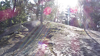
trail: Grand Wazoo
288 |
Aug 9, 2019 @ 8:35pm
Aug 9, 2019
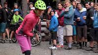
trail: Lost Lake Loop
326 |
Jul 25, 2017 @ 4:09pm
Jul 25, 2017
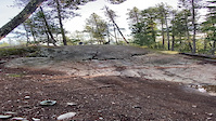
trail: Toads of the Short Forest
820 |
Oct 26, 2016 @ 5:53am
Oct 26, 2016
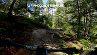
trail: Pinocchio's Furniture
765 |
Oct 26, 2016 @ 5:52am
Oct 26, 2016
trail: Why Johnny Can't Read
426 |
Jul 26, 2015 @ 10:20am
Jul 26, 2015
trail: Lost Lake Loop
433 |
Mar 7, 2015 @ 9:47pm
Mar 7, 2015
trail: Pinocchio's Furniture
1,118 |
May 23, 2012 @ 5:37pm
May 23, 2012
trail: Why Johnny Can't Read
351 |
Jul 1, 2008 @ 10:56pm
Jul 1, 2008Videos of Lost Lake Mountain Bike
trail: Toads of the Short Forest
|
Oct 31, 2020

trail: No Horses
2:16 |
388 |
Aug 10, 2020
trail: Pinocchio's Furniture
4:05 |
974 |
Jun 18, 2018
trail: Zappa / Cretins Connector
6:41 |
2725 |
Jul 2, 2016
trail: Toads of the Short Forest
0:26 |
942 |
Apr 19, 2015
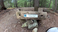
trail: Pinocchio's Furniture
5:00 |
1350 |
Mar 15, 2015

trail: Lost Lake Loop
14:42 |
73 |
Apr 5, 2022 , Whistler
trail: Tin Pants
14:42 |
110 |
Apr 5, 2022 , Whistler
Recent Trail Reports
| status | trail | date | condition | info | user |
|---|---|---|---|---|---|
| Tin Pants | Jul 1, 2022 @ 11:03am Jul 1, 2022 | Ideal | Onemoretman | ||
| Pinocchio's Furniture | Jul 1, 2022 @ 11:03am Jul 1, 2022 | Ideal | Onemoretman | ||
| Dwarf Nebula | Jul 1, 2022 @ 11:03am Jul 1, 2022 | Ideal | Onemoretman | ||
| Zoot Allures | Jul 1, 2022 @ 11:03am Jul 1, 2022 | Ideal | Onemoretman | ||
| Toads of the Short Forest | Jul 1, 2022 @ 11:03am Jul 1, 2022 | Ideal | Onemoretman | ||
| Gee I Like Your Pants | Jul 1, 2022 @ 11:03am Jul 1, 2022 | Ideal | Onemoretman | ||
| Son of Mr. Green Genes | Jul 1, 2022 @ 11:03am Jul 1, 2022 | Ideal | Onemoretman | ||
| Packard Goose | Jul 1, 2022 @ 11:03am Jul 1, 2022 | Ideal | Onemoretman | ||
| Grand Wazoo | Jul 1, 2022 @ 8:05am Jul 1, 2022 | Ideal | barbtyers | ||
| Muffin Man | Jun 26, 2022 @ 8:19pm Jun 26, 2022 | Dry | diegopermansu |
Activity Feed
| username | action | type | title | date | |
|---|---|---|---|---|---|
 | davo1515 | ridden | trail | Packard Goose and 2 more | Jul 5, 2022 @ 3:21pm 13 hours |
| TimmoWhistler | ridden | trail | The Passage | Jul 5, 2022 @ 9:36am 18 hours |
 | JohnFG | wishlist | region | Lost Lake | Jul 4, 2022 @ 7:22pm 1 day |
| TiffyP | wishlist | route | Whistler X Tri and 1 more | Jul 4, 2022 @ 2:40pm 2 days |
 | upside | wishlist | route | Whistler, BC - Lost Lake Trails - Intermediate Route | Jul 4, 2022 @ 12:00pm 2 days |
Recent Comments
| username | type | title | comment | date | |
|---|---|---|---|---|---|
| trail | Yesss so good | Jun 29, 2022 @ 9:15pm Jun 29, 2022 | ||
| trail | This was a fantastic trail - good condition... | Jun 29, 2022 @ 9:14pm Jun 29, 2022 | ||
 | trail | Not a real trail just a gravel road use for xc... | Jul 29, 2021 @ 12:17pm Jul 29, 2021 | ||
| trail | . | Jul 20, 2021 @ 10:26am Jul 20, 2021 | ||
 | report | Closed? | Jul 19, 2021 @ 4:28pm Jul 19, 2021 |
Nearby Areas
| name | distance | ||||
|---|---|---|---|---|---|
| Blackcomb CRA | 1 | 7 | 11 | 6 | 1.1 km |
| Whistler Village | 1 | 13 | 8 | 3 | 1.3 km |
| Whistler Mountain Bike Park | 9 | 45 | 36 | 24 | 2.1 km |
| No Flow Zone | 8 | 18 | 4 | 2.2 km | |
| Whistler North | 5 | 7 | 28 | 3 | 2.4 km |
Local Badges
-

Completionist20 awarded
Upcoming Local Events
-
-
-
-
Local Products
Local Products
Activity Type Stats
| activitytype | trails | distance | descent | descent distance | total vertical | rating | global rank | state rank | photos | reports | routes | ridelogs |
|---|---|---|---|---|---|---|---|---|---|---|---|---|
| Mountain Bike | 57 | 23 miles | 4,029 ft | 10 miles | 1,109 ft | #18 | #8 | 303 | 2,744 | 45 | 26,090 | |
| E-Bike | 54 | 20 miles | 2,943 ft | 9 miles | 351 ft | #8 | #4 | 2,606 | 4 | 437 | ||
| Hike | 56 | 21 miles | 3,150 ft | 9 miles | 351 ft | #9 | #4 | 2,742 | 1 | 454 | ||
| Trail Running | 56 | 21 miles | 3,150 ft | 9 miles | 351 ft | #8 | #4 | 2,742 | 10 | 1,945 | ||
| Snowshoe | 13 | 10 miles | 1,207 ft | 4 miles | 328 ft | #15 | #2 | 68 | 31 | |||
| Nordic Ski | 8 | 6 miles | 712 ft | 3 miles | 266 ft | #47 | #3 | 33 | 2 | 1,306 |
- By canadaka
 Trailforks & contributors
 - Admins: RMOW, WORCA, RMOW, WNSC, ridingloam, snowdan, TFerrao, dirtshifter, seb-kemp, o-diggity
- #1500 - 65,312 views
- lost lake activity log | embed map of Lost Lake mountain bike trails | lost lake mountain biking points of interest
Downloading of trail gps tracks in kml & gpx formats is enabled for Lost Lake.
You must login to download files.