1.3 miles
Distance
-450 ft
Descent
00:07:37
Avg time
Rock-It Details
-
Activities
- Mountain Bike
- Hike
- Trail Running
-
Riding AreaAliso and Wood Canyons Wilderness Park
Aliso Viejo, California -
Difficulty Rating
-
Voted DifficultyBlack Diamond (22 votes)
-
Trail TypeDoubletrack
-
Bike TypeDH, AM, XC, Gravel, Adaptive MTB
-
DirectionDownhill PrimaryPopular direction shown
-
Climb DifficultyBlue
-
Physical RatingModerate
-
Trail VisibilityAlways easy to follow
-
SeasonYear Round
-
eBike Allowed
-
TTFs on TrailRock Face, Rock Garden
-
Global Ranking
-
Local Popularity85 in Mountain Biking [+]
- 65 in Trail Running
- 75 in Hiking
-
Land ManagerCounty of Orange
Fun trail with long rock garden
Local Trail Association
-

-
Please consider joining or donating to the local trail association to supportdonate to earn trail karma!
trail development & maintenance.
More Stats for Rock-It mountain bike trail trail
-
Altitude change-450 ft
-
Altitude min307 ft
-
Altitude max757 ft
-
Altitude start757 ft
-
Altitude end308 ft
-
Grade-6.5%
-
Grade max-29.8%
-
Grade min3%
-
Distance climb23 ft
-
Distance down1 mile
-
Distance flat1,004 ft
-
Avg time00:07:37
-
Avg reverse time00:17:55
- view trail stats
close
Trail Conditions
- Unknown
- Snow Groomed
- Snow Packed
- Snow Covered
- Snow Cover Inadequate
- Freeze/thaw Cycle
- Icy
- Prevalent Mud
- Wet
- Variable
- Ideal
- Dry
- Very Dry
Trail Flow (Ridden Direction)
Trailforks scans users ridelogs to determine the most popular direction each trail is ridden. A good flowing trail network will have most trails flowing in a single direction according to their intension.
The colour categories are based on what percentage of riders are riding a trail in its intended direction.
The colour categories are based on what percentage of riders are riding a trail in its intended direction.
- > 96%
- > 90%
- > 80%
- > 70%
- > 50%
- < 50%
- bi-directional trail
- no data
Trail Last Ridden
Trailforks scans ridelogs to determine the last time a trail was ridden.
- < 2 days
- < 1 week
- < 2 weeks
- < 1 month
- < 6 months
- > 6 months
Trail Ridden Direction
The intended direction a trail should be ridden.
- Downhill Only
- Downhill Primary
- Both Directions
- Uphill Primary
- Uphill Only
- One Direction
Contribute Details
Colors indicate trail is missing specified detail.
- Description
- Photos
- Description & Photos
- Videos
Trail Popularity ?
Trailforks scans ridelogs to determine which trails are ridden the most in the last 9 months.
Trails are compared with nearby trails in the same city region with a possible 25 colour shades.
Think of this as a heatmap, more rides = more kinetic energy = warmer colors.
- most popular
- popular
- less popular
- not popular
ATV/ORV/OHV Filter
Max Vehicle Width
inches
Radar Time
x
Activity Recordings
Trailforks users anonymized public ridelogs from the past 6 months.
- mountain biking recent
- mountain biking (>6 month)
- hiking (1 year)
- moto (1 year)
Activity Recordings
Trailforks users anonymized public skilogs from the past 12 months.
- Downhill Ski
- Backcountry Ski
- Nordic Ski
Jump Magnitude Heatmap
Heatmap of where riders jump on trails. Zoom in to see individual jumps, click circles to view jump details.
Trails Deemphasized
Trails are shown in grey.
Only show trails with NO bikes.
Save the current map location and zoom level as your default home location whenever this page is loaded.
Save
Directions to rockit-29539 trailhead
(33.577000, -117.755530)
update trails status or condition
Rock-It Trail Reports
view all reports »
Recent Ridelog Activity on Trail
Past Week
- 19 rides
- 14 miles avg distance
6 Months
- 405 rides
- 13 miles avg distance
All
- 7,599 rides
Technical Trail Features (TTF)
- Rock-It Rock Garden
 Rock Garden
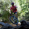
Photos
more »
Routes with this trail
more »
-
+ 1
DPTR
(Feb 27, 2022 at 6:58)
In my opinion this is the best trail at Wood Canyon. I think it is about a low black, and has the right combination of tech and flow. Recently (early 2022) it has been pretty eroded and gnarly than usual. It is a black diamond right now. Please DO NOT go up this trail, as many of the corners are very blind and some people go very fast down it. You may think it is okay because of the many different line choices, but some sections barely have room for a biker to pass a hiker squeezed into a bush, much less another biker pedaling the opposite direction.
[Reply]

 zdrenduro67
(Mar 8, 2021 at 12:08)
zdrenduro67
(Mar 8, 2021 at 12:08)
ok, first of all, this is not a black, I can ride this trail in my sleep even post brain tumor, dont overrate trails
[Reply]
IsaiahSimon1406
 (Sep 13, 2020 at 14:42)
Don’t go up, but the downhill is super fun. Some rock rolls, good berms, and a super long rock garden. After the rock garden tho there is a hard uphill. Good luck to anyone who can clear the uphill. I would call it a black and so does the trail system.
[Reply]
Videos
more »


Nearby Trails
- Rock It Connector 433 ft
- Stairsteps 1,736 ft
- Phillips Street 2,326 ft
- Old Stairsteps 2,589 ft
- Vista 3,041 ft
Aliso and Wood Canyons Wilderness Park
- embed Rock-It trail on your website
- By mellowxc & contributors
- #29539 - 8,387 views
- subscribe
- login to download gpx or kml files.