Supporters, Builders, Maintainers & Land Managers of Adobe Jack Trail

Biermann ConstructionSponsor
Thunder Mountain Bikes SedonaSponsor
USFSLand Manager
Adobe Jack Details
-
Activities
- Mountain Bike
- Hike
- Trail Running
-
Riding AreaAdobe Jack
Sedona, Arizona -
Difficulty Rating
-
Voted DifficultyBlue (2 votes)
-
Trail TypeSingletrack
-
Bike TypeAM, Adaptive MTB
-
DirectionBoth Directions
-
Climb DifficultyBlue
-
Physical RatingModerate
-
SeasonDon't Ride After Heavy Rain
-
Dogs AllowedYes
-
eBike Allowed
-
Global Ranking
-
Local Popularity95 in Mountain Biking [+]
- 80 in Trail Running
- 65 in Hiking
-
Land ManagerUSFS
The 1.97 mile Adobe Jack trail starts at the south end at the Adobe Jack parking lot and the north end at the Jordan trail near the popular Sink Hole. The estimated mountain bike skill rating for Adobe Jack is: Beginner-35%, Intermediate-60%, Advanced-4%, Expert-1%. The trail has numerous narrow climbing sections that an advanced intermediate rider may have to walk. The routing of the trail takes you through several dry wash sections that makes the route fun to ride. This trail is the west part of a loop that can take you around the whole Soldier Wash area. The most fun direction to ride Adobe Jack is north to south, but if you are going to do a BIG Soldier's Wash loop by including Jordan, Javelina and Crusy2, I think riding south to north on Adobe Jack is more enjoyable.
Access Info
Direct access to the south end of Adobe Jack is from the Adobe Jack trailhead. The north end of the Adobe Jack trail can be accessed from the Soldier's Wash trailhead.
Disclaimer
info
Adaptive Bike Info
Lots of pinch points
Local Trail Association
-

-

-

-
Please consider joining or donating to the local trail association to supportdonate to earn trail karma!
trail development & maintenance.
Traditionally Indigenous Territory
More Stats for Adobe Jack bike trail trail
-
Altitude change-78 ft
-
Altitude min4,340 ft
-
Altitude max4,447 ft
-
Altitude start4,443 ft
-
Altitude end4,364 ft
-
Grade-0.8%
-
Grade max-18.7%
-
Grade min20.7%
-
Distance climb2,274 ft
-
Distance down4,350 ft
-
Distance flat2,995 ft
-
Avg time00:20:27
-
Avg reverse time00:24:10
- view trail stats
- Unknown
- Snow Groomed
- Snow Packed
- Snow Covered
- Snow Cover Inadequate
- Freeze/thaw Cycle
- Icy
- Prevalent Mud
- Wet
- Variable
- Ideal
- Dry
- Very Dry
The colour categories are based on what percentage of riders are riding a trail in its intended direction.
- > 96%
- > 90%
- > 80%
- > 70%
- > 50%
- < 50%
- bi-directional trail
- no data
- < 2 days
- < 1 week
- < 2 weeks
- < 1 month
- < 6 months
- > 6 months
- Downhill Only
- Downhill Primary
- Both Directions
- Uphill Primary
- Uphill Only
- One Direction
- Description
- Photos
- Description & Photos
- Videos
- most popular
- popular
- less popular
- not popular
- mountain biking recent
- mountain biking (>6 month)
- hiking (1 year)
- moto (1 year)
- Downhill Ski
- Backcountry Ski
- Nordic Ski
Save the current map location and zoom level as your default home location whenever this page is loaded.
SaveAdobe Jack Trail Reports
Recent Ridelog Activity on Trail
Past Week
- 5 rides
- 10 miles avg distance
6 Months
- 688 rides
- 10 miles avg distance
All
- 3,534 rides
Photos
Routes with this trail
-
+ 0
 blakeherrmann
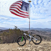 szed3
szed3
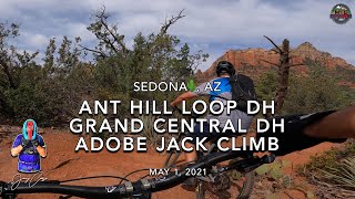
Videos


Nearby Trails
- Grand Central 1,398 ft
- Soldier Pass 1,516 ft
- Soldier Pass 1,677 ft
- Ant Hill 2,392 ft
- Fsr 09904c 4,882 ft
- embed Adobe Jack trail on your website
- By todd
 Trailforks & contributors
 - #14968 - 10,543 views
- subscribe
- login to download gpx or kml files.