1,063 ft
Distance
12 ft
Climb
-56 ft
Descent
00:02:03
Avg time
Hammer Down Details
-
Activities
- Mountain Bike
- E-Bike
-
Riding AreaSlaughter Pen Trails
Bentonville, Arkansas -
Difficulty Rating
-
Trail TypeSingletrack
-
Bike TypeAM, XC, DJ, Fat, Adaptive MTB
-
DirectionDownhill Only
-
eBike AllowedYes up to Class 1
-
TTFs on TrailBerm, Bridge, Drop, Jump, Gap Jump, Rock Garden
-
Global Ranking
-
Local Popularity95 in Mountain Biking [+]
- 100 in E-Biking
No description for Hammer Down trail has been added yet! Submit one here.
Hammer Down is a highly rated 1,063 ft popular blue singletrack trail located near Bentonville Arkansas. This mountain bike primary trail can be used downhill only. On average it takes 2 minutes to complete this trail.
Local Trail Association
-

-

-
Please consider joining or donating to the local trail association to supportdonate to earn trail karma!
trail development & maintenance.
Traditionally Indigenous Territory
More Stats for Hammer Down mountain bike trail trail
-
Altitude change-45 ft
-
Altitude min1,175 ft
-
Altitude max1,231 ft
-
Altitude start1,231 ft
-
Altitude end1,188 ft
-
Grade-4.2%
-
Grade max-13.8%
-
Grade min12.1%
-
Distance climb135 ft
-
Distance down899 ft
-
Distance flat33 ft
-
Avg time00:02:03
-
Avg reverse time00:03:37
- view trail stats
close
Trail Conditions
- Unknown
- Snow Groomed
- Snow Packed
- Snow Covered
- Snow Cover Inadequate
- Freeze/thaw Cycle
- Icy
- Prevalent Mud
- Wet
- Variable
- Ideal
- Dry
- Very Dry
Trail Flow (Ridden Direction)
Trailforks scans users ridelogs to determine the most popular direction each trail is ridden. A good flowing trail network will have most trails flowing in a single direction according to their intension.
The colour categories are based on what percentage of riders are riding a trail in its intended direction.
The colour categories are based on what percentage of riders are riding a trail in its intended direction.
- > 96%
- > 90%
- > 80%
- > 70%
- > 50%
- < 50%
- bi-directional trail
- no data
Trail Last Ridden
Trailforks scans ridelogs to determine the last time a trail was ridden.
- < 2 days
- < 1 week
- < 2 weeks
- < 1 month
- < 6 months
- > 6 months
Trail Ridden Direction
The intended direction a trail should be ridden.
- Downhill Only
- Downhill Primary
- Both Directions
- Uphill Primary
- Uphill Only
- One Direction
Contribute Details
Colors indicate trail is missing specified detail.
- Description
- Photos
- Description & Photos
- Videos
Trail Popularity ?
Trailforks scans ridelogs to determine which trails are ridden the most in the last 9 months.
Trails are compared with nearby trails in the same city region with a possible 25 colour shades.
Think of this as a heatmap, more rides = more kinetic energy = warmer colors.
- most popular
- popular
- less popular
- not popular
ATV/ORV/OHV Filter
Max Vehicle Width
inches
Radar Time
x
Activity Recordings
Trailforks users anonymized public ridelogs from the past 6 months.
- mountain biking recent
- mountain biking (>6 month)
- hiking (1 year)
- moto (1 year)
Activity Recordings
Trailforks users anonymized public skilogs from the past 12 months.
- Downhill Ski
- Backcountry Ski
- Nordic Ski
Jump Magnitude Heatmap
Heatmap of where riders jump on trails. Zoom in to see individual jumps, click circles to view jump details.
Trails Deemphasized
Trails are shown in grey.
Only show trails with NO bikes.
Save the current map location and zoom level as your default home location whenever this page is loaded.
Save
Directions to hammer-down-313274 trailhead
(36.393350, -94.207840)
update trails status or condition
Hammer Down Trail Reports
view all reports »
Recent Ridelog Activity on Trail
Past Week
- 46 rides
- 11 miles avg distance
6 Months
- 1,430 rides
- 13 miles avg distance
All
- 5,985 rides
Routes with this trail
more »
-
+ 0
rageify
(Dec 30, 2021 at 17:18)
Best flo tech trail...great place to practice
[Reply]
 jdisch
Super fast with a great mix of features - The trails starts with a large wooden ramp/slope drop followed by a steep chunky rock garden, several nice jumps, big berms and a few more rock gardens.
[Reply]
MARKZ1968
 (Dec 28, 2020 at 7:03)
Super fun trail, fast, three nice small rock gardens, couple of good jumps. Very fun. Tough climb back to the top but worth it.
[Reply]
 Moonie2123
Ya, super fun, and well built. Easy to loop and repeat. Pre-ride (case everything), re-ride then free ride!
[Reply]

jl1984
(Sep 4, 2020 at 13:44)
This trail is sick. Loved the rock gardens for a change of pace, would love to see more around here.
[Reply]
Arryq
(Aug 22, 2020 at 17:26)
While some locals have called this line “Flozone” since it was being put in, the official name for this line is “Hammer Down”
[Reply]
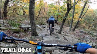
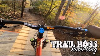
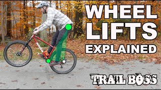
Videos
more »

Nearby Trails
- Ozone 751 ft
- Barn Burner 1,450 ft
- Ozone 1,572 ft
- Apple Turnover Connector 2,001 ft
- Apple Turnover 2,024 ft
Slaughter Pen Trails
- embed Hammer Down trail on your website
- By tbubier & contributors
- #313274 - 3,028 views
- subscribe
- login to download gpx or kml files.