1.7 miles
Distance
11 ft
Climb
-653 ft
Descent
00:09:07
Avg time
Ricochet Details
-
Activities
- Mountain Bike
-
Riding AreaUtah Olympic Park
Park City, Utah -
Difficulty Rating
-
Trail TypeDoubletrack
-
Bike TypeAM, XC, RD, Gravel, Adaptive MTB
-
DirectionDownhill OnlyPopular direction shown
-
Dogs AllowedYes
-
Global Ranking#944 in Mountain Biking
-
Local Popularity95 in Mountain Biking
The lower part has some fun rollers, and some good size berms. You can get some pretty good speed going down this section of trail. The end has big berms out in the open ski run. This is typical intermediate for most of Park City, but is easy compared to the typical jumps lines in the resort.
Local Trail Association
-

-
Please consider joining or donating to the local trail association to supportdonate to earn trail karma!
trail development & maintenance.
Traditionally Indigenous Territory
More Stats for Ricochet mountain bike trail trail
-
Altitude change-641 ft
-
Altitude min6,981 ft
-
Altitude max7,622 ft
-
Altitude start7,622 ft
-
Altitude end6,982 ft
-
Grade-7.1%
-
Grade max-55.1%
-
Grade min7%
-
Distance climb476 ft
-
Distance down2 miles
-
Distance flat561 ft
-
Avg time00:09:07
-
Avg reverse time00:12:18
- view trail stats
close
Trail Conditions
- Unknown
- Snow Groomed
- Snow Packed
- Snow Covered
- Snow Cover Inadequate
- Freeze/thaw Cycle
- Icy
- Prevalent Mud
- Wet
- Variable
- Ideal
- Dry
- Very Dry
Trail Flow (Ridden Direction)
Trailforks scans users ridelogs to determine the most popular direction each trail is ridden. A good flowing trail network will have most trails flowing in a single direction according to their intension.
The colour categories are based on what percentage of riders are riding a trail in its intended direction.
The colour categories are based on what percentage of riders are riding a trail in its intended direction.
- > 96%
- > 90%
- > 80%
- > 70%
- > 50%
- < 50%
- bi-directional trail
- no data
Trail Last Ridden
Trailforks scans ridelogs to determine the last time a trail was ridden.
- < 2 days
- < 1 week
- < 2 weeks
- < 1 month
- < 6 months
- > 6 months
Trail Ridden Direction
The intended direction a trail should be ridden.
- Downhill Only
- Downhill Primary
- Both Directions
- Uphill Primary
- Uphill Only
- One Direction
Contribute Details
Colors indicate trail is missing specified detail.
- Description
- Photos
- Description & Photos
- Videos
Trail Popularity ?
Trailforks scans ridelogs to determine which trails are ridden the most in the last 9 months.
Trails are compared with nearby trails in the same city region with a possible 25 colour shades.
Think of this as a heatmap, more rides = more kinetic energy = warmer colors.
- most popular
- popular
- less popular
- not popular
ATV/ORV/OHV Filter
Max Vehicle Width
inches
Radar Time
x
Activity Recordings
Trailforks users anonymized public ridelogs from the past 6 months.
- mountain biking recent
- mountain biking (>6 month)
- hiking (1 year)
- moto (1 year)
Activity Recordings
Trailforks users anonymized public skilogs from the past 12 months.
- Downhill Ski
- Backcountry Ski
- Nordic Ski
Jump Magnitude Heatmap
Heatmap of where riders jump on trails. Zoom in to see individual jumps, click circles to view jump details.
Trails Deemphasized
Trails are shown in grey.
Only show trails with NO bikes.
Save the current map location and zoom level as your default home location whenever this page is loaded.
Save
Directions to ricochet-11269 trailhead
(40.686660, -111.578370)
update trails status or condition
Ricochet Trail Reports
view all reports »
Recent Ridelog Activity on Trail
Past Week
- 114 rides
- 15 miles avg distance
6 Months
- 389 rides
- 15 miles avg distance
All
- 4,828 rides
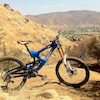
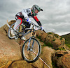
Photos
more »
Trail Lists
-
PC - Zone #5
16 trails
Routes with this trail
more »
Trail Products
-
- 1
 clarkhubbs22
Not a very fun descent at all.
[Reply]
prabhvv
 (Aug 4, 2020 at 14:26)
Super fun trail. Fast and flowy. A few sections of loose rocks (not bad though). Really fun berms and rollers to catch some air. Nothing too technical but can be really fast for a blue in some sections. Climbed the Canyons access road to get to the start of the trail.
[Reply]
 mattyj74
Not quite as bad as the description implies. They have built some small jumps & berms that make the trail a little fun & fast.
[Reply]
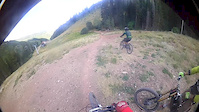
Videos
more »
youtuber
![So EPIC We had to do it TWICE in one day |...]()

23:01 |
36 |
Apr 18, 2022 , Park City

470 |
Aug 27, 2017 , Park City
2:01 |
155 |
Sep 10, 2017 , Park City
Nearby Trails
- Sun Peak Express 607 ft
- Drop Kick 2,395 ft
- Mid Mountain 2,398 ft
- Holly's 2,398 ft
- Lift Road 2,493 ft
- embed Ricochet trail on your website
- By todd Trailforks & contributors
- #11269 - 4,149 views
- subscribe
- login to download gpx or kml files.