1.1 miles
Distance
579 ft
Climb
-135 ft
Descent
00:13:33
Avg time
Supporters, Builders, Maintainers & Land Managers of Legacy Climb - Stl'lhalem Sintl' Trail

Sea to Sky Welding
since 2021Sponsor- Dream WizardsBuilder
- Dream WizardsMaintainer
Details
-
Activities
- Mountain Bike
- E-Bike
-
Riding AreaDiamond Head
Squamish, British Columbia -
AKALegacy Climb
-
Difficulty Rating
-
Trail TypeMachine Groomed
-
Bike TypeAM, XC
-
DirectionUphill OnlyPopular direction shown
-
Climb DifficultyBlue
-
Physical RatingModerate
-
Dogs AllowedYes
-
eBike AllowedYes up to Class 1
-
Global Ranking
-
Local Popularity100 in Mountain Biking [+]
- 100 in E-Biking
-
Year Opened2011
This 2010 Olympic Legacy Trail climbs up through smaller trees to an amazing waterfall. It then continues up and offers a nice ascent all the way to the top of North side Connector, avoiding the dusty road. Full Nelson, Angry Midget, One Man’s Garbage, and Half Nelson.
Local Trail Association
-

-

-
Please consider joining or donating to the local trail association to supportdonate to earn trail karma!
trail development & maintenance.
Traditionally Indigenous Territory
More Stats for Legacy Climb Trail - Stl'lhalem Sintl' mountain bike trail trail
-
Altitude change444 ft
-
Altitude min687 ft
-
Altitude max1,131 ft
-
Altitude start687 ft
-
Altitude end1,132 ft
-
Grade7.5%
-
Grade max-37.6%
-
Grade min48.1%
-
Distance climb4,035 ft
-
Distance down1,263 ft
-
Distance flat636 ft
-
Avg time00:13:33
-
Avg reverse time00:24:42
- view trail stats
close
Trail Conditions
- Unknown
- Snow Groomed
- Snow Packed
- Snow Covered
- Snow Cover Inadequate
- Freeze/thaw Cycle
- Icy
- Prevalent Mud
- Wet
- Variable
- Ideal
- Dry
- Very Dry
Trail Flow (Ridden Direction)
Trailforks scans users ridelogs to determine the most popular direction each trail is ridden. A good flowing trail network will have most trails flowing in a single direction according to their intension.
The colour categories are based on what percentage of riders are riding a trail in its intended direction.
The colour categories are based on what percentage of riders are riding a trail in its intended direction.
- > 96%
- > 90%
- > 80%
- > 70%
- > 50%
- < 50%
- bi-directional trail
- no data
Trail Last Ridden
Trailforks scans ridelogs to determine the last time a trail was ridden.
- < 2 days
- < 1 week
- < 2 weeks
- < 1 month
- < 6 months
- > 6 months
Trail Ridden Direction
The intended direction a trail should be ridden.
- Downhill Only
- Downhill Primary
- Both Directions
- Uphill Primary
- Uphill Only
- One Direction
Contribute Details
Colors indicate trail is missing specified detail.
- Description
- Photos
- Description & Photos
- Videos
Trail Popularity ?
Trailforks scans ridelogs to determine which trails are ridden the most in the last 9 months.
Trails are compared with nearby trails in the same city region with a possible 25 colour shades.
Think of this as a heatmap, more rides = more kinetic energy = warmer colors.
- most popular
- popular
- less popular
- not popular
ATV/ORV/OHV Filter
Max Vehicle Width
inches
Radar Time
x
Activity Recordings
Trailforks users anonymized public ridelogs from the past 6 months.
- mountain biking recent
- mountain biking (>6 month)
- hiking (1 year)
- moto (1 year)
Activity Recordings
Trailforks users anonymized public skilogs from the past 12 months.
- Downhill Ski
- Backcountry Ski
- Nordic Ski
Jump Magnitude Heatmap
Heatmap of where riders jump on trails. Zoom in to see individual jumps, click circles to view jump details.
Trails Deemphasized
Trails are shown in grey.
Only show trails with NO bikes.
Save the current map location and zoom level as your default home location whenever this page is loaded.
Save
Directions to legacy-climb-trail--stl-lhalem-sintl trailhead
(49.740860, -123.087210)
update trails status or condition
Legacy Climb... Trail Reports
view all reports »
Recent Ridelog Activity on Trail
Past Week
- 119 rides
- 11 miles avg distance
6 Months
- 2,408 rides
- 12 miles avg distance
All
- 21,043 rides
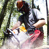
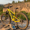
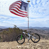
Photos
more »
Trail Lists
-
TBS Diamond Head
6 trails
-
SORCA 29 Trails
29 trails
Routes with this trail
more »
Trail Products
-
 SORCA Trail SupporterTrail Pass
-
+ 0
 bigredted
Tree work happening. Please avoid the lower section of the Legacy Climb.
[Reply]

 Shafto
One of the best climb trails. Enjoyable to mash the pedals up this one!
[Reply]
Jase-the-ace
 (Sep 5, 2018 at 11:41)
Great to have an alternative to biking up the forestry roads. As a whole though, I think there's a bit too much descent for a climb trail. Enough to add 280m vertical up to half Nelson seems like a bit too much. Some people may enjoy it, personally I think a climb trail should be designed to efficiently get you to the top of the trails
[Reply]
 szed3
szed3
Didn't know climb trails could be so fun! Lots of tech to keep things interesting: roots, rocks and a few tight switchbacks. Not super steep. I dig it!
[Reply]
Videos
more »

9:02 |
381 |
Aug 3, 2019 , Squamish
Nearby Trails
- Home Run 157 ft
- Phil & Cam's 1,601 ft
- Flat Alley 1,965 ft
- Powerhouse Access Road 2,388 ft
- Poop Alley 2,589 ft
- embed Legacy Climb Trail - Stl'lhalem Sintl' trail on your website
- By canadaka Trailforks & contributors
- #5886 - 11,361 views
- subscribe
- login to download gpx or kml files.