close
Trail Conditions
- Unknown
- Snow Groomed
- Snow Packed
- Snow Covered
- Snow Cover Inadequate
- Freeze/thaw Cycle
- Icy
- Prevalent Mud
- Wet
- Variable
- Ideal
- Dry
- Very Dry
Trail Flow (Ridden Direction)
Trailforks scans users ridelogs to determine the most popular direction each trail is ridden. A good flowing trail network will have most trails flowing in a single direction according to their intension.
The colour categories are based on what percentage of riders are riding a trail in its intended direction.
The colour categories are based on what percentage of riders are riding a trail in its intended direction.
- > 96%
- > 90%
- > 80%
- > 70%
- > 50%
- < 50%
- bi-directional trail
- no data
Trail Last Ridden
Trailforks scans ridelogs to determine the last time a trail was ridden.
- < 2 days
- < 1 week
- < 2 weeks
- < 1 month
- < 6 months
- > 6 months
Trail Ridden Direction
The intended direction a trail should be ridden.
- Downhill Only
- Downhill Primary
- Both Directions
- Uphill Primary
- Uphill Only
- One Direction
Contribute Details
Colors indicate trail is missing specified detail.
- Description
- Photos
- Description & Photos
- Videos
Trail Popularity ?
Trailforks scans ridelogs to determine which trails are ridden the most in the last 9 months.
Trails are compared with nearby trails in the same city region with a possible 25 colour shades.
Think of this as a heatmap, more rides = more kinetic energy = warmer colors.
- most popular
- popular
- less popular
- not popular
ATV/ORV/OHV Filter
Max Vehicle Width
inches
Radar Time
x
Activity Recordings
Trailforks users anonymized public ridelogs from the past 6 months.
- mountain biking recent
- mountain biking (>6 month)
- hiking (1 year)
- moto (1 year)
Activity Recordings
Trailforks users anonymized public skilogs from the past 12 months.
- Downhill Ski
- Backcountry Ski
- Nordic Ski
Jump Magnitude Heatmap
Heatmap of where riders jump on trails. Zoom in to see individual jumps, click circles to view jump details.
Trails Deemphasized
Trails are shown in grey.
Only show trails with NO bikes.
Save the current map location and zoom level as your default home location whenever this page is loaded.
Save
No description for Redwood City has been added yet!
Login or register to submit one.
Activities Click to view
- Mountain Bike
27 trails
- Hike
30 trails
- Trail Running
30 trails
Region Details
- 10
- 2
- 11
- 4
Region Status
Open as of 3 daysStats
- Avg Trail Rating
- Trails (view details)
- 30
- Trails Mountain Bike
- 27
- Trails Hike
- 30
- Trails Trail Running
- 30
- Trails Horse
- 26
- Total Distance
- 37 miles
- Total Descent
- 8,368 ft
- Total Vertical
- 2,238 ft
- Highest Trailhead
- 2,385 ft
- Reports
- 820
- Photos
- 103
- Ridden Counter
- 17,029
Sub Regions
-
El Corte de Madera Creek Open Space Preserve
- 2
- 11
- 4
-
Stulsaft Park
Popular Redwood City Mountain Biking Trails
Redwood City Mountain Bike Routes
| title | rating | distance |
|---|---|---|
| Skeggs Figure 8 Loop | 10 miles | |
| Skegg's Point 7 | 10 miles | |
| Skeggs 15 mile loop from new parking | 15 miles | |
| Blue Blossom Special: Intro to Skeggs | 6 miles | |
| Easy going loop | 10 miles | |
| Manzanita - Blue Blossom Fig. 8 | 12 miles | |
| Quick Training Loop | 3 miles | |
| Manzanita - Blue Blossom Fig 8 | 12 miles | |
| Skeggs-N-Eggs Lite | 11 miles | |
| ECdM 10 Mile Loop from Star Hill | 10 miles |
Photos of Redwood City Mountain Bike
trail: South Leaf
79 |
Apr 11, 2022 @ 9:26pm
Apr 11, 2022
trail: South Leaf
63 |
Apr 11, 2022 @ 9:26pm
Apr 11, 2022
trail: Steam Donkey
31 |
Mar 5, 2022 @ 9:41pm
Mar 5, 2022
trail: Methuselah
19 |
Feb 7, 2022 @ 10:21am
Feb 7, 2022
trail: Sierra Morena Trail
35 |
Jan 27, 2022 @ 5:31pm
Jan 27, 2022
trail: Sierra Morena Trail
33 |
Jan 27, 2022 @ 5:31pm
Jan 27, 2022
trail: Tafoni Trail (Upper)
12 |
Jan 27, 2022 @ 5:31pm
Jan 27, 2022
trail: Resolution
32 |
Jan 27, 2022 @ 5:31pm
Jan 27, 2022Videos of Redwood City Mountain Bike

trail: Giant Salamander
4:10 |
387 |
Sep 17, 2017
trail: Steam Donkey
1:33 |
420 |
Mar 6, 2016
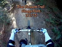
trail: Blue Blossom
3:56 |
631 |
Feb 28, 2014
trail: North Leaf
3:25 |
588 |
Dec 8, 2013
trail: El Corte de Madera Creek
1:56 |
1081 |
Dec 8, 2013
trail: Manzanita
1:21 |
231 |
May 26, 2013
trail: Blue Blossom
5:58 |
495 |
Feb 2, 2013
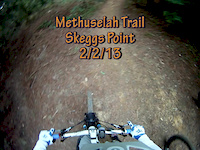
trail: Methuselah
3:40 |
264 |
Feb 2, 2013
Current Trail Warnings
| status | trail | date | condition | user | info |
|---|---|---|---|---|---|
| Tafoni Trail (Upper) | Jun 28, 2022 @ 6:32pm Jun 28, 2022 | Dry | vermeulenaidan | Major tree down around a blind corner |
Recent Trail Reports
| status | trail | date | condition | info | user |
|---|---|---|---|---|---|
| Methuselah | Jul 3, 2022 @ 8:48am 3 days | Dry | Liberti | ||
| Oljon | Jul 2, 2022 @ 2:17pm Jul 2, 2022 | Wet | ervinb123 | ||
| Sierra Morena Trail | Jun 25, 2022 @ 10:00am Jun 25, 2022 | Ideal | Morry53 | ||
| North Leaf | Jun 25, 2022 @ 10:00am Jun 25, 2022 | Ideal | Morry53 | ||
| Giant Salamander | Jun 25, 2022 @ 10:00am Jun 25, 2022 | Ideal | Morry53 | ||
| Crossover | Jun 25, 2022 @ 10:00am Jun 25, 2022 | Ideal | Morry53 | ||
| Blue Blossom | Jun 25, 2022 @ 10:00am Jun 25, 2022 | Ideal | Morry53 | ||
| Steam Donkey | Jun 25, 2022 @ 10:00am Jun 25, 2022 | Ideal | Morry53 | ||
| Manzanita | Jun 19, 2022 @ 10:47am Jun 19, 2022 | Ideal | shill | ||
| Manzanita Trail (Upper) | Jun 19, 2022 @ 10:47am Jun 19, 2022 | Ideal | shill |
Activity Feed
| username | action | type | title | date | |
|---|---|---|---|---|---|
 | MP240 | wishlist | route | Skeggs: Blue Blossom, Salamander, Resolution, Manzanita, Sierra Morena | Jul 5, 2022 @ 2:09pm 14 hours |
| habajca | ridden | trail | Blue Blossom | Jul 4, 2022 @ 10:49am 2 days |
| Liberti | add | report | Methuselah | Jul 3, 2022 @ 8:48am 3 days |
| ervinb123 | add | report | Oljon | Jul 2, 2022 @ 2:18pm Jul 2, 2022 |
| Darniel | wishlist | route | Skeggs Figure 8 Loop | Jul 2, 2022 @ 12:09pm Jul 2, 2022 |
Recent Comments
| username | type | title | comment | date | |
|---|---|---|---|---|---|
| trail | There is a downed tree across the trail about... | Jun 21, 2022 @ 5:32pm Jun 21, 2022 | ||
| trail | I am a fast rider - it’s simply not a... | Jun 15, 2022 @ 11:46pm Jun 15, 2022 | ||
 | trail | Try going faster, Resolution is the second... | Jun 15, 2022 @ 7:48pm Jun 15, 2022 | ||
| trail | This trail should be ridden downhill direction... | Jun 3, 2022 @ 8:49pm Jun 3, 2022 | ||
| trail | 100mm xc hardtail (Epic) rider here. Pretty... | Jun 2, 2022 @ 2:40pm Jun 2, 2022 |
Local Badges
-

Skeggs Up!0 awarded -

Completionist10 awarded -

10 Blue Trails452 awarded -

Climbing 10k Badge214 awarded -

Top 10 Trails44 awarded -

Big Ride 30k2,265 awarded
Local Mountain Biking Directory
-
Any Mountain
-
Chain Reaction BicyclesBike Shop
-
Go-ride BicyclesBike Shop
-
Woodside Bike ShopBike Shop
-
Performance - Redwood CityBike Shop
Activity Type Stats
| activitytype | trails | distance | descent | descent distance | total vertical | rating | global rank | state rank | photos | reports | routes | ridelogs |
|---|---|---|---|---|---|---|---|---|---|---|---|---|
| Mountain Bike | 27 | 35 miles | 8,018 ft | 16 miles | 2,238 ft | #344 | #181 | 99 | 818 | 34 | 17,686 | |
| Hike | 30 | 37 miles | 8,366 ft | 17 miles | 2,238 ft | #253 | #152 | 4 | 818 | 2 | 456 | |
| Trail Running | 30 | 37 miles | 8,366 ft | 17 miles | 2,238 ft | #254 | #152 | 818 | 1 | 46 | ||
| Horse | 26 | 34 miles | 8,002 ft | 16 miles | 1,634 ft | 126 | 1 |
- By brenthillier
 NSMBA TRAILFORKS & contributors
 - Admins: spokesmanmtb
- #7903 - 4,464 views
- redwood city activity log | embed map of Redwood City mountain bike trails | redwood city mountain biking points of interest polygons
Downloading of trail gps tracks in kml & gpx formats is enabled for Redwood City.
You must login to download files.