close
Trail Conditions
- Unknown
- Snow Groomed
- Snow Packed
- Snow Covered
- Snow Cover Inadequate
- Freeze/thaw Cycle
- Icy
- Prevalent Mud
- Wet
- Variable
- Ideal
- Dry
- Very Dry
Trail Flow (Ridden Direction)
Trailforks scans users ridelogs to determine the most popular direction each trail is ridden. A good flowing trail network will have most trails flowing in a single direction according to their intension.
The colour categories are based on what percentage of riders are riding a trail in its intended direction.
The colour categories are based on what percentage of riders are riding a trail in its intended direction.
- > 96%
- > 90%
- > 80%
- > 70%
- > 50%
- < 50%
- bi-directional trail
- no data
Trail Last Ridden
Trailforks scans ridelogs to determine the last time a trail was ridden.
- < 2 days
- < 1 week
- < 2 weeks
- < 1 month
- < 6 months
- > 6 months
Trail Ridden Direction
The intended direction a trail should be ridden.
- Downhill Only
- Downhill Primary
- Both Directions
- Uphill Primary
- Uphill Only
- One Direction
Contribute Details
Colors indicate trail is missing specified detail.
- Description
- Photos
- Description & Photos
- Videos
Trail Popularity ?
Trailforks scans ridelogs to determine which trails are ridden the most in the last 9 months.
Trails are compared with nearby trails in the same city region with a possible 25 colour shades.
Think of this as a heatmap, more rides = more kinetic energy = warmer colors.
- most popular
- popular
- less popular
- not popular
ATV/ORV/OHV Filter
Max Vehicle Width
inches
Radar Time
x
Activity Recordings
Trailforks users anonymized public ridelogs from the past 6 months.
- mountain biking recent
- mountain biking (>6 month)
- hiking (1 year)
- moto (1 year)
Activity Recordings
Trailforks users anonymized public skilogs from the past 12 months.
- Downhill Ski
- Backcountry Ski
- Nordic Ski
Jump Magnitude Heatmap
Heatmap of where riders jump on trails. Zoom in to see individual jumps, click circles to view jump details.
Trails Deemphasized
Trails are shown in grey.
Only show trails with NO bikes.
Save the current map location and zoom level as your default home location whenever this page is loaded.
Save
No description for Réseau du lac Gale has been added yet!
Login or register to submit one.
Primary Trail Type: Cross-Country
Activities Click to view
- Mountain Bike
2 trails
- E-Bike
2 trails
- Hike
6 trails
- Trail Running
6 trails
Region Details
- 2
Region Status
Open as of Jun 29, 2022Stats
- Avg Trail Rating
- Trails (view details)
- 6
- Trails Mountain Bike
- 2
- Trails E-Bike
- 2
- Trails Hike
- 6
- Trails Trail Running
- 6
- Trails Horse
- 2
- Trails Snowshoe
- 3
- Total Distance
- 7 miles
- Total Descent Distance
- 3 miles
- Total Descent
- 1,220 ft
- Total Vertical
- 603 ft
- Highest Trailhead
- 1,180 ft
- Reports
- 3
- Photos
- 11
- Ridden Counter
- 68
Popular Réseau du lac Gale Mountain Biking Trails
| status | title | difficulty | rating |
|---|---|---|---|
| Grillon | |||
| Grenouille |
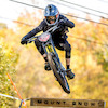
Photos of Réseau du lac Gale Mountain Bike
trail: Grive
4 |
Dec 4, 2021 @ 3:22pm
Dec 4, 2021
trail: Grive
4 |
Dec 4, 2021 @ 3:22pm
Dec 4, 2021
trail: Grive
7 |
Dec 4, 2021 @ 3:22pm
Dec 4, 2021
trail: Grillon
85 |
Jul 23, 2019 @ 6:48pm
Jul 23, 2019
trail: Grillon
169 |
Jul 23, 2019 @ 6:48pm
Jul 23, 2019
trail: Grillon
143 |
Aug 31, 2017 @ 12:19am
Aug 31, 2017
trail: Grillon
139 |
Aug 27, 2017 @ 4:32pm
Aug 27, 2017
trail: Grillon
141 |
Aug 27, 2017 @ 4:31pm
Aug 27, 2017Recent Trail Reports
| status | trail | date | condition | info | user |
|---|---|---|---|---|---|
| Grenouille | May 17, 2020 @ 7:26am May 17, 2020 | Ideal | wolfvf | ||
| Grillon | Aug 19, 2018 @ 3:02pm Aug 19, 2018 | Dry | Bigdap |
Activity Feed
| username | action | type | title | date | |
|---|---|---|---|---|---|
 | thewaflwizard | add | report | Grimpereau | Jul 3, 2022 @ 7:53pm 2 days |
 | oliviergiroux | ridden | trail | Grillon | May 16, 2022 @ 11:30am May 16, 2022 |
| vrince | add | photo | in Bromont, Quebec, Canada and 4 more | Dec 4, 2021 @ 3:22pm Dec 4, 2021 |
 | StephaneMarceau | update | trail | Grillon and 5 more | Dec 4, 2021 @ 3:01pm Dec 4, 2021 |
| vrince | add | photo | in Bromont, Quebec, Canada | Nov 14, 2021 @ 8:50am Nov 14, 2021 |
Recent Comments
| username | type | title | comment | date | |
|---|---|---|---|---|---|
| trail | Did the loop starting from the parking area,... | Aug 21, 2017 @ 6:34am Aug 21, 2017 |
Nearby Areas
| name | distance | ||||
|---|---|---|---|---|---|
| Réseau de la Montagne | 3 | 16 | 17 | 11 | 2.1 km |
| Réseau du Mont-Oak | 7 | 7 | 4 | 1 | 2.3 km |
| Bromont: Montagne d'Expériences | 6 | 12 | 17 | 16 | 2.8 km |
| Réseau Villageois | 2 | 3.8 km | |||
| Centre National Cyclisme Bromont | 4 | 1 | 1 | 1 | 4.3 km |
Activity Type Stats
| activitytype | trails | distance | descent | descent distance | total vertical | rating | global rank | state rank | photos | reports | routes | ridelogs |
|---|---|---|---|---|---|---|---|---|---|---|---|---|
| Mountain Bike | 2 | 5 miles | 830 ft | 2 miles | 581 ft | #8,501 | #118 | 5 | 3 | 114 | ||
| E-Bike | 2 | 5 miles | 830 ft | 2 miles | 581 ft | #3,153 | #53 | 3 | 3 | |||
| Hike | 6 | 7 miles | 1,220 ft | 3 miles | 604 ft | #7,529 | #92 | 6 | 3 | 53 | ||
| Trail Running | 6 | 7 miles | 1,220 ft | 3 miles | 604 ft | #7,516 | #93 | 3 | 2 | |||
| Horse | 2 | 5 miles | 830 ft | 2 miles | 581 ft | 1 | ||||||
| Snowshoe | 3 | 6 miles | 906 ft | 3 miles | 604 ft |
- By StephaneMarceau
 Trivélo TRAILFORKS & contributors
 - Admins: ASB
- #8454 - 3,380 views
- réseau du lac gale activity log | embed map of Réseau du lac Gale mountain bike trails |
Downloading of trail gps tracks in kml & gpx formats is enabled for Réseau du lac Gale.
You must login to download files.