15.0 miles
Distance
816 ft
Climb
-4,915 ft
Descent
1 mile
High Point
This is the classic Downieville Downhill route. Shuttle up to the start at the Sunshine Trail. From there it goes down to Butcher Ranch, 3rd Divide, and First Divide back in to town. There are alternative routes as well, but this is the classic.
Detailed Description
Downieville Downhill is a highly rated 15 mile popular expert route located near Downieville California. This mountain bike only route can be used one direction and has a hard overall physical rating. This route includes 7 trails. This route climbs 816 ft with a max elevation of 7,106 ft then descends -4,915 ft.
Local Trail Association
Please consider joining or donating to the local riding association to support trail development & maintenance.
donate to earn trail karma!
Trail Products
-
+ 0
dstark70sf
 (Jun 27, 2022 at 11:48)
Best trail I’ve ever done. I think about it often. Wear pads and be prepared to smile. Epic!
[Reply]
KileB123
(Jun 24, 2022 at 19:59)
Great trail, enjoy before it’s too hot and support the town by buying some stuff!
[Reply]
 savesthejade
Trail First Divide
A pretty flat/pedaly section of the downhill route. Must have been an old rail trail given the mellow grade. Some cliff/steep exposure at times but quite manageable.
[Reply]
savesthejade
Trail First Divide
A pretty flat/pedaly section of the downhill route. Must have been an old rail trail given the mellow grade. Some cliff/steep exposure at times but quite manageable.
[Reply]
savesthejade
Trail Third Divide
Open and fast loose dirt chute with some side features to kick off. Surprisingly few brake bumps.
[Reply]
Mgemassmer
(May 23, 2022 at 20:25)
Trail Sunrise Trail
Tons of snow…. Sunrise unrideable. Top of butcher is the same until the waterfalls.
[Reply]
 toftsmtb
Ride fast, don't die. Take some time to look around- the scenery is beautiful
[Reply]
 DrHog
DrHog
Trail Pauley Creek Trail
Great trail. After a couple of years hitting the classic, doing Gold Valley Rim to Pauley Creek was a natural variation. Is it better than Sunrise/Butcher Ranch? I don’t think so, but still worth a look.
[Reply]
atfarley
(Jun 24, 2020 at 13:54)
Trail First Divide
I never found the thousand feet of climbing.
[Reply]
atfarley
(Jun 24, 2020 at 13:54)
Trail First Divide
I never found the thousand feet of climbing.
[Reply]
 twowheeledwanderer
(Dec 1, 2019 at 11:18)
twowheeledwanderer
(Dec 1, 2019 at 11:18)
Trail Butcher Ranch Trail
Butcher Ranch Trail has a good mix of fast flow and techy bits. The 'hardest' feature on the whole route is the Waterfall which isn't too bad unless it's covered in water. Parts of Butcher are loose, steep, and chundery, and other parts are hardpacked and fast.
Use this guide to help plan your next trip to Downieville! twowheeledwanderer.com/posts/a-quick-mountain-bike-escape-to-downieville-california
[Reply]
Use this guide to help plan your next trip to Downieville! twowheeledwanderer.com/posts/a-quick-mountain-bike-escape-to-downieville-california
twowheeledwanderer
(Dec 1, 2019 at 11:13)
Trail Third Divide
Fast flow! Third Divide is basically where you open up the brakes and let it rip. There is one technical rock feature that is tricky to make (up not down) but other than it's fast and smooth(ish).
Use this guide to help plan your next trip to Downieville! twowheeledwanderer.com/posts/a-quick-mountain-bike-escape-to-downieville-california
[Reply]
Use this guide to help plan your next trip to Downieville! twowheeledwanderer.com/posts/a-quick-mountain-bike-escape-to-downieville-california
deln78
(Jul 22, 2019 at 7:46)
Trail Pauley Creek Trail
Awesome trail! Just like in the description above. Note that a much better access route is to first take the also-excellent Gold Valley Rim Trail, then a much shorter fire road connector.
[Reply]
Trails in Route
| 6 miles | |||||
| 15 miles | |||||
| 6 miles | |||||
| 7 miles | |||||
| 3 miles | |||||
| 11 miles |
Details
-
Riding area
-
Primary ActivityMountain Bike
-
Difficulty ratingBlack Diamond
-
Route TypeShuttled
-
Bike typeDH, AM, XC
-
DirectionOne Direction
-
Physical ratingHard
-
Ridelogs
More Stats for Downieville Downhill mountain bike route
-
Altitude change-4,101 ft
-
Altitude min2,980 ft
-
Altitude start7,081 ft
-
Altitude end2,979 ft
-
Grade-5.2%
-
Grade max-67.2%
-
Grade min34.4%
-
Distance climb3 miles
-
Distance down11 miles
-
Distance flat4,862 ft
close
Trail Conditions
- Unknown
- Snow Groomed
- Snow Packed
- Snow Covered
- Snow Cover Inadequate
- Freeze/thaw Cycle
- Icy
- Prevalent Mud
- Wet
- Variable
- Ideal
- Dry
- Very Dry
Trail Flow (Ridden Direction)
Trailforks scans users ridelogs to determine the most popular direction each trail is ridden. A good flowing trail network will have most trails flowing in a single direction according to their intension.
The colour categories are based on what percentage of riders are riding a trail in its intended direction.
The colour categories are based on what percentage of riders are riding a trail in its intended direction.
- > 96%
- > 90%
- > 80%
- > 70%
- > 50%
- < 50%
- bi-directional trail
- no data
Trail Last Ridden
Trailforks scans ridelogs to determine the last time a trail was ridden.
- < 2 days
- < 1 week
- < 2 weeks
- < 1 month
- < 6 months
- > 6 months
Trail Ridden Direction
The intended direction a trail should be ridden.
- Downhill Only
- Downhill Primary
- Both Directions
- Uphill Primary
- Uphill Only
- One Direction
Contribute Details
Colors indicate trail is missing specified detail.
- Description
- Photos
- Description & Photos
- Videos
Trail Popularity ?
Trailforks scans ridelogs to determine which trails are ridden the most in the last 9 months.
Trails are compared with nearby trails in the same city region with a possible 25 colour shades.
Think of this as a heatmap, more rides = more kinetic energy = warmer colors.
- most popular
- popular
- less popular
- not popular
ATV/ORV/OHV Filter
Max Vehicle Width
inches
Radar Time
x
Activity Recordings
Trailforks users anonymized public ridelogs from the past 6 months.
- mountain biking recent
- mountain biking (>6 month)
- hiking (1 year)
- moto (1 year)
Activity Recordings
Trailforks users anonymized public skilogs from the past 12 months.
- Downhill Ski
- Backcountry Ski
- Nordic Ski
Jump Magnitude Heatmap
Heatmap of where riders jump on trails. Zoom in to see individual jumps, click circles to view jump details.
Trails Deemphasized
Trails are shown in grey.
Only show trails with NO bikes.
Save the current map location and zoom level as your default home location whenever this page is loaded.
Save
Trail transparency
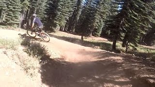
Photos
Videos
youtuber
![Riding Downieville | Beginner/Intermediate...]()

Riding Downieville | Beginner/Intermediate Perspective (GoPro 8)
27:15 | 481 | comments: 0 | favs:
Dec 10, 2019
Downieville Downhill - Downieville, CA
449 | comments: 0 | favs:
May 5, 2017
Recent Trail Reports Along Route
| status | trail | date | condition | description |
|---|---|---|---|---|
Jul 3, 2022 @ 11:09am 3 days | ||||
Jun 17, 2022 @ 2:57pm Jun 17, 2022 | ||||
Jun 16, 2022 @ 10:47am Jun 16, 2022 | ||||
Jun 16, 2022 @ 10:47am Jun 16, 2022 | ||||
Jun 11, 2020 @ 10:02am Jun 11, 2020 |
- By jmahler TRAILFORKS & contributors
- #622 - 19,174 views
- login to download gpx or kml files.