close
Trail Conditions
- Unknown
- Snow Groomed
- Snow Packed
- Snow Covered
- Snow Cover Inadequate
- Freeze/thaw Cycle
- Icy
- Prevalent Mud
- Wet
- Variable
- Ideal
- Dry
- Very Dry
Trail Flow (Ridden Direction)
Trailforks scans users ridelogs to determine the most popular direction each trail is ridden. A good flowing trail network will have most trails flowing in a single direction according to their intension.
The colour categories are based on what percentage of riders are riding a trail in its intended direction.
The colour categories are based on what percentage of riders are riding a trail in its intended direction.
- > 96%
- > 90%
- > 80%
- > 70%
- > 50%
- < 50%
- bi-directional trail
- no data
Trail Last Ridden
Trailforks scans ridelogs to determine the last time a trail was ridden.
- < 2 days
- < 1 week
- < 2 weeks
- < 1 month
- < 6 months
- > 6 months
Trail Ridden Direction
The intended direction a trail should be ridden.
- Downhill Only
- Downhill Primary
- Both Directions
- Uphill Primary
- Uphill Only
- One Direction
Contribute Details
Colors indicate trail is missing specified detail.
- Description
- Photos
- Description & Photos
- Videos
Trail Popularity ?
Trailforks scans ridelogs to determine which trails are ridden the most in the last 9 months.
Trails are compared with nearby trails in the same city region with a possible 25 colour shades.
Think of this as a heatmap, more rides = more kinetic energy = warmer colors.
- most popular
- popular
- less popular
- not popular
ATV/ORV/OHV Filter
Max Vehicle Width
inches
Radar Time
x
Activity Recordings
Trailforks users anonymized public ridelogs from the past 6 months.
- mountain biking recent
- mountain biking (>6 month)
- hiking (1 year)
- moto (1 year)
Activity Recordings
Trailforks users anonymized public skilogs from the past 12 months.
- Downhill Ski
- Backcountry Ski
- Nordic Ski
Jump Magnitude Heatmap
Heatmap of where riders jump on trails. Zoom in to see individual jumps, click circles to view jump details.
Trails Deemphasized
Trails are shown in grey.
Only show trails with NO bikes.
Save the current map location and zoom level as your default home location whenever this page is loaded.
SaveLes sentiers de vélo de montagne Empire 47 représentent un réseau de 45 km pour tous les niveaux. Ce site est en développement et prévoit atteindre un réseau de plus de 100 km à terme. Location de vélos disponible à l’accueil au Lac Delage. L'hiver c'est un site de fatbike très réputé avec plus de 45 km de sentiers entretenus mécaniquement quotidiennement au besoin et plus de 75 fatbikes disponibles en location pour toute la famille dont certains avec assistance électrique.
The Empire 47 (E47) network consist of 45km of trails for every skill levels. The network is under continuous development and the goal is to offer around 100km of trails when it reaches maturity. Bike rental is available at the trailhead pavillon. Comes winter, E47 is a major fatbike hub with 45km of exceptionally well groomed trails, over 75 fatbikes available for rent: E-assist, Kids and Adults complete sizing.
The Empire 47 (E47) network consist of 45km of trails for every skill levels. The network is under continuous development and the goal is to offer around 100km of trails when it reaches maturity. Bike rental is available at the trailhead pavillon. Comes winter, E47 is a major fatbike hub with 45km of exceptionally well groomed trails, over 75 fatbikes available for rent: E-assist, Kids and Adults complete sizing.
Primary Trail Type: Cross-Country
eBikes Allowed:
Yes
AKA: E47
Land Status: Private Property
Access Info:
Parking lot and trailhead is located at 26 rue du Pied-des-Pentes, G3C 5A2 in Lac-Delage, PQ.
Use the gravel parking and make you way up towards the Pavillon (brown) to register and pay your access.
Use the gravel parking and make you way up towards the Pavillon (brown) to register and pay your access.
Links
Region Supporters & Maintainers
![]()
Québec Vélo de MontagneSponsor
Activities Click to view
- Mountain Bike
64 trails
- E-Bike
32 trails
- Snowshoe
10 trails
Region Details
- 2
- 16
- 33
- 11
- 1
- 1
Region Status
Open as of May 25, 2021Stats
- Avg Trail Rating
- Trails (view details)
- 73
- Trails Mountain Bike
- 64
- Trails E-Bike
- 32
- Trails Hike
- 14
- Trails Trail Running
- 18
- Trails Snowshoe
- 10
- Total Distance
- 68 miles
- Total Descent
- 12,923 ft
- Total Vertical
- 872 ft
- Highest Trailhead
- 1,406 ft
- Reports
- 491
- Photos
- 178
- Ridden Counter
- 34,270
Popular E47- Empire 47 Mountain Biking Trails
E47- Empire 47 Mountain Bike Routes
| title | rating | distance |
|---|---|---|
| Boucle Découverte Experte | 8 miles | |
| 3 miles | ||
| Parcours vélo jeunes 10-11 ans race | 3 miles | |
| Vélo sprint XTERRA Québec parcours officiel race | 10 miles | |
| QSE 2019: Stage 3 - E47 Lac-Delage race | 13 miles |
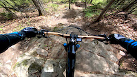
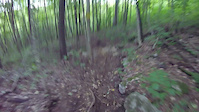
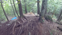
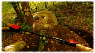
Photos of E47- Empire 47 Mountain Bike
trail: Zomby Woof
25 |
Oct 8, 2021 @ 5:47pm
Oct 8, 2021
trail: Huron
48 |
Oct 8, 2021 @ 5:47pm
Oct 8, 2021
trail: Huron
32 |
Oct 8, 2021 @ 5:46pm
Oct 8, 2021
trail: Valkyrie
44 |
Oct 6, 2021 @ 6:29pm
Oct 6, 2021
trail: Belzébrute
74 |
Oct 6, 2021 @ 6:28pm
Oct 6, 2021
trail: Belzébrute
52 |
Oct 6, 2021 @ 6:27pm
Oct 6, 2021
trail: Belzébrute
47 |
Oct 6, 2021 @ 6:27pm
Oct 6, 2021
trail: Haute Valkyrie
886 |
Jul 30, 2018 @ 9:57am
Jul 30, 2018Videos of E47- Empire 47 Mountain Bike
trail: Haute Valkyrie
1:03 |
487 |
May 24, 2020

trail: Pada-one (jump line)
1:34 |
278 |
Oct 11, 2019

trail: Pada-one (jump line)
1:01 |
102 |
Oct 11, 2019
trail: Végétarienne
2:13 |
53 |
Sep 9, 2019
trail: Nanaimo
1:09 |
340 |
Sep 9, 2019
youtuber
![Voici en exclusivité la monstrueuse NOSFERATU]()

3:57 |
41 |
May 30, 2022
youtuber
![Les conditions automnale sont tout simplement...]()
6:11 |
67 |
Nov 8, 2021
youtuber
![Another English POV - Belzébrute at Empire 47]()
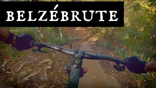
trail: Belzébrute
14:46 |
154 |
Oct 14, 2021 , Lac Delage
Recent Trail Reports
| status | trail | date | condition | info | user |
|---|---|---|---|---|---|
| Pètpisrépète | Jun 26, 2022 @ 6:12am Jun 26, 2022 | Ideal | fagelinas | ||
| Apex | Jun 26, 2022 @ 6:12am Jun 26, 2022 | Ideal | fagelinas | ||
| Kamasutrail | Jun 26, 2022 @ 6:12am Jun 26, 2022 | Ideal | fagelinas | ||
| Nanaimo | Jun 1, 2022 @ 2:54pm Jun 1, 2022 | Wet | Wolfpat | ||
| Jed-Hi (jump line) | Jun 1, 2022 @ 2:54pm Jun 1, 2022 | Ideal | Wolfpat | ||
| Flowrentide | Jun 1, 2022 @ 2:54pm Jun 1, 2022 | Variable | Wolfpat | ||
| Montée de lait | May 29, 2022 @ 11:09am May 29, 2022 | Variable | Willracine | ||
| Pada-one (jump line) | May 29, 2022 @ 11:09am May 29, 2022 | Ideal | Willracine | ||
| Accès Jumpline | May 29, 2022 @ 11:09am May 29, 2022 | Ideal | Willracine | ||
| Tantquàyêtre | Jan 29, 2022 @ 7:54am Jan 29, 2022 | Snow Groomed | rhopper WMBC |
Activity Feed
| username | action | type | title | date | |
|---|---|---|---|---|---|
 | rfoco | ridden | poi | Long ladder bridge off huge rocks | Jul 5, 2022 @ 5:29pm 11 hours |
 | Vickmazer | wishlist | region | E47- Empire 47 | Jul 5, 2022 @ 4:30pm 12 hours |
| NevrEnuf | wishlist | region | E47- Empire 47 | Jul 5, 2022 @ 2:41pm 13 hours |
| rogerk | wishlist | region | E47- Empire 47 | Jul 5, 2022 @ 2:30pm 14 hours |
| mbratina | ridden | trail | Belzébrute | Jul 5, 2022 @ 11:21am 17 hours |
Recent Comments
| username | type | title | comment | date | |
|---|---|---|---|---|---|
 | trail | Isn't this train a fatbike only trail in the... | Oct 19, 2021 @ 10:02am Oct 19, 2021 | ||
| trail | Flowy a souhait ! Des beaux gros berms et des... | Oct 6, 2021 @ 6:02pm Oct 6, 2021 | ||
| trail | Wow, flow, jump et ponts, ma « best »... | Jul 11, 2021 @ 12:59pm Jul 11, 2021 | ||
 | trail | A well built climb, that isn’t technical,... | May 29, 2021 @ 5:43pm May 29, 2021 | ||
| trail | This trail doesn’t have much in the way of... | May 29, 2021 @ 5:41pm May 29, 2021 |
Nearby Areas
| name | distance | ||||
|---|---|---|---|---|---|
| Centre Castor | 1 | 1 | 4.7 km | ||
| Secteur du sommet | 5.5 km | ||||
| Sentiers du Moulin | 3 | 20 | 17 | 9 | 6.4 km |
| Lignes d'Hydro - Québec | 1 | 9.2 km | |||
| Alouette | 12 | 1 | 9.6 km |
Local Badges
-

Completionist1 awarded
Activity Type Stats
| activitytype | trails | distance | descent | descent distance | total vertical | rating | global rank | state rank | photos | reports | routes | ridelogs |
|---|---|---|---|---|---|---|---|---|---|---|---|---|
| Mountain Bike | 64 | 59 miles | 10,922 ft | 26 miles | 873 ft | #142 | #4 | 177 | 491 | 6 | 13,776 | |
| E-Bike | 32 | 37 miles | 7,028 ft | 16 miles | 833 ft | #130 | #6 | 438 | 2 | 245 | ||
| Hike | 14 | 10 miles | 2,008 ft | 4 miles | 827 ft | 426 | 2 | 61 | ||||
| Trail Running | 18 | 13 miles | 2,969 ft | 6 miles | 827 ft | 430 | 12 | 112 | ||||
| Snowshoe | 10 | 14 miles | 2,530 ft | 6 miles | 791 ft | #52 | 14 |
- By brenthillier
 NSMBA TRAILFORKS & contributors
 - Admins: E47, LB-Cycle
- #17150 - 29,116 views
- e47- empire 47 activity log | embed map of E47- Empire 47 mountain bike trails | e47- empire 47 mountain biking points of interest
Downloading of trail gps tracks in kml & gpx formats is enabled for E47- Empire 47.
You must login to download files.