close
Trail Conditions
- Unknown
- Snow Groomed
- Snow Packed
- Snow Covered
- Snow Cover Inadequate
- Freeze/thaw Cycle
- Icy
- Prevalent Mud
- Wet
- Variable
- Ideal
- Dry
- Very Dry
Trail Flow (Ridden Direction)
Trailforks scans users ridelogs to determine the most popular direction each trail is ridden. A good flowing trail network will have most trails flowing in a single direction according to their intension.
The colour categories are based on what percentage of riders are riding a trail in its intended direction.
The colour categories are based on what percentage of riders are riding a trail in its intended direction.
- > 96%
- > 90%
- > 80%
- > 70%
- > 50%
- < 50%
- bi-directional trail
- no data
Trail Last Ridden
Trailforks scans ridelogs to determine the last time a trail was ridden.
- < 2 days
- < 1 week
- < 2 weeks
- < 1 month
- < 6 months
- > 6 months
Trail Ridden Direction
The intended direction a trail should be ridden.
- Downhill Only
- Downhill Primary
- Both Directions
- Uphill Primary
- Uphill Only
- One Direction
Contribute Details
Colors indicate trail is missing specified detail.
- Description
- Photos
- Description & Photos
- Videos
Trail Popularity ?
Trailforks scans ridelogs to determine which trails are ridden the most in the last 9 months.
Trails are compared with nearby trails in the same city region with a possible 25 colour shades.
Think of this as a heatmap, more rides = more kinetic energy = warmer colors.
- most popular
- popular
- less popular
- not popular
ATV/ORV/OHV Filter
Max Vehicle Width
inches
Radar Time
x
Activity Recordings
Trailforks users anonymized public ridelogs from the past 6 months.
- mountain biking recent
- mountain biking (>6 month)
- hiking (1 year)
- moto (1 year)
Activity Recordings
Trailforks users anonymized public skilogs from the past 12 months.
- Downhill Ski
- Backcountry Ski
- Nordic Ski
Jump Magnitude Heatmap
Heatmap of where riders jump on trails. Zoom in to see individual jumps, click circles to view jump details.
Trails Deemphasized
Trails are shown in grey.
Only show trails with NO bikes.
Save the current map location and zoom level as your default home location whenever this page is loaded.
Save
No description for Ballinastoe has been added yet!
Login or register to submit one.
 google parking directions
google parking directionsThis region uses the Uk/Euro style trail grading system.
Activities Click to view
- Mountain Bike
27 trails
- E-Bike
15 trails
- Hike
15 trails
- Trail Running
15 trails
Region Details
- 7
- 3
- 11
- 6
Region Status
Open as of May 23, 2022Stats
- Avg Trail Rating
- Trails (view details)
- 28
- Trails Mountain Bike
- 27
- Trails E-Bike
- 15
- Trails Hike
- 15
- Trails Trail Running
- 15
- Total Distance
- 26 miles
- Total Descent
- 6,340 ft
- Total Vertical
- 1,387 ft
- Highest Trailhead
- 2,074 ft
- Reports
- 328
- Photos
- 49
- Ridden Counter
- 4,378
Popular Ballinastoe Mountain Biking Trails
Ballinastoe Mountain Bike Routes
| title | rating | distance |
|---|---|---|
| Ballinastoe loop | 8 miles | |
| Biking Blitz 2022: Ballinastoe race | 9 miles | |
| Gravity Enduro Series 2022 - Ballinastoe race | 14 miles | |
| Nat Champs Djouce Race Day race | 16 miles | |
| race | 16 miles | |
| 9 mile Ballinastoe All-Mountain Ride | popular ridelog | 9 miles |
| 10 mile Ballinastoe All-Mountain Ride | popular ridelog | 10 miles |
| 9 mile Ballinastoe Ride | popular ridelog | 9 miles |
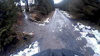
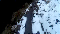
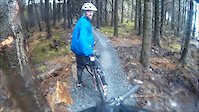
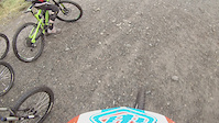
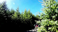
Photos of Ballinastoe Mountain Bike
trail: House Bound
52 |
Feb 13, 2022 @ 4:24pm
Feb 13, 2022
trail: Dead Forest
44 |
Nov 18, 2021 @ 2:22am
Nov 18, 2021
trail: Bump n' Grind
78 |
Nov 8, 2021 @ 11:35am
Nov 8, 2021
trail: Zipper
22 |
Sep 27, 2021 @ 11:55am
Sep 27, 2021
trail: Indriya
98 |
Jan 16, 2021 @ 6:49am
Jan 16, 2021
trail: Access Road
26 |
Jan 11, 2021 @ 12:09am
Jan 11, 2021
trail: Access Road
22 |
Jan 11, 2021 @ 12:09am
Jan 11, 2021
trail: Zipper
22 |
Jan 9, 2021 @ 5:41am
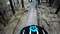
Jan 9, 2021Videos of Ballinastoe Mountain Bike
trail: House Bound
6:41 |
328 |
Mar 11, 2016
trail: Expressway
3:27 |
83 |
Mar 8, 2016
trail: Bump n' Grind
7:18 |
381 |
Mar 1, 2016
trail: GE stage 3
1:05 |
628 |
Jan 7, 2015
3:18 |
140 |
Sep 2, 2014

0:18 |
143 |
Aug 18, 2014

2:04 |
372 |
Jun 9, 2014
2:21 |
134 |
May 28, 2014
Recent Trail Reports
| status | trail | date | condition | info | user |
|---|---|---|---|---|---|
| Starter | May 23, 2022 @ 11:22am May 23, 2022 | Variable | slundy99 | ||
| Cool runnings | May 23, 2022 @ 11:22am May 23, 2022 | Variable | slundy99 | ||
| Black Forest | May 23, 2022 @ 11:22am May 23, 2022 | Wet | slundy99 | ||
| Bump n' Grind | May 23, 2022 @ 11:22am May 23, 2022 | Wet | slundy99 | ||
| Expressway | May 23, 2022 @ 11:22am May 23, 2022 | Wet | slundy99 | ||
| Access Road | May 23, 2022 @ 11:22am May 23, 2022 | Wet | slundy99 | ||
| House Bound | May 23, 2022 @ 11:22am May 23, 2022 | Wet | slundy99 | ||
| Flatliner | May 23, 2022 @ 11:22am May 23, 2022 | Wet | slundy99 | ||
| Home Run | May 23, 2022 @ 11:22am May 23, 2022 | Wet | slundy99 | ||
| Dead Forest | May 22, 2022 @ 2:42am May 22, 2022 | Unknown | Commencalteam1 |
Activity Feed
| username | action | type | title | date | |
|---|---|---|---|---|---|
 | JHalbsy | wishlist | route | Ballinastoe loop | Jul 5, 2022 @ 6:22am 22 hours |
 | elyari | update | route | Gravity Enduro Series 2022 - Ballinastoe | Jun 29, 2022 @ 3:41pm Jun 29, 2022 |
| elyari | update | route | Gravity Enduro Series 2022 - Ballinastoe | Jun 28, 2022 @ 12:18pm Jun 28, 2022 |
| elyari | add | route | Gravity Enduro Series 2022 - Ballinastoe | Jun 28, 2022 @ 10:23am Jun 28, 2022 |
| elyari | add | trail | Dark Loam and 6 more | Jun 28, 2022 @ 8:49am Jun 28, 2022 |
Recent Comments
| username | type | title | comment | date | |
|---|---|---|---|---|---|
| trail | U go to boardwalk trail keep going and just... | Jan 10, 2021 @ 12:56am Jan 10, 2021 | ||
| trail | thanks! updated! | Jul 24, 2020 @ 3:48am Jul 24, 2020 | ||
| trail | Cool runnings is the official name | Jul 19, 2020 @ 5:32am Jul 19, 2020 | ||
| trail | This trail is called coal minet | Aug 18, 2019 @ 6:53am Aug 18, 2019 | ||
 | trail | Hmmm, I think I might have worked it out from... | Mar 27, 2018 @ 11:58am Mar 27, 2018 |
Nearby Areas
| name | distance | ||||
|---|---|---|---|---|---|
| Lough Dan | 2 | 5 | 2.7 km | ||
| Wicklow | 2.9 km | ||||
| Djouce Woods | 11 | 3.1 km | |||
| Crone | 1 | 7 | 5 | 4 km | |
| Downs Hill | 9 | 1 | 4.8 km |
Local Badges
-

Completionist0 awarded
Activity Type Stats
| activitytype | trails | distance | descent | descent distance | total vertical | rating | global rank | state rank | photos | reports | routes | ridelogs |
|---|---|---|---|---|---|---|---|---|---|---|---|---|
| Mountain Bike | 27 | 23 miles | 6,257 ft | 15 miles | 1,109 ft | #1,214 | #3 | 48 | 327 | 5 | 2,696 | |
| E-Bike | 15 | 13 miles | 4,003 ft | 10 miles | 764 ft | #577 | #3 | 1 | 300 | 3 | 152 | |
| Hike | 15 | 16 miles | 2,762 ft | 8 miles | 1,388 ft | #1,299 | #4 | 322 | 42 | |||
| Trail Running | 15 | 16 miles | 2,762 ft | 8 miles | 1,388 ft | #1,308 | #4 | 322 | 20 |
- By brenthillier
 NSMBA TRAILFORKS & contributors
 - Admins: apply
- #4905 - 13,089 views
- ballinastoe activity log | embed map of Ballinastoe mountain bike trails | ballinastoe mountain biking points of interest
Downloading of trail gps tracks in kml & gpx formats is enabled for Ballinastoe.
You must login to download files.