7.9 miles
Distance
428 ft
Climb
-1,303 ft
Descent
01:10:14
Avg time
Supporters, Builders, Maintainers & Land Managers of Peaks Trail
USFSLand Manager
Peaks Details
-
Activities
- Mountain Bike
- Hike
- Trail Running
-
Riding AreaBreckenridge
, Colorado -
Difficulty Rating
-
Voted DifficultyBlue (1 vote)
-
Trail TypeSingletrack
-
DirectionBoth Directions
-
Dogs AllowedYes
-
eBike Allowed
-
Global Ranking
-
Local Popularity90 in Mountain Biking [+]
- 65 in Trail Running
- 85 in Hiking
No description for Peaks trail has been added yet! Submit one here.
Peaks is a highly rated 8 mile popular blue singletrack scenic trail located near Breckenridge Colorado. This mountain bike primary trail can be used both directions. On average it takes 1 hour10 minutes to complete this trail.
Local Trail Association
-

-
Please consider joining or donating to the local trail association to supportdonate to earn trail karma!
trail development & maintenance.
Traditionally Indigenous Territory
More Stats for Peaks mountain bike trail trail
-
Altitude change-875 ft
-
Altitude min9,098 ft
-
Altitude max10,182 ft
-
Altitude start9,990 ft
-
Altitude end9,114 ft
-
Grade-2.1%
-
Grade max-24.3%
-
Grade min15.2%
-
Distance climb2 miles
-
Distance down5 miles
-
Distance flat2,320 ft
-
Avg time01:10:14
-
Avg reverse time01:57:07
- view trail stats
close
Trail Conditions
- Unknown
- Snow Groomed
- Snow Packed
- Snow Covered
- Snow Cover Inadequate
- Freeze/thaw Cycle
- Icy
- Prevalent Mud
- Wet
- Variable
- Ideal
- Dry
- Very Dry
Trail Flow (Ridden Direction)
Trailforks scans users ridelogs to determine the most popular direction each trail is ridden. A good flowing trail network will have most trails flowing in a single direction according to their intension.
The colour categories are based on what percentage of riders are riding a trail in its intended direction.
The colour categories are based on what percentage of riders are riding a trail in its intended direction.
- > 96%
- > 90%
- > 80%
- > 70%
- > 50%
- < 50%
- bi-directional trail
- no data
Trail Last Ridden
Trailforks scans ridelogs to determine the last time a trail was ridden.
- < 2 days
- < 1 week
- < 2 weeks
- < 1 month
- < 6 months
- > 6 months
Trail Ridden Direction
The intended direction a trail should be ridden.
- Downhill Only
- Downhill Primary
- Both Directions
- Uphill Primary
- Uphill Only
- One Direction
Contribute Details
Colors indicate trail is missing specified detail.
- Description
- Photos
- Description & Photos
- Videos
Trail Popularity ?
Trailforks scans ridelogs to determine which trails are ridden the most in the last 9 months.
Trails are compared with nearby trails in the same city region with a possible 25 colour shades.
Think of this as a heatmap, more rides = more kinetic energy = warmer colors.
- most popular
- popular
- less popular
- not popular
ATV/ORV/OHV Filter
Max Vehicle Width
inches
Radar Time
x
Activity Recordings
Trailforks users anonymized public ridelogs from the past 6 months.
- mountain biking recent
- mountain biking (>6 month)
- hiking (1 year)
- moto (1 year)
Activity Recordings
Trailforks users anonymized public skilogs from the past 12 months.
- Downhill Ski
- Backcountry Ski
- Nordic Ski
Jump Magnitude Heatmap
Heatmap of where riders jump on trails. Zoom in to see individual jumps, click circles to view jump details.
Trails Deemphasized
Trails are shown in grey.
Only show trails with NO bikes.
Save the current map location and zoom level as your default home location whenever this page is loaded.
Save
Directions to peaks trailhead
(39.487590, -106.067200)
update trails status or condition
Peaks Trail Reports
view all reports »
Recent Ridelog Activity on Trail
Past Week
- 17 rides
- 18 miles avg distance
6 Months
- 68 rides
- 21 miles avg distance
All
- 1,009 rides

Photos
more »
Routes with this trail
more »
Upcoming Trail Events
-
+ 0
 hi-dr-nick
Congrats forester service, you succeeded in continuing your mission by sanitizing the Breck size even further with the lame reroute around the punchy climbs. Those areas didn’t even have drainage issues. Why don’t you go fix the big big areas with actual drainage issues on the frisco side instead of “fixing” non issues.
[Reply]
AlpineAspirations
(Jun 5, 2021 at 16:18)
This is a nice trail with a little bit of everything. Starting at Peak 7 the trail is more technical with roots and rocks. The middle section is relatively flat with nice flowing rollers. The end of the trail near Frisco is a mild decent over mixed terrain. This trail is fairly heavily trafficked by hikers. I’m not sure how this was ever voted the best trail in Summit unless it was based strictly on the amount of use.
[Reply]
briananacker
 (Oct 24, 2020 at 10:54)
From breck to Frisco. A bit of a schizo trail in terms of grade and surface and habitat; lots of punchy climbs and descents, in and out of the woods, smooth then rocky then rooty, dry then loam then springs then loose. At some point a sustained descent sets in and its fast and furious in the beat way. Towards the end you’ll find an unreasonable amount of wandering tourists.
[Reply]
AlexanderCR
(Jul 11, 2020 at 15:46)
A fun trail with roots, rocks and occasional puddles caused by natural springs. This trail has a lot of climbing if you are coming up from Frisco, but the descent is well worth it. You can ride this trail as a out and back , or you can go all the way through and down to Breck. Locals recommend this trail, and I can see why. Peaks Trail has won the Best Trail in Frisco twice in a row in the Best of Summit (2017 and 201 . It has rocks, roots and log drops. Add in plenty of loam and you have a classic mountain bike trail that has been cherished through the years.
[Reply]
agoddard
(Jul 1, 2020 at 20:03)
Fabulous trail that locals recommend. This is a fun, flowy trail with a mix of moderate climbs, rock gardens, and easy cruiser sections where you can take in the amazing scenery. If you can't do a big loop, have a friend shuttle you to the trailhead at Breck. It is 2:1 downhill to Frisco. Add on Hattie's at the end in Frisco for a little more edgy challenge.
[Reply]
 Mlyell21
(Aug 26, 2017 at 8:44)
Mlyell21
(Aug 26, 2017 at 8:44)
I rode this as a loop, riding the rec path from Breck and climbing from Frisco ending with a downhill through the resort to the 4 o'clock freeride park. While a fun
[Reply]
Mlyell21
(Sep 28, 2017 at 20:44)
I guess the rest of my comment got eaten.
Continuing ....
While a fun ride, most of the heavy lifting was during the ascent from Frisco, and I couldn't help but wish that I had started at the top in Breck to come down as the descent would have been quite a bit more fun than wayfinding back down the hill from Breck's Ski resort,
[Reply]
Continuing ....
While a fun ride, most of the heavy lifting was during the ascent from Frisco, and I couldn't help but wish that I had started at the top in Breck to come down as the descent would have been quite a bit more fun than wayfinding back down the hill from Breck's Ski resort,
Monsterworkout
(May 24, 2017 at 10:12)
An enjoyable ride that's not too technical. Although the area closest to Breckinridge is a very rocky and tree rooted trail best suited for a full suspension bike. Heading from Breckinridge to Frisco is more descending than ascending. Be prepared for a good climb as you leave Frisco back to Breckinridge.
[Reply]
Videos
more »

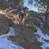
5:47 |
684 |
Jun 28, 2019 , Breckenridge
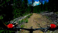
3:31 |
621 |
Jun 29, 2014 , Breckenridge
Nearby Trails
- Toad Alley 190 ft
- Wirepatch Road 1,247 ft
- Independence Superchair 1,273 ft
- Gold Digger 3,638 ft
- Rocky Mountain Superchair 3,957 ft
- embed Peaks trail on your website
- By todd Trailforks & contributors
- #12749 - 7,163 views
- subscribe
- login to download gpx or kml files.