close
Trail Conditions
- Unknown
- Snow Groomed
- Snow Packed
- Snow Covered
- Snow Cover Inadequate
- Freeze/thaw Cycle
- Icy
- Prevalent Mud
- Wet
- Variable
- Ideal
- Dry
- Very Dry
Trail Flow (Ridden Direction)
Trailforks scans users ridelogs to determine the most popular direction each trail is ridden. A good flowing trail network will have most trails flowing in a single direction according to their intension.
The colour categories are based on what percentage of riders are riding a trail in its intended direction.
The colour categories are based on what percentage of riders are riding a trail in its intended direction.
- > 96%
- > 90%
- > 80%
- > 70%
- > 50%
- < 50%
- bi-directional trail
- no data
Trail Last Ridden
Trailforks scans ridelogs to determine the last time a trail was ridden.
- < 2 days
- < 1 week
- < 2 weeks
- < 1 month
- < 6 months
- > 6 months
Trail Ridden Direction
The intended direction a trail should be ridden.
- Downhill Only
- Downhill Primary
- Both Directions
- Uphill Primary
- Uphill Only
- One Direction
Contribute Details
Colors indicate trail is missing specified detail.
- Description
- Photos
- Description & Photos
- Videos
Trail Popularity ?
Trailforks scans ridelogs to determine which trails are ridden the most in the last 9 months.
Trails are compared with nearby trails in the same city region with a possible 25 colour shades.
Think of this as a heatmap, more rides = more kinetic energy = warmer colors.
- most popular
- popular
- less popular
- not popular
ATV/ORV/OHV Filter
Max Vehicle Width
inches
Radar Time
x
Activity Recordings
Trailforks users anonymized public ridelogs from the past 6 months.
- mountain biking recent
- mountain biking (>6 month)
- hiking (1 year)
- moto (1 year)
Activity Recordings
Trailforks users anonymized public skilogs from the past 12 months.
- Downhill Ski
- Backcountry Ski
- Nordic Ski
Jump Magnitude Heatmap
Heatmap of where riders jump on trails. Zoom in to see individual jumps, click circles to view jump details.
Trails Deemphasized
Trails are shown in grey.
Only show trails with NO bikes.
Save the current map location and zoom level as your default home location whenever this page is loaded.
SaveWelcome to North America's premier natural laboratory for testing tire performance on loose-over-hard conditions. The South Hills are Helena's backyard. With nearly 80 miles of singletrack and trailheads in many neighborhoods, even downtown, the South Hills trail network offers rides ranging from 3 to 50+ miles. The network is spread out across a series of four ridges separated by gulches.
It's not uncommon to go for a ride without seeing anyone else, but you should expect to encounter other trail users. Trail etiquette is an evergreen topic, so please ride with respect and be courteous with other users. Slow down when you encounter hikers, yield if you're approaching them from the front, and be pleasant. These open lands are a patchwork of public and private ownership, and good trail etiquette helps maintain and expand our access.
View region descriptions for other activity types
It's not uncommon to go for a ride without seeing anyone else, but you should expect to encounter other trail users. Trail etiquette is an evergreen topic, so please ride with respect and be courteous with other users. Slow down when you encounter hikers, yield if you're approaching them from the front, and be pleasant. These open lands are a patchwork of public and private ownership, and good trail etiquette helps maintain and expand our access.
Generic
The South Hills are Helena's backyard. There are nearly nearly 80 miles of singletrack and trailheads in many neighborhoods, even downtown. The network is spread out across a series of four ridges that are separated by gulches.It's not uncommon to venture out without seeing anyone else, but you should expect to encounter other trail users. Please be courteous with other users as you enjoy our trails. These open lands are a patchwork of public and private ownership, and good trail etiquette helps maintain and expand our access.
Mountain Bike
Welcome to North America's premier natural laboratory for testing tire performance on loose-over-hard conditions. The South Hills are Helena's backyard. With nearly 80 miles of singletrack and trailheads in many neighborhoods, even downtown, the South Hills trail network offers rides ranging from 3 to 50+ miles. The network is spread out across a series of four ridges separated by gulches.It's not uncommon to go for a ride without seeing anyone else, but you should expect to encounter other trail users. Trail etiquette is an evergreen topic, so please ride with respect and be courteous with other users. Slow down when you encounter hikers, yield if you're approaching them from the front, and be pleasant. These open lands are a patchwork of public and private ownership, and good trail etiquette helps maintain and expand our access.
E-Bike
E-bikes aren't allowed on City of Helena or USFS trails in the South Hills. Sorry homie. Hike
The South Hills are Helena's backyard. With nearly 80 miles of singletrack and trailheads in many neighborhoods, even downtown, the South Hills trail network offers day hikes ranging from 1 to 10+ miles. (Camping is not allowed on City land or on USFS sections adjacent to the city.)These open lands are a patchwork of public and private ownership, and good trail etiquette helps maintain and expand our access. Don't cut switchbacks. Reconsider your hike if trails are soft, and stay on trail to avoid widening it. It's not uncommon to venture out without seeing anyone else, but you should expect to encounter other trail users. Please be courteous as you enjoy our trails - yield to overtaking users, whether on foot or bike. Remember that dogs must be under control at all times, and the City of Helena requires leashes within 100 yards of a trailhead.
Trail Running
The South Hills are Helena's backyard. With nearly 80 miles of singletrack and trailheads in many neighborhoods, even downtown, the South Hills trail network offers runs ranging from 1 to 40 miles. The network is spread out across a series of four ridges that are separated by gulches.These open lands are a patchwork of public and private ownership, and good trail etiquette helps maintain and expand our access. Don't cut switchbacks. Reconsider your run if trails are soft, and stay on trail to avoid widening it. It's not uncommon to venture out without seeing anyone else, but you should expect to encounter other trail users. Please be courteous with other users as you enjoy our trails - yield to overtaking users, whether on foot or bike.
Horse
The South Hills are Helena's backyard. The trail network features nearly 80 miles of singletrack and trailheads in many neighborhoods, even downtown. The network is spread out across a series of four ridges that are separated by gulches.Horses are not allowed on City of Helena trails, but they are allowed on the USFS trails farther south. Equestrians on these trails should be prepared to encounter other users, especially mountain bikers, runners, and hikers.
Dirtbike/Moto
There are no motorized trails in the South Hills, only roads. Farther to the south, the Lava Mountain Trail is motorized. Observed Trials
There are no motorized trails in the South Hills, only roads. Farther to the south, the Lava Mountain Trail is motorized. ATV/ORV/OHV
There are no motorized trails in the South Hills, only roads. Farther to the south, the Lava Mountain Trail is motorized. Snowshoe
The South Hills offer excellent snowshoeing opportunities whenever there is enough snow. More reliable snowshoeing options are MacDonald Pass (outside the groomed area) and Stemple Pass. Backcountry Ski
Mount Ascension and Mount Helena offer some popular glade skiing options on the infrequent occasions when Helena receives enough snow. Nordic Ski
The South Hills offer excellent Nordic opportunities whenever there is enough snow. Deford Trail and the lower slopes of Mount Ascension are popular Nordic options. The rest of the trail system provides the general outline for challenging backcountry tours.More reliable XC skiing options are MacDonald Pass and Stemple Pass.
Primary Trail Type: Cross-Country
eBikes Allowed:
No
Shuttleable: YES
 google parking directions
 Access Info:
The most popular starting point for riding in the South Hills is South Park Avenue. Many people park on the street or in a city parking lot near the library. The Park Avenue Building parking lot is another popular off-street option.
Activities Click to view
- Mountain Bike
185 trails
- E-Bike
15 trails
- Hike
179 trails
- Trail Running
179 trails
- Horse
21 trails
- Dirtbike/Moto
18 trails
- ATV/ORV/OHV
18 trails
- Snowmobile
0 trails
- Snowshoe
173 trails
- Backcountry Ski
1 trails
- Nordic Ski
177 trails
Region Details
- 21
- 11
- 47
- 84
- 18
- 4
Region Status
Open as of 2 daysStats
- Avg Trail Rating
- Trails (view details)
- 185
- Trails Mountain Bike
- 186
- Trails E-Bike
- 15
- Trails Hike
- 179
- Trails Trail Running
- 179
- Trails Horse
- 21
- Trails Dirtbike/Moto
- 18
- Trails ATV/ORV/OHV
- 18
- Trails Snowshoe
- 173
- Trails Backcountry Ski
- 1
- Trails Nordic Ski
- 177
- Total Distance
- 149 miles
- Total Descent
- 30,170 ft
- Total Vertical
- 2,542 ft
- Highest Trailhead
- 6,453 ft
- Reports
- 9,402
- Photos
- 678
- Ridden Counter
- 29,330
Popular South Hills Mountain Biking Trails
South Hills Mountain Bike Routes
| title | rating | distance |
|---|---|---|
| Mount Helena Ridge to Show-Me-the-Horse | 6 miles | |
| Mount Helena Ridge - Hogsback - Horse | 13 miles | |
| Show Me the Hog | 8 miles | |
| Eddye McClure Loop | 7 miles | |
| Mount Helena Ridge - Emmett's - Horse | 11 miles | |
| Gin Money | 4 miles | |
| Show Me the Hog | 6 miles | |
| Mount Ascension: Entertainment / Little Moab | 5 miles | |
| Mount Helena Ridge - 2018 Construction Route | 8 miles | |
| Two Quick Descents | 2 miles |
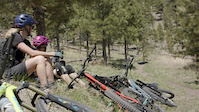
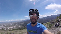
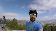
Photos of South Hills Mountain Bike
trail: Top of the World
32 |
Sep 24, 2021 @ 1:58pm
Sep 24, 2021
trail: Cruse Control Trail - upper
44 |
Jun 19, 2021 @ 4:35pm
Jun 19, 2021
trail: Cruse Control Trail - upper
50 |
Jun 19, 2021 @ 4:35pm
Jun 19, 2021
trail: Archery Range Trail
54 |
Dec 10, 2020 @ 4:25pm
Dec 10, 2020
trail: Rodney Ridge Trail
40 |
Dec 10, 2020 @ 4:20pm
Dec 10, 2020
trail: Eddye McClure East
191 |
Jul 24, 2017 @ 7:34pm
Jul 24, 2017
trail: Eddye McClure East
252 |
May 29, 2017 @ 5:23pm
May 29, 2017
trail: Mt Ascension Loop
288 |
Oct 26, 2014 @ 2:49pm
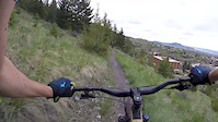
Oct 26, 2014Videos of South Hills Mountain Bike

71 |
May 20, 2022

|
May 15, 2022
trail: Big Dorothy Trail
1:00 |
227 |
May 14, 2020
2:34 |
374 |
May 21, 2018
7:56 |
743 |
May 21, 2018
6:26 |
367 |
May 21, 2018

trail: North Access Trail
0:10 |
37 |
Mar 15, 2018
trail: Daisy Hill Trail
1:02 |
37 |
Jul 22, 2017
Recent Trail Reports
| status | trail | date | condition | info | user |
|---|---|---|---|---|---|
| Wakina Sky Road | Jul 4, 2022 @ 6:49am 2 days | Ideal | RockyMTrider | ||
| Wakina Sky Trail | Jul 4, 2022 @ 6:49am 2 days | Ideal | RockyMTrider | ||
| Stairway To Heaven Trail - Upper | Jul 4, 2022 @ 6:49am 2 days | Ideal | RockyMTrider | ||
| Dazed and Confused | Jul 4, 2022 @ 6:49am 2 days | Ideal | RockyMTrider | ||
| Dante's Inferno | Jul 4, 2022 @ 6:49am 2 days | Ideal | RockyMTrider | ||
| Wakina Gully/Skills Course | Jul 2, 2022 @ 10:33am Jul 2, 2022 | Dry | evasive MBG | ||
| Stairway To Heaven Trail - Lower | Jul 2, 2022 @ 10:33am Jul 2, 2022 | Dry | evasive MBG | ||
| Evan's Trail | Jul 2, 2022 @ 10:33am Jul 2, 2022 | Dry | evasive MBG | ||
| Acropolis to Sparta | Jul 2, 2022 @ 10:33am Jul 2, 2022 | Dry | evasive MBG | ||
| Acropolis Crest Trail | Jul 2, 2022 @ 10:33am Jul 2, 2022 | Dry | evasive MBG |
Activity Feed
| username | action | type | title | date | |
|---|---|---|---|---|---|
 | damagingfish | ridden | route | Mount Ascension: Entertainment / Little Moab | Jul 5, 2022 @ 11:04am 17 hours |
 | evasive | add | event | MBG-PPLT worknight on Show-Me-the-Horse Trail | Jul 5, 2022 @ 9:55am 18 hours |
| RockyMTrider | add | report | Wakina Sky Road and 4 more | Jul 4, 2022 @ 9:18am 2 days |
| damagingfish | wishlist | route | 2015 Montana Enduro Series #1: Helenduro | Jul 2, 2022 @ 10:18pm Jul 2, 2022 |
| evasive | add | report | Wakina Sky Road and 6 more | Jul 2, 2022 @ 2:32pm Jul 2, 2022 |
Recent Comments
| username | type | title | comment | date | |
|---|---|---|---|---|---|
| trail | Sick trail indeed, loved this one | Apr 9, 2022 @ 3:38pm Apr 9, 2022 | ||
| trail | This trail is a lot of fun, GREAT flow with... | Apr 8, 2022 @ 6:18pm Apr 8, 2022 | ||
| trail | The top section of this trail is a lot of fun,... | Jan 31, 2022 @ 7:32am Jan 31, 2022 | ||
| trail | Overall great trail. Like so many other... | Jan 11, 2022 @ 4:07pm Jan 11, 2022 | ||
| trail | Overall sick trail. On this trail, compared... | Jan 11, 2022 @ 4:05pm Jan 11, 2022 |
Nearby Areas
| name | distance | ||||
|---|---|---|---|---|---|
| Tenmile Creek Park | 3.6 km | ||||
| Clancy OHV Area | 11 | 5.7 km | |||
| Priest Area | 8 | 10 | 7.3 km | ||
| Scratchgravel Hills | 30 | 12 | 5 | 1 | 8.7 km |
| North Elkhorns | 28 | 23 | 8 | 1 | 9.3 km |
Local Badges
-

Completionist0 awarded
Upcoming Local Events
-
-
-
Local Products
Local Products
Activity Type Stats
| activitytype | trails | distance | descent | descent distance | total vertical | rating | global rank | state rank | photos | reports | routes | ridelogs |
|---|---|---|---|---|---|---|---|---|---|---|---|---|
| Mountain Bike | 185 | 149 miles | 30,171 ft | 66 miles | 2,543 ft | #156 | #66 | 662 | 9,426 | 24 | 13,591 | |
| E-Bike | 15 | 43 miles | 3,196 ft | 13 miles | 2,267 ft | #1,845 | 8,707 | 16 | ||||
| Hike | 179 | 147 miles | 29,229 ft | 64 miles | 2,543 ft | #110 | #55 | 16 | 9,391 | 937 | ||
| Trail Running | 179 | 147 miles | 29,229 ft | 64 miles | 2,543 ft | #108 | #54 | 9,391 | 1 | 226 | ||
| Horse | 21 | 24 miles | 5,289 ft | 11 miles | 1,969 ft | #39 | #34 | 7,425 | ||||
| Dirtbike/Moto | 18 | 49 miles | 4,331 ft | 17 miles | 2,303 ft | #211 | 7,420 | 3 | ||||
| ATV/ORV/OHV | 18 | 49 miles | 4,331 ft | 17 miles | 2,303 ft | #179 | 7,420 | 2 | ||||
| Snowshoe | 173 | 133 miles | 28,688 ft | 62 miles | 2,379 ft | #9 | #6 | 3,613 | 1 | 3 | ||
| Backcountry Ski | 1 | 400 ft | 10 ft | 367 ft | 10 ft | #133 | 1 | 3,236 | 3 | |||
| Nordic Ski | 177 | 140 miles | 28,976 ft | 63 miles | 2,379 ft | #3 | #3 | 3,611 | 2 | 14 |
- By brenthillier
 NSMBA TRAILFORKS & contributors
 - Admins: MONTANABIKERMAN, evasive, wyomont, MBG, BikeHelena, wyomont, PPLT
- #3445 - 35,074 views
- south hills activity log | embed map of South Hills mountain bike trails | south hills mountain biking points of interest
Downloading of trail gps tracks in kml & gpx formats is enabled for South Hills.
You must login to download files.