1.5 miles
Distance
2 ft
Climb
-799 ft
Descent
00:06:15
Avg time
Supporters, Builders, Maintainers & Land Managers of Show-Me-The-Horse Trail
USFSLand Manager
Details
-
Activities
- Mountain Bike
- Hike
- Trail Running
- Snowshoe
- Nordic Ski
-
Riding AreaSouth Hills
Helena, Montana -
Ref Number#378
-
AKAHorse Trail
-
Difficulty Rating
-
Hiking SAC ScaleT1 Hiking
-
Trail TypeSingletrack
-
Snow GroomingBackcountry
-
Bike TypeAM, XC, CX, Gravel
-
DirectionDownhill PrimaryPopular direction shown
-
Climb DifficultyBlack Diamond
-
Physical RatingModerate
-
Trail VisibilityAlways easy to follow
-
SeasonApril - November
-
Dogs AllowedYes
-
eBike Allowed
-
TTFs on TrailBerm, Jump
-
Global Ranking
-
Local Popularity100 in Mountain Biking [+]
- 5 in Trail Running
- 80 in Hiking
- 5 in Snowshoeing
- 5 in Skiing
-
Land ManagerUSFS
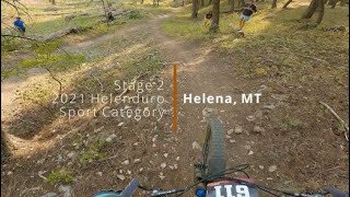
Show-Me-The-Horse is Helena's most popular downhill trail. It starts in open meadows, drops into open ponderosa pine forest, and ends in a tight, wooded gully. The trail empties onto Grizzly Gulch Road, and watch for traffic when exiting. It is not formally directional, and is multi-use, so be on the lookout for trail runners or hikers. There is no parking available at the bottom.
Local Trail Association
-

-

-
Please consider joining or donating to the local trail association to supportdonate to earn trail karma!
trail development & maintenance.
Traditionally Indigenous Territory
More Stats for Show-Me-The-Horse Trail bike trail trail
-
Altitude change-799 ft
-
Altitude min4,467 ft
-
Altitude max5,265 ft
-
Altitude start5,265 ft
-
Altitude end4,465 ft
-
Grade-10.2%
-
Grade max-28%
-
Grade min3%
-
Distance climb98 ft
-
Distance down1 mile
-
Distance flat292 ft
-
Avg time00:06:15
-
Avg reverse time00:29:43
- view trail stats
close
Trail Conditions
- Unknown
- Snow Groomed
- Snow Packed
- Snow Covered
- Snow Cover Inadequate
- Freeze/thaw Cycle
- Icy
- Prevalent Mud
- Wet
- Variable
- Ideal
- Dry
- Very Dry
Trail Flow (Ridden Direction)
Trailforks scans users ridelogs to determine the most popular direction each trail is ridden. A good flowing trail network will have most trails flowing in a single direction according to their intension.
The colour categories are based on what percentage of riders are riding a trail in its intended direction.
The colour categories are based on what percentage of riders are riding a trail in its intended direction.
- > 96%
- > 90%
- > 80%
- > 70%
- > 50%
- < 50%
- bi-directional trail
- no data
Trail Last Ridden
Trailforks scans ridelogs to determine the last time a trail was ridden.
- < 2 days
- < 1 week
- < 2 weeks
- < 1 month
- < 6 months
- > 6 months
Trail Ridden Direction
The intended direction a trail should be ridden.
- Downhill Only
- Downhill Primary
- Both Directions
- Uphill Primary
- Uphill Only
- One Direction
Contribute Details
Colors indicate trail is missing specified detail.
- Description
- Photos
- Description & Photos
- Videos
Trail Popularity ?
Trailforks scans ridelogs to determine which trails are ridden the most in the last 9 months.
Trails are compared with nearby trails in the same city region with a possible 25 colour shades.
Think of this as a heatmap, more rides = more kinetic energy = warmer colors.
- most popular
- popular
- less popular
- not popular
ATV/ORV/OHV Filter
Max Vehicle Width
inches
Radar Time
x
Activity Recordings
Trailforks users anonymized public ridelogs from the past 6 months.
- mountain biking recent
- mountain biking (>6 month)
- hiking (1 year)
- moto (1 year)
Activity Recordings
Trailforks users anonymized public skilogs from the past 12 months.
- Downhill Ski
- Backcountry Ski
- Nordic Ski
Jump Magnitude Heatmap
Heatmap of where riders jump on trails. Zoom in to see individual jumps, click circles to view jump details.
Trails Deemphasized
Trails are shown in grey.
Only show trails with NO bikes.
Save the current map location and zoom level as your default home location whenever this page is loaded.
Save
Directions to showmethehorse-trail trailhead
(46.576060, -112.098770)
update trails status or condition
... Trail Reports
view all reports »
Recent Ridelog Activity on Trail
Past Week
- 10 rides
- 12 miles avg distance
6 Months
- 207 rides
- 12 miles avg distance
All
- 2,264 rides
 Jump
JumpPhotos
more »
Routes with this trail
more »
Upcoming Trail Events
-
+ 1
MT36
(Jan 11, 2022 at 16:07)
Overall great trail. Like so many other trails here though, it would be nice to not spend so much time maching straight down the fall line, riding the brakes, eating up all that vertical you just earned. Some more effective use of natural features, more supported turns and some opportunities for air would make this trail epic.
[Reply]

 Zgriff71
I did thanks, I just wasn't sure if anything had changed since we got this warmer weather.
[Reply]
 Kory-King
Its a good trail and all but the best in Montana... basically all the downhill parts of the Bangtail Divide trail were much better than this trail.
[Reply]
HAMMR412
 (Sep 18, 2019 at 10:34)
Always fun, nothing too technical to be worried about, rather docile, and very beautiful!
If you like trails that kick your butt, then this is a great beginner trail.
[Reply]
If you like trails that kick your butt, then this is a great beginner trail.
Videos
more »
6:07 |
101 |
Sep 30, 2021 , Helena
5:42 |
1045 |
May 17, 2016 , Helena
Nearby Trails
- Mount Helena Ridge Trail (lower) 0 ft
- Mini Ridge Trail 2 miles
- Mini-emmett's Connection 2 miles
- Wakina Sky Trail 2 miles
- South Dump Gulch Trail 2 miles
- embed Show-Me-The-Horse Trail trail on your website
- By drewswayne & contributors
- #5220 - 8,003 views
- subscribe
- login to download gpx or kml files.