close
Trail Conditions
- Unknown
- Snow Groomed
- Snow Packed
- Snow Covered
- Snow Cover Inadequate
- Freeze/thaw Cycle
- Icy
- Prevalent Mud
- Wet
- Variable
- Ideal
- Dry
- Very Dry
Trail Flow (Ridden Direction)
Trailforks scans users ridelogs to determine the most popular direction each trail is ridden. A good flowing trail network will have most trails flowing in a single direction according to their intension.
The colour categories are based on what percentage of riders are riding a trail in its intended direction.
The colour categories are based on what percentage of riders are riding a trail in its intended direction.
- > 96%
- > 90%
- > 80%
- > 70%
- > 50%
- < 50%
- bi-directional trail
- no data
Trail Last Ridden
Trailforks scans ridelogs to determine the last time a trail was ridden.
- < 2 days
- < 1 week
- < 2 weeks
- < 1 month
- < 6 months
- > 6 months
Trail Ridden Direction
The intended direction a trail should be ridden.
- Downhill Only
- Downhill Primary
- Both Directions
- Uphill Primary
- Uphill Only
- One Direction
Contribute Details
Colors indicate trail is missing specified detail.
- Description
- Photos
- Description & Photos
- Videos
Trail Popularity ?
Trailforks scans ridelogs to determine which trails are ridden the most in the last 9 months.
Trails are compared with nearby trails in the same city region with a possible 25 colour shades.
Think of this as a heatmap, more rides = more kinetic energy = warmer colors.
- most popular
- popular
- less popular
- not popular
ATV/ORV/OHV Filter
Max Vehicle Width
inches
Radar Time
x
Activity Recordings
Trailforks users anonymized public ridelogs from the past 6 months.
- mountain biking recent
- mountain biking (>6 month)
- hiking (1 year)
- moto (1 year)
Activity Recordings
Trailforks users anonymized public skilogs from the past 12 months.
- Downhill Ski
- Backcountry Ski
- Nordic Ski
Jump Magnitude Heatmap
Heatmap of where riders jump on trails. Zoom in to see individual jumps, click circles to view jump details.
Trails Deemphasized
Trails are shown in grey.
Only show trails with NO bikes.
Save the current map location and zoom level as your default home location whenever this page is loaded.
SaveThe Bluff is Smithers’ classic mountain bike playground. To the right of the access road are the original downhill-oriented
freeride trails. They have steep technical lines, fast and flowy berms, and stunts to challenge the most advanced riders, while also allowing beginner and intermediate riders to develop their skills.
Access the area from the Duthie Trailhead,which is just across the CN Tracks from Elks Park. There’s a 0.9 km boardwalk access trail to the old road, and it’s uphill from there. A new uptrack starts about 200m up the road on the right.
Once you reach the top, choose smooth and fast trails like The Shining (which also connects to Smoothy and Penetralia) and Aunti Flo, or tackle the technical challenges of Four Horseman, Remembrance Day or Trail of Bones.
If you are looking for more of a XC/All-mountain ride, try the new two-way trails on the left side of the access road. All Screwed Up and Long Way leave the road at the information kiosk. All Screwed Up will take you towards Seymour Ridge on flowy singletrack, and Long Way will take you up The Bluff where you can easily connect to the other downhill trails or continue climbing to the lookout at the very top.
 google parking directions
 Access Info:
Access the area from the Duthie Trailhead,which is just across the CN Tracks from Elks Park.
Disclaimer:
Respect CN Property and use the overpass on Dahlie Road to get to the trailhead.
Activities Click to view
- Mountain Bike
36 trails
- Hike
35 trails
- Trail Running
35 trails
Region Details
- 5
- 5
- 20
- 6
Region Status
Open as of Jun 15, 2022Stats
- Avg Trail Rating
- Trails (view details)
- 36
- Trails Mountain Bike
- 36
- Trails Hike
- 35
- Trails Trail Running
- 35
- Total Distance
- 22 miles
- Total Descent Distance
- 11 miles
- Total Descent
- 7,179 ft
- Total Vertical
- 1,256 ft
- Highest Trailhead
- 2,891 ft
- Reports
- 1,210
- Photos
- 259
- Ridden Counter
- 4,226
Popular The Bluff Recreation Area Trails
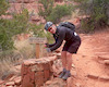
Photos of The Bluff Recreation Area Mountain Bike
trail: Lower Auntie Flo
6 |
May 22, 2022 @ 7:23am
May 22, 2022
trail: Lower Auntie Flo
3 |
May 22, 2022 @ 7:22am
May 22, 2022
trail: Uptrack
2 |
May 22, 2022 @ 7:21am
May 22, 2022
trail: Soul Stripper Connector
1 |
May 22, 2022 @ 7:20am
May 22, 2022
trail: Soul Stripper Connector
1 |
May 22, 2022 @ 7:19am
May 22, 2022
trail: Soul Stripper Connector
1 |
May 22, 2022 @ 7:18am
May 22, 2022
trail: All Screwed Up
1 |
May 22, 2022 @ 7:18am
May 22, 2022
trail: Deep Bluff
4 |
May 22, 2022 @ 7:16am
May 22, 2022Videos of The Bluff Recreation Area Mountain Bike

trail: Shining
1:14 |
306 |
Dec 17, 2013

trail: Shining
5:12 |
255 |
Jun 13, 2020 , Smithers
trail: Broken Axe
163 |
Jun 13, 2020 , Smithers

trail: Trail of Bones
7:22 |
460 |
May 18, 2020 , Smithers
Recent Trail Reports
| status | trail | date | condition | info | user |
|---|---|---|---|---|---|
| Deep Bluff | Jun 30, 2022 @ 11:51am Jun 30, 2022 | Dry | gearjunkie | ||
| Upper Longway | Jun 27, 2022 @ 11:33am Jun 27, 2022 | Variable | gfortin SMBA | ||
| Deep Bluff sec 4 | Jun 26, 2022 @ 10:16am Jun 26, 2022 | Variable | gfortin SMBA | ||
| Apocalypse | Jun 20, 2022 @ 8:37am Jun 20, 2022 | Dry | Phillycheesesteak | ||
| Broken Axe Lookout | Jun 18, 2022 @ 9:03am Jun 18, 2022 | Variable | gfortin SMBA | ||
| Upper Bluff Road | Jun 15, 2022 @ 3:54am Jun 15, 2022 | Variable | gfortin SMBA | ||
| Nervous Shakedown | Jun 15, 2022 @ 3:54am Jun 15, 2022 | Variable | gfortin SMBA | ||
| Four Horseman | Jun 8, 2022 @ 10:49pm Jun 8, 2022 | Ideal | coolyhands | ||
| Uptrack | Jun 2, 2022 @ 9:34am Jun 2, 2022 | Variable | gfortin SMBA | ||
| Back In Black | May 30, 2022 @ 5:23pm May 30, 2022 | Wet | nc99 |
Activity Feed
| username | action | type | title | date | |
|---|---|---|---|---|---|
 | gfortin | add | trail | Child's Play Connector | Jul 1, 2022 @ 7:25am Jul 1, 2022 |
| gfortin | comment | report | Deep Bluff | Jun 30, 2022 @ 8:03pm Jun 30, 2022 |
| gearjunkie | add | report | Deep Bluff | Jun 30, 2022 @ 11:51am Jun 30, 2022 |
| gfortin | update | trail | Upper Longway | Jun 28, 2022 @ 6:43am Jun 28, 2022 |
| gfortin | add | report | Upper Longway | Jun 27, 2022 @ 11:34am Jun 27, 2022 |
Recent Comments
| username | type | title | comment | date | |
|---|---|---|---|---|---|
| report | The trail is open to the picnic table. This... | Jun 30, 2022 @ 8:03pm Jun 30, 2022 | ||
 | trail | UN | Jun 21, 2022 @ 12:34pm Jun 21, 2022 | ||
| trail | April 8- trail closed | Apr 8, 2022 @ 10:19am Apr 8, 2022 | ||
| trail | April 8- trail closed | Apr 8, 2022 @ 10:18am Apr 8, 2022 | ||
| trail | Video coming from the NW? (And I agree re: rating) | Aug 17, 2021 @ 9:30pm Aug 17, 2021 |
Nearby Areas
| name | distance | ||||
|---|---|---|---|---|---|
| Piper Recreation Area | 5 | 3 | 2.6 km | ||
| Ptarmigan Recreation Trails | 1 | 1 | 4 km | ||
| Babine Mountains Provincial Park | 1 | 1 | 14 km | ||
| Dome Mountain | 15 km |
Local Badges
-

Completionist0 awarded
Upcoming Local Events
-
-
-
-
Local Trail Supporters
- Dave Bobb
- Carl Lutz
- Jeff McKaY
![]()
Local Trail Supporters
- Dave Bobb
- Carl Lutz
- Jeff McKaY
![]()
Activity Type Stats
| activitytype | trails | distance | descent | descent distance | total vertical | rating | global rank | state rank | photos | reports | routes | ridelogs |
|---|---|---|---|---|---|---|---|---|---|---|---|---|
| Mountain Bike | 36 | 22 miles | 7,178 ft | 11 miles | 1,257 ft | #1,315 | #122 | 254 | 1,210 | 3,344 | ||
| Hike | 35 | 22 miles | 6,857 ft | 11 miles | 1,257 ft | #1,065 | #98 | 1 | 1,208 | 77 | ||
| Trail Running | 35 | 22 miles | 6,857 ft | 11 miles | 1,257 ft | #1,072 | #98 | 4 | 1,208 | 219 |
- By brenthillier
 NSMBA TRAILFORKS & contributors
 - Admins: SMBA, BVCC, BBSS, wildmckay, sobikeski, NBC, PGBRS, aleksa
- #3358 - 11,151 views
- the bluff recreation area activity log | embed map of The Bluff Recreation Area mountain bike trails | the bluff recreation area mountain biking points of interest
Downloading of trail gps tracks in kml & gpx formats is enabled for The Bluff Recreation Area.
You must login to download files.