11.1 miles
Distance
447 ft
Climb
-3,264 ft
Descent
01:56:51
Avg time
Supporters, Builders, Maintainers & Land Managers of Porcupine Rim Trail

BLMLand Manager
Porcupine Rim Details
-
Activities
- Mountain Bike
- Hike
- Trail Running
-
Riding AreaLa Sal Mountains
Moab, Utah -
Difficulty Rating
-
Voted DifficultyBlack Diamond (8 votes)
-
Trail TypeSingletrack
-
Bike TypeAM
-
DirectionDownhill PrimaryPopular direction shown
-
Climb DifficultyGreen
-
Physical RatingModerate
-
Dogs AllowedYes
-
eBike Allowed
-
TTFs on TrailDrop
-
Global Ranking
-
Local Popularity100 in Mountain Biking [+]
- 85 in Trail Running
- 80 in Hiking
-
Land ManagerUSFS
Porcupine Rim bike trail is one of the must ride biking trails of Moab, Utah. Long pedal up form town but best when shuttled to the top. On the bike map it is often combined as the Whole Enchilada with Porcupine Rim, Kokopelli, Hazard County and Burro Pass.
The main bike trail is about 18KM long with a gentle -5% grade. The trail can ridden in an hour non stop, but most people take multiple hours to session the various steps and drops and take photos of the World famous views of Castle Valley.
Local Trail Association
-

-
Please consider joining or donating to the local trail association to supportdonate to earn trail karma!
trail development & maintenance.
Traditionally Indigenous Territory
More Stats for Porcupine Rim mountain bike trail trail
-
Altitude change-2,817 ft
-
Altitude min3,986 ft
-
Altitude max6,813 ft
-
Altitude start6,803 ft
-
Altitude end3,986 ft
-
Grade-4.806%
-
Grade max-105.651%
-
Grade min63.33%
-
Distance climb2 miles
-
Distance down9 miles
-
Distance flat2,974 ft
-
Avg time01:56:51
-
Avg reverse time01:39:53
- view trail stats
close
Trail Conditions
- Unknown
- Snow Groomed
- Snow Packed
- Snow Covered
- Snow Cover Inadequate
- Freeze/thaw Cycle
- Icy
- Prevalent Mud
- Wet
- Variable
- Ideal
- Dry
- Very Dry
Trail Flow (Ridden Direction)
Trailforks scans users ridelogs to determine the most popular direction each trail is ridden. A good flowing trail network will have most trails flowing in a single direction according to their intension.
The colour categories are based on what percentage of riders are riding a trail in its intended direction.
The colour categories are based on what percentage of riders are riding a trail in its intended direction.
- > 96%
- > 90%
- > 80%
- > 70%
- > 50%
- < 50%
- bi-directional trail
- no data
Trail Last Ridden
Trailforks scans ridelogs to determine the last time a trail was ridden.
- < 2 days
- < 1 week
- < 2 weeks
- < 1 month
- < 6 months
- > 6 months
Trail Ridden Direction
The intended direction a trail should be ridden.
- Downhill Only
- Downhill Primary
- Both Directions
- Uphill Primary
- Uphill Only
- One Direction
Contribute Details
Colors indicate trail is missing specified detail.
- Description
- Photos
- Description & Photos
- Videos
Trail Popularity ?
Trailforks scans ridelogs to determine which trails are ridden the most in the last 9 months.
Trails are compared with nearby trails in the same city region with a possible 25 colour shades.
Think of this as a heatmap, more rides = more kinetic energy = warmer colors.
- most popular
- popular
- less popular
- not popular
ATV/ORV/OHV Filter
Max Vehicle Width
inches
Radar Time
x
Activity Recordings
Trailforks users anonymized public ridelogs from the past 6 months.
- mountain biking recent
- mountain biking (>6 month)
- hiking (1 year)
- moto (1 year)
Activity Recordings
Trailforks users anonymized public skilogs from the past 12 months.
- Downhill Ski
- Backcountry Ski
- Nordic Ski
Jump Magnitude Heatmap
Heatmap of where riders jump on trails. Zoom in to see individual jumps, click circles to view jump details.
Trails Deemphasized
Trails are shown in grey.
Only show trails with NO bikes.
Save the current map location and zoom level as your default home location whenever this page is loaded.
Save
Directions to porcupine-rim trailhead
(38.594130, -109.377270)
update trails status or condition
Porcupine Rim Trail Reports
view all reports »
Recent Ridelog Activity on Trail
Past Week
- 9 rides
- 31 miles avg distance
6 Months
- 1,067 rides
- 29 miles avg distance
All
- 9,765 rides

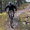
Photos
more »
Trail Lists
-
Trails To Ride in 2018
7 trails
-
Bucket List Trails
11 trails
Routes with this trail
more »
-
+ 0
 Winjones8
I’d say double track is rad if you like rad gnarly downhills that really test your physical ability. Single track is obviously sick too though.
[Reply]
Madsadsalad
 (Dec 13, 2021 at 19:28)
“Flow” trails are fine for areas with very little acreage to jam in an efficient trail network, but as much as they are fun, they are also generally scripted, planned, and frankly rather sterile. A lot of the new trails in Moab are like this. Fun trails, but essentially all pretty much the same. At its inception, Mountain Biking was about covering large stretches of mixed terrain with resilience, fortitude, and a spirit of adventure. Technical skills were just as, if not more important, than pumping and flow my bro. There were no soulless trail cutting machines and fastidiously groomed berms. The rocks were actually considered a feature and not a bug. Trails had character. So it is with the iconic Porcupine Rim. Love it while it lasts. The lower section was once much more raw, challenging, and gnarly before the masses complained it into submission. Porcupine is a grand cathedral of the sport and should be approached with reverence. If not awe.
[Reply]
sunderland56
(Dec 14, 2021 at 8:21)
Any changes to Porcupine Rim are due to mother nature - the constant sun / wind / rain / snow / etc - not workers making changes. That trail is insanely difficult to get to with tools and so it only receives minimal work. It is also within a WSA which restricts what can be done.
We are lucky to have several MTB Hall of Famers living in Moab and they say the trail is just as challenging as it was back in the day. Remember, though, that bikes have gotten a LOT better, which makes everything seem that much easier.
[Reply]
We are lucky to have several MTB Hall of Famers living in Moab and they say the trail is just as challenging as it was back in the day. Remember, though, that bikes have gotten a LOT better, which makes everything seem that much easier.
misterjohn123
(Dec 10, 2021 at 17:47)
agree with most commenters here. trail is split into double track section and singletrack section. first half of double track is just a road with lots of rocks and short technical climbs. second half gets more technical with drops and ledges, lots of fun but lots of opportunities to get caught on square rock edges. singletrack portion is awesome and worth going through the double track imo. relatively flowy with cool technical sections (drops, off camber, exposure) and great views. area near the river is REALLY technical on the ups and downs but easily scoped and walked, props if you can clean this.
[Reply]
 EpicTrails
Moabs biggest disappointment. The last 5% of the trail is super fun and there are awesome views along the way, but most of the trail is just a road full of janky chunder.
[Reply]
eeshtar
(Oct 16, 2021 at 18:52)
Surely there are trail builders keen to create an alternate to the endless soul crushing double track
[Reply]
northernshoob
(Jun 13, 2021 at 9:40)
Can’t believe I did this ride starting in 102° weather. If your not an experienced rider, do not, by any means, ride this trail. Full face helmet recommended due to jagged rocks and easy over-handlebars experiences. Luckily I did not fly over my handlebars. I could see it happening quite easily as two in my group happened to do this. Bring LOTS of water as well as electrolytes ESPECIALLY if you are doing it in the summer. Some parts of the trail are virtually unrideable (near the end) so expect to dismount (and don’t feel bad about it). Be careful out there, it’s a rough trail that shouldn’t be done without full dedication. Have a good ride.
[Reply]
kennethspencer44
(Mar 31, 2021 at 18:53)
I am 52 and have been mountain biking for 20 years but I am not a big drop off guy and I am a little more cautious these days due to my age. My bike today was my 2013 Rocky Mtn. Element 930 which is a full suspension cross country bike without a lot of travel. Having said all of that I think Porcupine is a very fun trail and I am glad I rode it. When it looked too sketchy I just walked it on through. We shuttled up as high as we could and did 16 miles on the trail and 4 more to get back to town. It is a very fun and technical trail.
[Reply]
RyanCox21
(Nov 2, 2020 at 11:11)
People that don’t like the double track either have shitty bikes, or don’t like rowdy downhill riding.
[Reply]
 Jjwhite5
My favorite trail of all time. It’s only fun if you can get comfortable launching off the jumps. To me it’s the right level of technicality. While I like Capt Ahab for its views etc. it’s a little nerve racking to ride and the downhill isn’t very fast. PPR is fast and not super scary so in my mind it sits right there as the perfect level of fun. Great downhill, really fun jumps and the right amount of technical features to feel like you did some work.
[Reply]
 freerider619
(Sep 2, 2020 at 5:52)
freerider619
(Sep 2, 2020 at 5:52)
Fun ride. Not a typical downhill trail. I’m from PACNW and have been spoiled riding flowy dh trails. This trail had some sections that flow. Lots of small drops off rock ledges. Some technical sections which will have you on edge. Literally. I brought my enduro bike which did very great for this trails. I ended up getting dropped off at the first trail head off the main road and then had to climb a brutal 3 miles up hill. Which normally wouldn’t be a problem but being acclimated at sea level and then trying to climb at 5k elevation was tough for the lungs but well worth it.
[Reply]
JackBrady
(Jun 13, 2020 at 17:01)
Double track part is fun to bomb but will murder your hands. Last section of trail should be a double black.
[Reply]
 twowheeledwanderer
(Dec 1, 2019 at 10:56)
twowheeledwanderer
(Dec 1, 2019 at 10:56)
This is the best part of the Whole Enchilada, especially as you get further down toward the river. As for the doubletrack, it is kind of meh IF you follow the main lines, but once you figure out that there are tons of alt lines - including drops and kickers - to the sides of the doubletrack it becomes immensely more fun. Read more about The Whole Enchilada in this blog post twowheeledwanderer.com/posts/the-whole-enchilada-what-you-need-to-know
[Reply]
mattman0321
(Oct 1, 2019 at 13:40)
Never seen such bad trail manners, I was yelled at for going the “wrong way” though this doesn’t seem to be a one directional trail
[Reply]
 vydra
(Jul 27, 2019 at 19:10)
vydra
(Jul 27, 2019 at 19:10)
Epic view, many technical rocky section, when “flowy” it’s deep sand. I’d recommend this trail, though bring a gallon or two in the summer heat.
[Reply]

dogbutt65
(Mar 28, 2019 at 18:54)
This is a very good trail for ADVANCED riders. Do not expect ‘flow’ riding of any sort. The 900’ vert climb to the rim is technical with multiple rock steps. The long descent takes you past countless 1-2’ rock step downs - FUN! Not for the feint of heart. Intermediate riders should look elsewhere - not the place to snap a collar bone. It took me riding solo a total 2:30 fromlower trailhead to hit the river at bottom, incl 20 mins of break time. I would do this again in a heartbeat, hopefully with snow gone so we can devourthe whole enchilada!
[Reply]
spacemanDan
(Nov 21, 2018 at 17:22)
Bottom 2 miles of this trail is probably the coolest trail Ive ever ridden. One or two darn near vertical rock garden sections that I hiked(and would rank as double black) but virtually all of the decent was do-able for me with no dabs. EPIC VIEWS
[Reply]
bschleenbaker
(Oct 1, 2018 at 14:42)
Upper portions are great for views, middle double track is mostly just to get between A and B but the last 2 miles of trail, that's where it"s at. Some of the best built trail you can find anywhere with amazing views and technical moves.
[Reply]
kiki1597
(Jun 27, 2018 at 12:14)
Great ride - one of my favorite trails in Moab! Get a shuttle up and just enjoy the ride down! Love the technical sections and the views are incredible. Highly recommend this trail to any confident rider, and those from out of town should definitely do it (if they're good riders and not afraid of exposure or semi-sketchy technical descents).
[Reply]
 whatthecraig
(May 21, 2018 at 7:25)
whatthecraig
(May 21, 2018 at 7:25)
Great views and the last section is nice, but I will take the road to Sand Flats next time. Even on a big squishy 150mm 29er, this trail was extremely rough and downright painful to ride. I landed on my wrist earlier in the day and the constant jarring put me in a lot of pain.
[Reply]
 jsnswt
(Apr 19, 2018 at 17:27)
jsnswt
(Apr 19, 2018 at 17:27)
double track sucks, too rocky and jagged. except for those ledge drops which are pretty fun. Single track is fun and fast.
[Reply]
 WillieB
Double track was brutal. Only serious masochists would like that bit
[Reply]
 carsonjensen
(Nov 25, 2017 at 16:19)
carsonjensen
(Nov 25, 2017 at 16:19)
Single track sections are amazing, the double track sucks though.
[Reply]
 JakeAndersonShred
(Dec 17, 2014 at 14:00)
JakeAndersonShred
(Dec 17, 2014 at 14:00)
Porcupine Rim is a great trail. It is a very fast, kick-ass, rockin' downhill trail that will rattle your teeth. If you are looking for a lot of uphill portions, this trail is not for you. I started at the LPS and had essentially no climbs. There are super fun technical spots and killer views. Have fun and shred hard!
[Reply]
 canadaka
Even though parts of the porcupine rim are double track, I found it very fun to rip down at high speed on a beefier full suspension bike. Then the singletrack portion along the canyon edge is super fun, with some nice optional drops and exposure. Nice thing about the trail is riders of all levels can go, advanced riders will just go faster to make it more technical.
[Reply]

Videos
more »


Nearby Trails
- Porcupine Rim Sand Flats Access 0 ft
- Lazy Man's Rd 1 mile
- Lps 2 miles
- The Snotch 2 miles
- The Notch 2 miles
- embed Porcupine Rim trail on your website
- By brenthillier NSMBA TRAILFORKS & contributors
- #3963 - 59,720 views
- subscribe
- login to download gpx or kml files.