1,572 ft
Distance
-128 ft
Descent
00:02:25
Avg time
Supporters, Builders, Maintainers & Land Managers of Pingu Trail

The Raven Pub
since 2014Sponsor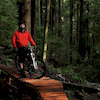
Dave ShortBuilder
joewoywitka
since 2019Builder
Pingu Details
-
Activities
- Mountain Bike
- Hike
- Trail Running
-
Riding AreaMount Seymour
North Vancouver, British Columbia -
Difficulty Rating
-
Voted DifficultyBlack Diamond (2 votes)
-
Trail TypeSingletrack
-
Bike TypeDH
-
DirectionDownhill OnlyPopular direction shown
-
Dogs AllowedYes
-
TTFs on TrailDrop, Jump
-
Ride in RainYes
-
Global Ranking
-
Local Popularity100 in Mountain Biking [+]
- 55 in Trail Running
- 75 in Hiking
-
Land ManagerDistrict of North Vancouver
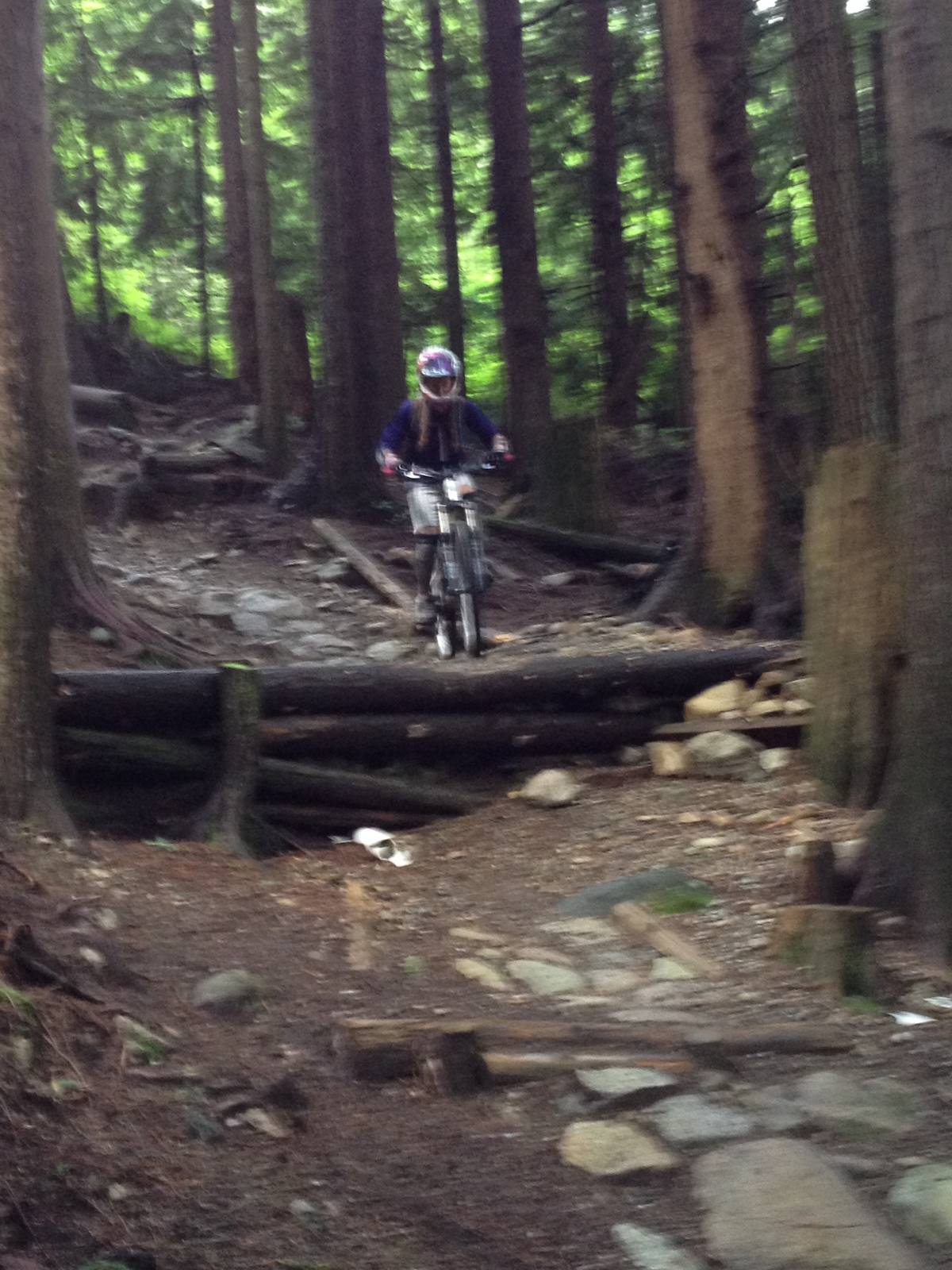
Yet another classic brought back from the dead thanks to the NSMBA TAP program. New tables, optional step down and plenty of fast & flowy terrain, the trail is good for big or little bikes. The old drop has recently got a tranny with rumour of a higher, shorter take off in the near future. Avoid the chunder exit by riding straight across Incline to connect to the BP along the short & sweet Pingor Connector built by the Shore Corps.
Access Info
Accessed from the powerlines and ending at the Baden Powell.
Local Trail Association
-

-

-
Please consider joining or donating to the local trail association to supportdonate to earn trail karma!
trail development & maintenance.
Traditionally Indigenous Territory
More Stats for Pingu mountain bike trail trail
-
Altitude change-128 ft
-
Altitude min1,360 ft
-
Altitude max1,488 ft
-
Altitude start1,488 ft
-
Altitude end1,358 ft
-
Grade-8.1%
-
Grade max-19%
-
Grade min-2.6%
-
Distance down1,572 ft
-
Avg time00:02:25
-
Avg reverse time00:07:21
- view trail stats
close
Trail Conditions
- Unknown
- Snow Groomed
- Snow Packed
- Snow Covered
- Snow Cover Inadequate
- Freeze/thaw Cycle
- Icy
- Prevalent Mud
- Wet
- Variable
- Ideal
- Dry
- Very Dry
Trail Flow (Ridden Direction)
Trailforks scans users ridelogs to determine the most popular direction each trail is ridden. A good flowing trail network will have most trails flowing in a single direction according to their intension.
The colour categories are based on what percentage of riders are riding a trail in its intended direction.
The colour categories are based on what percentage of riders are riding a trail in its intended direction.
- > 96%
- > 90%
- > 80%
- > 70%
- > 50%
- < 50%
- bi-directional trail
- no data
Trail Last Ridden
Trailforks scans ridelogs to determine the last time a trail was ridden.
- < 2 days
- < 1 week
- < 2 weeks
- < 1 month
- < 6 months
- > 6 months
Trail Ridden Direction
The intended direction a trail should be ridden.
- Downhill Only
- Downhill Primary
- Both Directions
- Uphill Primary
- Uphill Only
- One Direction
Contribute Details
Colors indicate trail is missing specified detail.
- Description
- Photos
- Description & Photos
- Videos
Trail Popularity ?
Trailforks scans ridelogs to determine which trails are ridden the most in the last 9 months.
Trails are compared with nearby trails in the same city region with a possible 25 colour shades.
Think of this as a heatmap, more rides = more kinetic energy = warmer colors.
- most popular
- popular
- less popular
- not popular
ATV/ORV/OHV Filter
Max Vehicle Width
inches
Radar Time
x
Activity Recordings
Trailforks users anonymized public ridelogs from the past 6 months.
- mountain biking recent
- mountain biking (>6 month)
- hiking (1 year)
- moto (1 year)
Activity Recordings
Trailforks users anonymized public skilogs from the past 12 months.
- Downhill Ski
- Backcountry Ski
- Nordic Ski
Jump Magnitude Heatmap
Heatmap of where riders jump on trails. Zoom in to see individual jumps, click circles to view jump details.
Trails Deemphasized
Trails are shown in grey.
Only show trails with NO bikes.
Save the current map location and zoom level as your default home location whenever this page is loaded.
Save
Directions to pingu trailhead
(49.339140, -122.969870)
update trails status or condition
Pingu Trail Reports
view all reports »
Recent Ridelog Activity on Trail
Past Week
- 97 rides
- 8 miles avg distance
6 Months
- 3,139 rides
- 9 miles avg distance
All
- 24,802 rides
Photos
more »
Trail Lists
-
 NSMBA TAP 201319 trails
 -
 CMHC Trails35 trails
 -
Mount Seymour
57 trails
-
Seymour
6 trails
-
MOUNT SEYMOUR
7 trails
Routes with this trail
more »
Trail Products
-
+ 3
melikebike74
 (Sep 15, 2021 at 15:19)
Interesting battle at the exit between team strava-braid and team old skool. A bit laughable how bad the stravers want that 0.86 seconds!
[Reply]
kupos
(Jun 5, 2021 at 15:57)
Great flowy trail. Easier than Pangor, and one of the easier Blacks on the mountain.
[Reply]
bboyshredder
(Mar 20, 2020 at 8:20)
Awesome trail jumps are very well made but the last jump is pretty sketchy and if you case your bike you will get a flat so bring a spare tire.
[Reply]
lvshore103
(Mar 7, 2020 at 22:05)
Thanks for clarifying Joe, and for the good work on the trail. The drop is certainly more solid now and will last a while! Only problem is, I think, that it's done so well that it blends in and one (or i at least) can't tell that something has changed until one's right upon it (or below it . So I put the comment for anyone else who follows their old lines, like me and might get surprised. And yes, there is a good ride-around, as well as a line to roll it.
[Reply]
lvshore103
(Feb 29, 2020 at 19:36)
Danger: 3rd drop from the top had been modified and is now higher. I've ridden this trail 100s of times and never had a problem rollong over all drops. Now it seems that there's been some work on the 3rd one from the top and, if taken in the middle, it's become a mandatory jump. There is no warning, and the modification is not obvious from above. There is still an OK roll line on the side, but you have to know it. If you're not OK jumping it, it's best to approach with caution!
[Reply]
joewoywitka
That line had been a mandatory drop for the majority of the trails history. The old log that supported the trail had rotted away (making it roll-able) and the trail was ready to collapse: m.pinkbike.com/photo/18368337
I cribbed in the drop with a new piece of cedar to retain the trail and bring it back to its former state. You can see what it used to look like in older photos: ep1.pinkbike.org/p6pb8209236/p6pb8209236.jpg
I may make it roll-able in the future, but the trail is a black and all the drops have ride-arounds.
[Reply]
I cribbed in the drop with a new piece of cedar to retain the trail and bring it back to its former state. You can see what it used to look like in older photos: ep1.pinkbike.org/p6pb8209236/p6pb8209236.jpg
I may make it roll-able in the future, but the trail is a black and all the drops have ride-arounds.
 mtbmudhoney
Great job Joe! Thanks for restoring the original challenge. It is still rollable if you don’t mind steep rolls
[Reply]
y7kim
(Jul 18, 2016 at 17:38)
Is the ladder over the step down going to be permanent now? I hope not...
[Reply]
Videos
more »


Nearby Trails
- Lower Incline 1,309 ft
- Power Line 1,407 ft
- Salvation 1,752 ft
- Pangor 1,998 ft
- Mushroom Trail 2,080 ft
- embed Pingu trail on your website
- By canadaka Trailforks & contributors
- #221 - 23,857 views
- subscribe
- login to download gpx or kml files.