4,462 ft
Distance
61 ft
Climb
-138 ft
Descent
00:13:38
Avg time
Supporters, Builders, Maintainers & Land Managers of UPS Trail
USFSLand Manager
UPS Details
-
Activities
- Mountain Bike
- Hike
- Trail Running
-
Riding AreaLa Sal Mountains
Moab, Utah -
AKAUpper Porcupine Singletrack
-
Difficulty Rating
-
Voted DifficultyBlack Diamond (4 votes)
-
Trail TypeSingletrack
-
Bike TypeAM, XC
-
DirectionDownhill PrimaryPopular direction shown
-
Dogs AllowedYes
-
eBike Allowed
-
Global Ranking
-
Local Popularity100 in Mountain Biking [+]
- 80 in Trail Running
- 80 in Hiking
-
Land ManagerUSFS
One of my favorite trails - some short techy sections and fast slab descents with a great flow throughout
Local Trail Association
-

-
Please consider joining or donating to the local trail association to supportdonate to earn trail karma!
trail development & maintenance.
Traditionally Indigenous Territory
More Stats for UPS mountain bike trail trail
-
Altitude change-77 ft
-
Altitude min7,696 ft
-
Altitude max7,809 ft
-
Altitude start7,777 ft
-
Altitude end7,700 ft
-
Grade-1.726%
-
Grade max-40%
-
Grade min18.525%
-
Distance climb1,218 ft
-
Distance down2,567 ft
-
Distance flat677 ft
-
Avg time00:13:38
-
Avg reverse time00:21:39
- view trail stats
close
Trail Conditions
- Unknown
- Snow Groomed
- Snow Packed
- Snow Covered
- Snow Cover Inadequate
- Freeze/thaw Cycle
- Icy
- Prevalent Mud
- Wet
- Variable
- Ideal
- Dry
- Very Dry
Trail Flow (Ridden Direction)
Trailforks scans users ridelogs to determine the most popular direction each trail is ridden. A good flowing trail network will have most trails flowing in a single direction according to their intension.
The colour categories are based on what percentage of riders are riding a trail in its intended direction.
The colour categories are based on what percentage of riders are riding a trail in its intended direction.
- > 96%
- > 90%
- > 80%
- > 70%
- > 50%
- < 50%
- bi-directional trail
- no data
Trail Last Ridden
Trailforks scans ridelogs to determine the last time a trail was ridden.
- < 2 days
- < 1 week
- < 2 weeks
- < 1 month
- < 6 months
- > 6 months
Trail Ridden Direction
The intended direction a trail should be ridden.
- Downhill Only
- Downhill Primary
- Both Directions
- Uphill Primary
- Uphill Only
- One Direction
Contribute Details
Colors indicate trail is missing specified detail.
- Description
- Photos
- Description & Photos
- Videos
Trail Popularity ?
Trailforks scans ridelogs to determine which trails are ridden the most in the last 9 months.
Trails are compared with nearby trails in the same city region with a possible 25 colour shades.
Think of this as a heatmap, more rides = more kinetic energy = warmer colors.
- most popular
- popular
- less popular
- not popular
ATV/ORV/OHV Filter
Max Vehicle Width
inches
Radar Time
x
Activity Recordings
Trailforks users anonymized public ridelogs from the past 6 months.
- mountain biking recent
- mountain biking (>6 month)
- hiking (1 year)
- moto (1 year)
Activity Recordings
Trailforks users anonymized public skilogs from the past 12 months.
- Downhill Ski
- Backcountry Ski
- Nordic Ski
Jump Magnitude Heatmap
Heatmap of where riders jump on trails. Zoom in to see individual jumps, click circles to view jump details.
Trails Deemphasized
Trails are shown in grey.
Only show trails with NO bikes.
Save the current map location and zoom level as your default home location whenever this page is loaded.
Save
Directions to ups trailhead
(38.561710, -109.327390)
update trails status or condition
UPS Trail Reports
view all reports »
Recent Ridelog Activity on Trail
Past Week
- 16 rides
- 29 miles avg distance
6 Months
- 738 rides
- 24 miles avg distance
All
- 8,123 rides

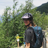
Photos
more »
Routes with this trail
more »
-
+ 0
 twowheeledwanderer
(Dec 1, 2019 at 11:00)
twowheeledwanderer
(Dec 1, 2019 at 11:00)
This where The Whole Enchilada starts to get fun! Amazing views, cool red rock slabs, some techy bits, and a lot of speed. Read more about The Whole Enchilada and UPS here! twowheeledwanderer.com/posts/the-whole-enchilada-what-you-need-to-know
[Reply]
 WillieB
In my mind this trail is the main reason to ride all the way through to Porc Rim. So good! Slab sections are fun and gnar.
[Reply]
flagrfr
(Apr 22, 2018 at 16:47)
One of my favorite trails - some short techy sections and fast slab descents with a great flow throughout
[Reply]
Videos
more »

13:08 |
96 |
Nov 9, 2021 , Moab

21:56 |
164 |
Jun 6, 2021 , Moab

121 |
May 26, 2021 , Moab

17:10 |
149 |
Nov 24, 2020 , Moab
Nearby Trails
- Upper Porcupine St 1 mile
- Fsr 004 1 mile
- Jimmy Keen 2 miles
- Jimmy Keen Return 2 miles
- Ups Lower 2 miles
- embed UPS trail on your website
- By todd
 Trailforks & contributors
 - #8852 - 8,245 views
- subscribe
- login to download gpx or kml files.