All-American Details
-
Activities
- Mountain Bike
- E-Bike
- Hike
- Trail Running
-
Riding AreaCrystal Bridges
Bentonville, Arkansas -
Difficulty Rating
-
Voted DifficultyGreen (3 votes)
-
Trail TypeSingletrack
-
Bike TypeAM, XC, DJ, Fat
-
DirectionBoth Directions
-
Climb DifficultyGreen
-
Physical RatingEasy
-
SeasonYear round trail
-
Family FriendlyYes
-
Dogs AllowedYes
-
eBike AllowedYes up to Class 1
-
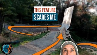
TTFs on TrailBridge, Jump, Ladder Bridge
-
Global Ranking
-
Local Popularity100 in Mountain Biking [+]
- 100 in E-Biking
- 100 in Trail Running
- 100 in Hiking
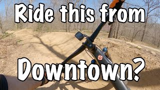
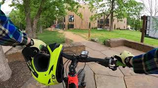
Overlooking the beautiful Crystal Bridges Museum of American Art and running parallel to the Crystal Bridges walking path (as part of the Razorback Greenway), this fun section of family riding is great for all ages. Optional raised features will allow the more advanced rider some fun as they introduce children to the sport. At the very northern end is a fun downhill feature that leads more advanced riders to the rest of Slaughter Pen Trails (this area is typically ridden downhill only, with the return back up the paved walking path).
Access Info
Parking anywhere in downtown Bentonville will get you to the entrance, but parking near Lawrence Plaza or at Compton Gardens puts you right at the paved trail head. Down the path and across the big bridge leads to the dirt entrance on the left (West).
Local Trail Association
-

-

-
Please consider joining or donating to the local trail association to supportdonate to earn trail karma!
trail development & maintenance.
Traditionally Indigenous Territory
More Stats for All-American mountain bike trail trail
-
Altitude change-94 ft
-
Altitude min1,196 ft
-
Altitude max1,290 ft
-
Altitude start1,290 ft
-
Altitude end1,198 ft
-
Grade-2%
-
Grade max-18.7%
-
Grade min6.2%
-
Distance climb548 ft
-
Distance down2,677 ft
-
Distance flat1,401 ft
-
Avg time00:06:51
-
Avg reverse time00:08:11
- view trail stats
- Unknown
- Snow Groomed
- Snow Packed
- Snow Covered
- Snow Cover Inadequate
- Freeze/thaw Cycle
- Icy
- Prevalent Mud
- Wet
- Variable
- Ideal
- Dry
- Very Dry
The colour categories are based on what percentage of riders are riding a trail in its intended direction.
- > 96%
- > 90%
- > 80%
- > 70%
- > 50%
- < 50%
- bi-directional trail
- no data
- < 2 days
- < 1 week
- < 2 weeks
- < 1 month
- < 6 months
- > 6 months
- Downhill Only
- Downhill Primary
- Both Directions
- Uphill Primary
- Uphill Only
- One Direction
- Description
- Photos
- Description & Photos
- Videos
- most popular
- popular
- less popular
- not popular
- mountain biking recent
- mountain biking (>6 month)
- hiking (1 year)
- moto (1 year)
- Downhill Ski
- Backcountry Ski
- Nordic Ski
Save the current map location and zoom level as your default home location whenever this page is loaded.
SaveAll-American Trail Reports
Recent Ridelog Activity on Trail
Past Week
- 84 rides
- 13 miles avg distance
6 Months
- 3,443 rides
- 18 miles avg distance
All
- 19,641 rides

Photos
Routes with this trail
-
+ 0
 jasonferrier
Videos

Nearby Trails
- Razorback Greenway Road Detour 43 ft
- Razorback Greenway North Bentonville 1,299 ft
- Crystal Bridges Art Trail 1,795 ft
- Crystal Bridges Art Trail East 3,878 ft
- Orchard Trail 4,380 ft
- embed All-American trail on your website
- By brenthillier
 NSMBA TRAILFORKS & contributors
 - #4748 - 10,136 views
- subscribe
- login to download gpx or kml files.