656 ft
Distance
7 ft
Climb
-32 ft
Descent
00:01:15
Avg time
Adonis Buster Details
-
Activities
- Mountain Bike
- Hike
- Trail Running
-
Riding AreaMount Seymour
North Vancouver, British Columbia -
Difficulty Rating
-
Trail TypeSingletrack
-
Bike TypeAM, XC
-
DirectionUphill OnlyPopular direction shown
-
Climb DifficultyBlue
-
Physical RatingEasy
-
Dogs AllowedYes
-
TTFs on TrailDrop
-
Global Ranking
-
Local Popularity85 in Mountain Biking [+]
- 80 in Trail Running
- 90 in Hiking
-
Year Opened2016
-
Land ManagerCHMC
Short climbing connector off lower Asian Adonis to avoid descending along the Baden Powell hiking trail. Trail by mtbtrails.ca. Maintained by Sharon and Lee
Traditionally Indigenous Territory
More Stats for Adonis Buster mountain bike trail trail
-
Altitude change-26 ft
-
Altitude min899 ft
-
Altitude max932 ft
-
Altitude start932 ft
-
Altitude end906 ft
-
Grade-4%
-
Grade max-12.8%
-
Grade min8.3%
-
Distance climb72 ft
-
Distance down423 ft
-
Distance flat157 ft
-
Avg time00:01:15
-
Avg reverse time00:06:28
- view trail stats
close
Trail Conditions
- Unknown
- Snow Groomed
- Snow Packed
- Snow Covered
- Snow Cover Inadequate
- Freeze/thaw Cycle
- Icy
- Prevalent Mud
- Wet
- Variable
- Ideal
- Dry
- Very Dry
Trail Flow (Ridden Direction)
Trailforks scans users ridelogs to determine the most popular direction each trail is ridden. A good flowing trail network will have most trails flowing in a single direction according to their intension.
The colour categories are based on what percentage of riders are riding a trail in its intended direction.
The colour categories are based on what percentage of riders are riding a trail in its intended direction.
- > 96%
- > 90%
- > 80%
- > 70%
- > 50%
- < 50%
- bi-directional trail
- no data
Trail Last Ridden
Trailforks scans ridelogs to determine the last time a trail was ridden.
- < 2 days
- < 1 week
- < 2 weeks
- < 1 month
- < 6 months
- > 6 months
Trail Ridden Direction
The intended direction a trail should be ridden.
- Downhill Only
- Downhill Primary
- Both Directions
- Uphill Primary
- Uphill Only
- One Direction
Contribute Details
Colors indicate trail is missing specified detail.
- Description
- Photos
- Description & Photos
- Videos
Trail Popularity ?
Trailforks scans ridelogs to determine which trails are ridden the most in the last 9 months.
Trails are compared with nearby trails in the same city region with a possible 25 colour shades.
Think of this as a heatmap, more rides = more kinetic energy = warmer colors.
- most popular
- popular
- less popular
- not popular
ATV/ORV/OHV Filter
Max Vehicle Width
inches
Radar Time
x
Activity Recordings
Trailforks users anonymized public ridelogs from the past 6 months.
- mountain biking recent
- mountain biking (>6 month)
- hiking (1 year)
- moto (1 year)
Activity Recordings
Trailforks users anonymized public skilogs from the past 12 months.
- Downhill Ski
- Backcountry Ski
- Nordic Ski
Jump Magnitude Heatmap
Heatmap of where riders jump on trails. Zoom in to see individual jumps, click circles to view jump details.
Trails Deemphasized
Trails are shown in grey.
Only show trails with NO bikes.
Save the current map location and zoom level as your default home location whenever this page is loaded.
Save
Directions to adonis-buster trailhead
(49.334920, -122.985640)
update trails status or condition
Adonis Buster Trail Reports
view all reports »
Recent Ridelog Activity on Trail
Past Week
- 24 rides
- 8 miles avg distance
6 Months
- 539 rides
- 9 miles avg distance
All
- 4,958 rides
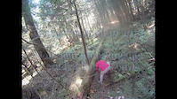
Photos
more »
Trail Lists
-
 CMHC Trails35 trails
 -
Mount Seymour
57 trails
Routes with this trail
more »
Trail Products
-
+ 0
 dubprof
(Nov 24, 2016 at 11:06)
dubprof
(Nov 24, 2016 at 11:06)
….
[Reply]
paulbc
(Jun 25, 2016 at 22:34)
Is there anything marking the start of this off AA, or a notable feature on AA to watch for? I've gone looking for it twice, but couldn't spot it.
[Reply]
 Sharonb
Keep an eye on your left, if you get to the big log at the left corner that's seeps you've gone too far.
[Reply]
paulbc
(Jun 28, 2016 at 23:50)
I went looking again this afternoon, going slow after I crossed C-B, and found it. Thanks.
[Reply]
 leelau
stringaling nailed it. It's an alternative to B-P which gets trashed in the wet. The entrance is awkward and janky for sure. Plan is to make it a little better but it got warm real quick and the bugs were coming
[Reply]
stringaling
 (May 17, 2016 at 13:57)
Coming back to c-buster is the whole point. An alternative to heading down Baden Powell after completing the lower section of Asian Adonis.
The entrance to the trail off of Asian Adonis is a bit awkard though.
[Reply]
The entrance to the trail off of Asian Adonis is a bit awkard though.
 j-rawk
I rode this the other week and was awfully disappointed that it was just a flat/climb back to the c buster intersection I had just passed a few minutes before! Might appeal to xc types just looking to lengthen their ride, I'll just turn down lower c buster
[Reply]
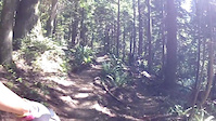
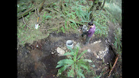
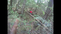
Videos
more »
0:58 |
185 |
Jun 29, 2016 , North Vancouver
0:58 |
138 |
Apr 28, 2016 , North Vancouver
0:58 |
156 |
May 12, 2016 , North Vancouver
0:41 |
57 |
Apr 19, 2016 , North Vancouver
Nearby Trails
- Baden Adonis Connector 0 ft
- Lower C-buster 866 ft
- Penny Lane 928 ft
- Pussyfoot 1,490 ft
- Applicator 1,509 ft
- embed Adonis Buster trail on your website
- By canadaka Trailforks & contributors
- #56490 - 3,869 views
- subscribe
- login to download gpx or kml files.