10.3 miles
Distance
2,281 ft
Climb
-2,282 ft
Descent
2,381 ft
High Point
First time riding here. This is the game plan.
Detailed Description
Easy going loop is a 10 mile popular intermediate route located near Redwood City California. This mountain bike only route. This route includes 5 trails. This route climbs 2,281 ft with a max elevation of 2,381 ft then descends -2,282 ft.
Local Trail Association
Please consider joining or donating to the local riding association to support trail development & maintenance.
donate to earn trail karma!
-
+ 0
packer14
 (Jun 21, 2022 at 17:32)
Trail Blue Blossom
There is a downed tree across the trail about 200 yards after the trail splits off from the Lawrence Creek Trail. Don’t come in too hot otherwise you gonna get drilled.
[Reply]
 norbyd
(Jun 22, 2021 at 12:19)
norbyd
(Jun 22, 2021 at 12:19)
Good loop, Blue blossom has some challenging climbing sections; it also needs a trim. In some spots it’s hard to navigate due to the foliage!
[Reply]
norbyd
(Jun 18, 2021 at 22:10)
Trail Blue Blossom
I did submit a Trail Report since there is too much foliage along the DH to navigate. Needs some maintenance, IMO. Can be a safety issue. I had to slow down and stop to navigate before proceeding in these sections.
[Reply]
Wmmiller2
(Feb 14, 2021 at 11:21)
Trail Sierra Morena Trail
Lots of leaves and branches down. Wet with puddles in corners
[Reply]
MtbSkier71
(Dec 27, 2020 at 13:12)
Trail Blue Blossom
Upper entrance to the trail isn't well marked so don't blast down Lawrence Creek without looking right. Should be downhill only trail -- although with all the fire road, I don't know why any singletrack would be taken uphill here at Skeggs. This is a fun singletrack with flow and a few jumps/drops, with a tight turn or two. It's a little less traveled, so there's a few branches that may cut you.
[Reply]
MtbSkier71
(Dec 27, 2020 at 13:02)
Trail Oljon
The upper part to Steam Donkey is fun, fun, fun. My 11 year old son developed his skills riding this to Steam Donkey (upper only) to Gordon Mill up. It's a great ~20 minute loop that isn't too technical but just enough variety to learn skills and have fun. Make some noise on blind turns since this is a well hiked trail. More experienced riders will enjoy taking this trail at speed and mastering the switchbacks.
[Reply]


 jizgrey
(Jul 14, 2019 at 13:12)
jizgrey
(Jul 14, 2019 at 13:12)
Trail Blue Blossom
This map is slightly incorrect. Once Spring Board intersects with Blue Blossom, it becomes Spring Board trail. It's pretty obvious when you're at the end of Blue Blossom as Spring Board is a fire road, but still...
[Reply]

Trails in Route
Details
-
Riding area
-
Primary ActivityMountain Bike
-
Difficulty ratingBlue
-
Bike typeTrials
-
Ridelogs
More Stats for Easy going loop mountain bike route
-
Altitude change-2 ft
-
Altitude min1,398 ft
-
Altitude start2,208 ft
-
Altitude end2,205 ft
-
Grade max-63.7%
-
Grade min53.8%
-
Distance climb5 miles
-
Distance down5 miles
-
Distance flat4,331 ft
close
Trail Conditions
- Unknown
- Snow Groomed
- Snow Packed
- Snow Covered
- Snow Cover Inadequate
- Freeze/thaw Cycle
- Icy
- Prevalent Mud
- Wet
- Variable
- Ideal
- Dry
- Very Dry
Trail Flow (Ridden Direction)
Trailforks scans users ridelogs to determine the most popular direction each trail is ridden. A good flowing trail network will have most trails flowing in a single direction according to their intension.
The colour categories are based on what percentage of riders are riding a trail in its intended direction.
The colour categories are based on what percentage of riders are riding a trail in its intended direction.
- > 96%
- > 90%
- > 80%
- > 70%
- > 50%
- < 50%
- bi-directional trail
- no data
Trail Last Ridden
Trailforks scans ridelogs to determine the last time a trail was ridden.
- < 2 days
- < 1 week
- < 2 weeks
- < 1 month
- < 6 months
- > 6 months
Trail Ridden Direction
The intended direction a trail should be ridden.
- Downhill Only
- Downhill Primary
- Both Directions
- Uphill Primary
- Uphill Only
- One Direction
Contribute Details
Colors indicate trail is missing specified detail.
- Description
- Photos
- Description & Photos
- Videos
Trail Popularity ?
Trailforks scans ridelogs to determine which trails are ridden the most in the last 9 months.
Trails are compared with nearby trails in the same city region with a possible 25 colour shades.
Think of this as a heatmap, more rides = more kinetic energy = warmer colors.
- most popular
- popular
- less popular
- not popular
ATV/ORV/OHV Filter
Max Vehicle Width
inches
Radar Time
x
Activity Recordings
Trailforks users anonymized public ridelogs from the past 6 months.
- mountain biking recent
- mountain biking (>6 month)
- hiking (1 year)
- moto (1 year)
Activity Recordings
Trailforks users anonymized public skilogs from the past 12 months.
- Downhill Ski
- Backcountry Ski
- Nordic Ski
Jump Magnitude Heatmap
Heatmap of where riders jump on trails. Zoom in to see individual jumps, click circles to view jump details.
Trails Deemphasized
Trails are shown in grey.
Only show trails with NO bikes.
Save the current map location and zoom level as your default home location whenever this page is loaded.
Save
Trail transparency
Photos
Videos

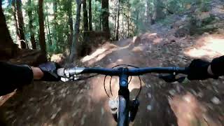
El Corte De Madera Creek Preserve (Skeggs) | Oljon, Blue Blossom, Timberview Trails
trail: Blue Blossom
15:06 | 14 | comments: 0 | favs:
Jun 22, 2022
Recent Trail Reports Along Route
more reports »
- By Drtriderr & contributors
- #27403 - 275 views
- login to download gpx or kml files.