6.7 miles
Distance
875 ft
Climb
-878 ft
Descent
760 ft
High Point
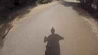
A great beginner/gravel loop with nice views and some smooth single track.
Detailed Description
Arastradero Sampler is a 7 mile popular easy route located near Palo Alto California. This mountain bike primary route can be used one direction and has a easy overall physical rating. This route includes 13 trails. This route climbs 875 ft with a max elevation of 760 ft then descends -878 ft.
Local Trail Association
Please consider joining or donating to the local riding association to support trail development & maintenance.
donate to earn trail karma!
Trails in Route
| 1 mile | |||||
| 1,339 ft | |||||
| 1,309 ft | |||||
| 932 ft | |||||
| 745 ft | |||||
| 2,858 ft | |||||
| 3,323 ft | |||||
| 492 ft | |||||
| 1,211 ft | |||||
| 1,204 ft | |||||
| 167 ft | |||||
| 1,732 ft | |||||
| 719 ft |
Details
-
Riding area
-
Primary ActivityMountain Bike
-
Other Activities
- Hike
- Trail Running
-
Difficulty ratingGreen
-
Route TypeLoop
-
Bike typeXC, Adaptive MTB, CX, Gravel
-
DirectionOne Direction
-
Physical ratingEasy
-
Ridelogs
More Stats for Arastradero Sampler mountain bike route
-
Altitude min289 ft
-
Altitude start315 ft
-
Altitude end312 ft
-
Grade max-36%
-
Grade min33.6%
-
Distance climb3 miles
-
Distance down3 miles
-
Distance flat2,825 ft
close
Trail Conditions
- Unknown
- Snow Groomed
- Snow Packed
- Snow Covered
- Snow Cover Inadequate
- Freeze/thaw Cycle
- Icy
- Prevalent Mud
- Wet
- Variable
- Ideal
- Dry
- Very Dry
Trail Flow (Ridden Direction)
Trailforks scans users ridelogs to determine the most popular direction each trail is ridden. A good flowing trail network will have most trails flowing in a single direction according to their intension.
The colour categories are based on what percentage of riders are riding a trail in its intended direction.
The colour categories are based on what percentage of riders are riding a trail in its intended direction.
- > 96%
- > 90%
- > 80%
- > 70%
- > 50%
- < 50%
- bi-directional trail
- no data
Trail Last Ridden
Trailforks scans ridelogs to determine the last time a trail was ridden.
- < 2 days
- < 1 week
- < 2 weeks
- < 1 month
- < 6 months
- > 6 months
Trail Ridden Direction
The intended direction a trail should be ridden.
- Downhill Only
- Downhill Primary
- Both Directions
- Uphill Primary
- Uphill Only
- One Direction
Contribute Details
Colors indicate trail is missing specified detail.
- Description
- Photos
- Description & Photos
- Videos
Trail Popularity ?
Trailforks scans ridelogs to determine which trails are ridden the most in the last 9 months.
Trails are compared with nearby trails in the same city region with a possible 25 colour shades.
Think of this as a heatmap, more rides = more kinetic energy = warmer colors.
- most popular
- popular
- less popular
- not popular
ATV/ORV/OHV Filter
Max Vehicle Width
inches
Radar Time
x
Activity Recordings
Trailforks users anonymized public ridelogs from the past 6 months.
- mountain biking recent
- mountain biking (>6 month)
- hiking (1 year)
- moto (1 year)
Activity Recordings
Trailforks users anonymized public skilogs from the past 12 months.
- Downhill Ski
- Backcountry Ski
- Nordic Ski
Jump Magnitude Heatmap
Heatmap of where riders jump on trails. Zoom in to see individual jumps, click circles to view jump details.
Trails Deemphasized
Trails are shown in grey.
Only show trails with NO bikes.
Save the current map location and zoom level as your default home location whenever this page is loaded.
Save
Trail transparency
Photos
Videos

Arastradero "Sampler" mountain bike route - 4k w/ map overlay
43:27 | 36 | comments: 0 | favs:
May 4, 2022
Arastradero preserve. Bay laurel trail.
trail: Bay Laurel Trail
3:00 | 96 | comments: 0 | favs:
Sep 29, 2015
Me riding at a local trail spot. Not the greatest trails but fun for a quickie.
Recent Trail Reports Along Route
more reports »
- By sg33
 & contributors
 - #28195 - 730 views
- login to download gpx or kml files.