1.4 miles
Distance
50 ft
Climb
-419 ft
Descent
00:10:46
Avg time
Old Colma Road Details
-
Activities
- Mountain Bike
- Hike
- Trail Running
-
Riding AreaPedro Mountain
Montara, California -
Difficulty Rating
-
Trail TypeSingletrack
-
Bike TypeDH, AM, XC
-
DirectionDownhill PrimaryPopular direction shown
-
Climb DifficultyBlue
-
Trail VisibilityAlways easy to follow
-
Dogs AllowedYes
-
Global Ranking
-
Local Popularity95 in Mountain Biking [+]
- 75 in Trail Running
- 95 in Hiking
This segment is a partial track of what was originally know as "Half Moon Bay - Colma Road". It was built in 1879 as the first road commissioned by San Mateo County over the mountain. It was replaced in 1915 by the nearby Coastside Boulevard (Old San Pedro Mtn Road Trail).Which in turn was replaced by Hwy 1 in 1937.The increased popularity of the automobile made OCR impractical as it was planned with horse wagon and bicycles in mind. This path was lost for nearly 100 years. It began to resurface as a route through volunteer efforts in 2014
More Stats for Old Colma Road mountain bike trail trail
-
Altitude change-369 ft
-
Altitude min237 ft
-
Altitude max606 ft
-
Altitude start606 ft
-
Altitude end236 ft
-
Grade-5.2%
-
Grade max-45.1%
-
Grade min19.5%
-
Distance climb1,224 ft
-
Distance down5,098 ft
-
Distance flat830 ft
-
Avg time00:10:46
-
Avg reverse time00:19:22
- view trail stats
close
Trail Conditions
- Unknown
- Snow Groomed
- Snow Packed
- Snow Covered
- Snow Cover Inadequate
- Freeze/thaw Cycle
- Icy
- Prevalent Mud
- Wet
- Variable
- Ideal
- Dry
- Very Dry
Trail Flow (Ridden Direction)
Trailforks scans users ridelogs to determine the most popular direction each trail is ridden. A good flowing trail network will have most trails flowing in a single direction according to their intension.
The colour categories are based on what percentage of riders are riding a trail in its intended direction.
The colour categories are based on what percentage of riders are riding a trail in its intended direction.
- > 96%
- > 90%
- > 80%
- > 70%
- > 50%
- < 50%
- bi-directional trail
- no data
Trail Last Ridden
Trailforks scans ridelogs to determine the last time a trail was ridden.
- < 2 days
- < 1 week
- < 2 weeks
- < 1 month
- < 6 months
- > 6 months
Trail Ridden Direction
The intended direction a trail should be ridden.
- Downhill Only
- Downhill Primary
- Both Directions
- Uphill Primary
- Uphill Only
- One Direction
Contribute Details
Colors indicate trail is missing specified detail.
- Description
- Photos
- Description & Photos
- Videos
Trail Popularity ?
Trailforks scans ridelogs to determine which trails are ridden the most in the last 9 months.
Trails are compared with nearby trails in the same city region with a possible 25 colour shades.
Think of this as a heatmap, more rides = more kinetic energy = warmer colors.
- most popular
- popular
- less popular
- not popular
ATV/ORV/OHV Filter
Max Vehicle Width
inches
Radar Time
x
Activity Recordings
Trailforks users anonymized public ridelogs from the past 6 months.
- mountain biking recent
- mountain biking (>6 month)
- hiking (1 year)
- moto (1 year)
Activity Recordings
Trailforks users anonymized public skilogs from the past 12 months.
- Downhill Ski
- Backcountry Ski
- Nordic Ski
Jump Magnitude Heatmap
Heatmap of where riders jump on trails. Zoom in to see individual jumps, click circles to view jump details.
Trails Deemphasized
Trails are shown in grey.
Only show trails with NO bikes.
Save the current map location and zoom level as your default home location whenever this page is loaded.
Save
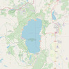
Directions to old-colma-road trailhead
(37.573490, -122.514660)
update trails status or condition
Old Colma Road Trail Reports
view all reports »
Recent Ridelog Activity on Trail
Past Week
- 20 rides
- 12 miles avg distance
6 Months
- 555 rides
- 12 miles avg distance
All
- 2,347 rides
Photos
more »
Routes with this trail
more »
-
+ 3
 SikeMo
This trail is best ridden in the downhill direction. The views are incredible and the trail is very narrow in places. There is a staircase about midway through the descent that you will have to carry your bike up. Shortly before the staircase, the trail has significant cliffside exposure and you best be on your toes.
[Reply]
Videos
more »

15:41 |
106 |
Oct 6, 2021 , Montara

8:15 |
124 |
Oct 2, 2021 , Montara

3:42 |
350 |
Feb 9, 2021 , Montara
Nearby Trails
- Devil's Slide Trail 1,033 ft
- Tunnel 1,824 ft
- Tanga 2,192 ft
- Old Colma Road 2,247 ft
- Mile 2,283 ft
- embed Old Colma Road trail on your website
- By banq
 & contributors
 - #238788 - 4,063 views
- subscribe
- login to download gpx or kml files.