close
Trail Conditions
- Unknown
- Snow Groomed
- Snow Packed
- Snow Covered
- Snow Cover Inadequate
- Freeze/thaw Cycle
- Icy
- Prevalent Mud
- Wet
- Variable
- Ideal
- Dry
- Very Dry
Trail Flow (Ridden Direction)
Trailforks scans users ridelogs to determine the most popular direction each trail is ridden. A good flowing trail network will have most trails flowing in a single direction according to their intension.
The colour categories are based on what percentage of riders are riding a trail in its intended direction.
The colour categories are based on what percentage of riders are riding a trail in its intended direction.
- > 96%
- > 90%
- > 80%
- > 70%
- > 50%
- < 50%
- bi-directional trail
- no data
Trail Last Ridden
Trailforks scans ridelogs to determine the last time a trail was ridden.
- < 2 days
- < 1 week
- < 2 weeks
- < 1 month
- < 6 months
- > 6 months
Trail Ridden Direction
The intended direction a trail should be ridden.
- Downhill Only
- Downhill Primary
- Both Directions
- Uphill Primary
- Uphill Only
- One Direction
Contribute Details
Colors indicate trail is missing specified detail.
- Description
- Photos
- Description & Photos
- Videos
Trail Popularity ?
Trailforks scans ridelogs to determine which trails are ridden the most in the last 9 months.
Trails are compared with nearby trails in the same city region with a possible 25 colour shades.
Think of this as a heatmap, more rides = more kinetic energy = warmer colors.
- most popular
- popular
- less popular
- not popular
ATV/ORV/OHV Filter
Max Vehicle Width
inches
Radar Time
x
Activity Recordings
Trailforks users anonymized public ridelogs from the past 6 months.
- mountain biking recent
- mountain biking (>6 month)
- hiking (1 year)
- moto (1 year)
Activity Recordings
Trailforks users anonymized public skilogs from the past 12 months.
- Downhill Ski
- Backcountry Ski
- Nordic Ski
Jump Magnitude Heatmap
Heatmap of where riders jump on trails. Zoom in to see individual jumps, click circles to view jump details.
Trails Deemphasized
Trails are shown in grey.
Only show trails with NO bikes.
Save the current map location and zoom level as your default home location whenever this page is loaded.
SaveSoquel Demonstration State Forest is situated in the Santa Cruz Mountains along California's central coast. Originally part of a Mexican land grant, the property was logged by several different owners prior to the State taking ownership in 1988. Today, the Forest provides the public access to the beauty of the coastal redwoods and the wildlife found in this habitat type. Per CALFire policy no ebikes are allowed at SDSF.
This area provides the best legal technical and intermediate/advanced riding in the Bay Area.
This area provides the best legal technical and intermediate/advanced riding in the Bay Area.
source: CAL FIRE Soquel
 google parking directions
 Access Info:
There is a parking pullout and parking lot located 29400 Highland Way, Los Gatos, CA. Those wanting an epic day can ride through Nisene Marks from Aptos.
Activities Click to view
- Mountain Bike
24 trails
- Hike
22 trails
- Trail Running
23 trails
- Horse
1 trails
Region Details
- 13
- 9
- 2
Region Status
Open as of Oct 28, 2021Stats
- Avg Trail Rating
- Trails (view details)
- 24
- Trails Mountain Bike
- 24
- Trails E-Bike
- 1
- Trails Hike
- 22
- Trails Trail Running
- 23
- Trails Horse
- 1
- Total Distance
- 30 miles
- Total Descent
- 6,828 ft
- Total Vertical
- 2,056 ft
- Highest Trailhead
- 2,541 ft
- Reports
- 1,091
- Photos
- 246
- Ridden Counter
- 38,866
Popular Soquel Demonstration State Forest Trails
Mountain Bike Routes
| title | rating | distance |
|---|---|---|
| Flow Trail loop | 14 miles | |
| Flow/Braille Double Lap | 18 miles | |
| Flow Loop via Bussard | 14 miles | |
| Demo Braille Bomber | 12 miles | |
| Santa Cruz Flow Trail | 3 miles | |
| Demo: 3 Musketeers | 24 miles | |
| Santa Cruz Tour | 27 miles | |
| Trail One List - Double Demo Flow | 16 miles | |
| Demo: Flow/Sawpit | 20 miles | |
| Braille Loop | 10 miles |
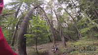
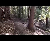
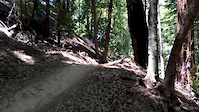
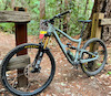
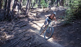
Photos of Soquel Demonstration State Forest Mountain Bike
trail: Flow Trail 1
721 |
Apr 17, 2019 @ 11:22pm
Apr 17, 2019
trail: Flow Trail 1
339 |
Aug 19, 2018 @ 12:22pm
Aug 19, 2018
trail: Flow Trail 3
328 |
Jun 26, 2018 @ 9:52pm
Jun 26, 2018
trail: Flow Trail 3
270 |
Jun 26, 2018 @ 9:42pm
Jun 26, 2018
trail: Ridge Trail
426 | | 1 comments
Feb 3, 2015 @ 8:05pm
Feb 3, 2015
trail: Flow Trail 6
3,481 | | 1 comments
Nov 14, 2014 @ 12:08am
Nov 14, 2014
trail: Flow Trail 6
1,643 |
Jun 24, 2014 @ 5:43pm
Jun 24, 2014
trail: Ridge Trail
875 |
May 8, 2013 @ 3:59pm
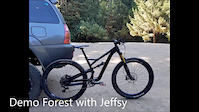
May 8, 2013Videos of Soquel Demonstration State Forest Mountain Bike
trail: Ridge Trail
0:44 |
119 |
May 29, 2019
trail: Flow Trail 5
0:16 |
109 |
Mar 16, 2019
trail: Flow Trail 6
6:10 |
485 |
Aug 22, 2016
trail: Flow Trail 5
0:08 |
228 |
Aug 8, 2016
trail: Flow Trail 5
0:08 |
295 |
Jun 11, 2016
trail: Corral Trail
0:06 |
422 |
May 9, 2016
trail: Flow Trail 1
4:41 |
248 |
May 5, 2016
trail: Flow Trail 6
0:17 |
444 |
Mar 12, 2016
Recent Trail Reports
| status | trail | date | condition | info | user |
|---|---|---|---|---|---|
| Flow Trail 1 | Jul 4, 2022 @ 7:58pm 1 day | Dry | Christopher8vQUfC | ||
| Ridge Trail | Jul 3, 2022 @ 10:09am 3 days | Dry | shill | ||
| Sawpit Trail | Jul 3, 2022 @ 10:09am 3 days | Dry | shill | ||
| Sulphur Spring Road | Jul 3, 2022 @ 10:09am 3 days | Dry | shill | ||
| Flow Trail 2 | Jun 25, 2022 @ 8:05am Jun 25, 2022 | Dry | Baunty | ||
| Flow Trail 3 | Jun 25, 2022 @ 8:05am Jun 25, 2022 | Dry | Baunty | ||
| Flow Trail 4 | Jun 25, 2022 @ 8:05am Jun 25, 2022 | Dry | Baunty | ||
| Flow Trail 5 | Jun 25, 2022 @ 8:05am Jun 25, 2022 | Dry | Baunty | ||
| Flow Trail 6 | Jun 25, 2022 @ 8:05am Jun 25, 2022 | Dry | Baunty | ||
| Tractor Trail | Jun 19, 2022 @ 2:02pm Jun 19, 2022 | Dry | LoneFalcon |
Activity Feed
| username | action | type | title | date | |
|---|---|---|---|---|---|
 | MTBDan23 | ridden | trail | Ridge Trail and 6 more | Jul 5, 2022 @ 4:46pm 10 hours |
| Christopher8vQUfC | add | report | Flow Trail 1 | Jul 4, 2022 @ 7:58pm 1 day |
 | shill | add | report | Ridge Trail and 2 more | Jul 4, 2022 @ 9:27am 2 days |
| jtash | wishlist | route | Flow Trail loop | Jul 3, 2022 @ 2:14pm 3 days |
 | mikeschen12 | wishlist | route | Flow and Braille | Jul 3, 2022 @ 1:59pm 3 days |
Recent Comments
| username | type | title | comment | date | |
|---|---|---|---|---|---|
 | trail | Exactly | Jul 2, 2022 @ 6:00pm Jul 2, 2022 | ||
| trail | True but I see them there quite a bit | Jul 2, 2022 @ 1:22pm Jul 2, 2022 | ||
 | trail | Ebikes aren’t allowed, but I don’t think... | May 16, 2022 @ 11:37am May 16, 2022 | ||
| trail | Agreed it has one little rock garden that can... | May 11, 2022 @ 10:35am May 11, 2022 | ||
| trail | Super Natural, very loose as well, probably... | May 11, 2022 @ 10:26am May 11, 2022 |
Nearby Areas
| name | distance | ||||
|---|---|---|---|---|---|
| Nisene Marks State Park | 3 | 5 | 4.1 km | ||
| Glenwood Open Space Preserve | 1 | 1 | 6.2 km | ||
| Sierra Azul Open Space Preserve | 3 | 3 | 1 | 6.9 km | |
| Rancho Cañada del Oro | 3 | 3 | 7.1 km | ||
| Almaden Quicksilver County Park | 7 | 3 | 7.3 km |
Local Badges
-

Completionist1 awarded
Pinkbike Articles
Nov 21, 2019
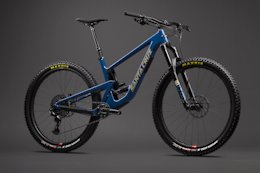 Enter to Win a Santa Cruz Mountain Bike & Help Mountain Bikers of Santa Cruz Build A New Trail
For every $5 you pitch in, you'll be entered to win the production Santa Cruz of your choice--any model, any build.
May 15, 2015
 Trailforks Trail of the Month: Santa Cruz Flow Trail
Santa Cruz was once famous for illegal trails, but thanks to organized riders there is a change in the air with new developments like the recently...
Activity Type Stats
| activitytype | trails | distance | descent | descent distance | total vertical | rating | global rank | state rank | photos | reports | routes | ridelogs |
|---|---|---|---|---|---|---|---|---|---|---|---|---|
| Mountain Bike | 24 | 30 miles | 6,827 ft | 17 miles | 2,057 ft | #121 | #47 | 246 | 1,091 | 16 | 14,666 | |
| E-Bike | 1 | 4 miles | 1,033 ft | 3 miles | 1,033 ft | 815 | 614 | |||||
| Hike | 22 | 29 miles | 6,342 ft | 17 miles | 2,057 ft | #79 | #40 | 1,084 | 30 | |||
| Trail Running | 23 | 30 miles | 6,827 ft | 17 miles | 2,057 ft | #73 | #37 | 1,089 | 12 | |||
| Horse | 1 | 1 mile | 610 ft | 1 mile | 610 ft | #988 | 301 |
- By brenthillier
 NSMBA TRAILFORKS & contributors
 - Admins: SCMTS Staff
- #6934 - 74,903 views
- soquel demonstration state forest activity log | embed map of Soquel Demonstration State Forest mountain bike trails | soquel demonstration state forest mountain biking points of interest polygons
Downloading of trail gps tracks in kml & gpx formats is enabled for Soquel Demonstration State Forest.
You must login to download files.