close
Trail Conditions
- Unknown
- Snow Groomed
- Snow Packed
- Snow Covered
- Snow Cover Inadequate
- Freeze/thaw Cycle
- Icy
- Prevalent Mud
- Wet
- Variable
- Ideal
- Dry
- Very Dry
Trail Flow (Ridden Direction)
Trailforks scans users ridelogs to determine the most popular direction each trail is ridden. A good flowing trail network will have most trails flowing in a single direction according to their intension.
The colour categories are based on what percentage of riders are riding a trail in its intended direction.
The colour categories are based on what percentage of riders are riding a trail in its intended direction.
- > 96%
- > 90%
- > 80%
- > 70%
- > 50%
- < 50%
- bi-directional trail
- no data
Trail Last Ridden
Trailforks scans ridelogs to determine the last time a trail was ridden.
- < 2 days
- < 1 week
- < 2 weeks
- < 1 month
- < 6 months
- > 6 months
Trail Ridden Direction
The intended direction a trail should be ridden.
- Downhill Only
- Downhill Primary
- Both Directions
- Uphill Primary
- Uphill Only
- One Direction
Contribute Details
Colors indicate trail is missing specified detail.
- Description
- Photos
- Description & Photos
- Videos
Trail Popularity ?
Trailforks scans ridelogs to determine which trails are ridden the most in the last 9 months.
Trails are compared with nearby trails in the same city region with a possible 25 colour shades.
Think of this as a heatmap, more rides = more kinetic energy = warmer colors.
- most popular
- popular
- less popular
- not popular
ATV/ORV/OHV Filter
Max Vehicle Width
inches
Radar Time
x
Activity Recordings
Trailforks users anonymized public ridelogs from the past 6 months.
- mountain biking recent
- mountain biking (>6 month)
- hiking (1 year)
- moto (1 year)
Activity Recordings
Trailforks users anonymized public skilogs from the past 12 months.
- Downhill Ski
- Backcountry Ski
- Nordic Ski
Jump Magnitude Heatmap
Heatmap of where riders jump on trails. Zoom in to see individual jumps, click circles to view jump details.
Trails Deemphasized
Trails are shown in grey.
Only show trails with NO bikes.
Save the current map location and zoom level as your default home location whenever this page is loaded.
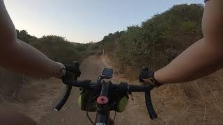
SaveWaterdog Lake/Hidden Canyon Park contains 260 acres of open space and a multi-use trail system located 25 miles south of San Francisco. It is a place for fun, adventure, commune with nature, and service. While the City oversees its management, volunteers have long contributed to trail building and maintenance efforts.
William C. Ralston, founder of the Bank of California, originally commissioned the lake to collect spring water to funnel to his summer home—now known as Ralston Hall Mansion. Following Ralston’s death, the Sisters of Notre Dame de Namur acquired the land, leasing it to the City of Belmont in 1965. In 1978, John S. Brooks dedicated an additional 51 acres to the City.
William C. Ralston, founder of the Bank of California, originally commissioned the lake to collect spring water to funnel to his summer home—now known as Ralston Hall Mansion. Following Ralston’s death, the Sisters of Notre Dame de Namur acquired the land, leasing it to the City of Belmont in 1965. In 1978, John S. Brooks dedicated an additional 51 acres to the City.
source: ...
Primary Trail Type: Cross-Country
Land Status: City Managed
 google parking directions
Links
Region Supporters & Maintainers
- Waterdog Trail KeepersMaintainer
![]()
Waterdog Open Space StewardsMaintainer
Activities Click to view
- Mountain Bike
22 trails
- E-Bike
0 trails
- Hike
20 trails
- Trail Running
20 trails
- Horse
0 trails
Region Details
- 6
- 6
- 10
Region Status
Open as of Jun 10, 2022Stats
- Avg Trail Rating
- Trails (view details)
- 22
- Trails Mountain Bike
- 22
- Trails Hike
- 20
- Trails Trail Running
- 20
- Trails Observed Trials
- 2
- Total Distance
- 13 miles
- Total Descent
- 2,531 ft
- Total Vertical
- 472 ft
- Highest Trailhead
- 711 ft
- Reports
- 1,228
- Photos
- 76
- Ridden Counter
- 10,240
Popular Waterdog Lake Park Mountain Biking Trails
Waterdog Lake Park Mountain Bike Routes
| title | rating | distance |
|---|---|---|
| Waterdog Complete Loop | 7 miles | |
| Full loop from the top | 8 miles | |
| The Waterdog Tour | 10 miles | |
| Water Dog to Jack Daniels Loop | 6 miles | |
| Water Dog Tour de Force | 9 miles | |
| 8 mile Waterdog Lake Park All-Mountain Ride | popular ridelog | 8 miles |
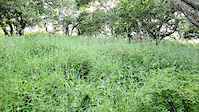
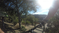
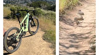
Photos of Waterdog Lake Park Mountain Bike
trail: Ensatina Trail
6 |
Jun 10, 2022 @ 9:41pm
Jun 10, 2022
trail: Rambler Trail
27 |
May 2, 2022 @ 10:52am
May 2, 2022
trail: John Brooks Trail
33 |
Aug 19, 2021 @ 9:31am
Aug 19, 2021
trail: Water Dog Lake Loop
46 |
Feb 15, 2021 @ 11:39am
Feb 15, 2021
trail: Berry Trail
38 |
Feb 15, 2021 @ 11:39am
Feb 15, 2021
trail: John Brooks Trail
48 |
Feb 15, 2021 @ 10:56am
Feb 15, 2021
trail: John Brooks Trail
54 |
Feb 15, 2021 @ 10:55am
Feb 15, 2021
trail: Lake Connector
37 |
Jan 31, 2021 @ 10:51am
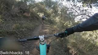
Jan 31, 2021Videos of Waterdog Lake Park Mountain Bike
trail: Water Dog Lake Loop
0:39 |
2 |
May 14, 2019
trail: Rambler Trail
7:30 |
603 |
Jul 19, 2016
5:53 |
15 |
May 20, 2022

trail: Labor of Love
3:40 |
22 |
May 20, 2022 , Belmont

trail: Chaparral Trail
12:48 |
195 |
Feb 14, 2021 , Belmont

trail: Berry Trail
12:48 |
121 |
Feb 14, 2021 , Belmont
trail: Labor of Love
12:48 |
171 |
Feb 14, 2021 , Belmont
trail: Upper Creek Trail
2:22 |
205 |
Sep 18, 2020 , Belmont
Recent Trail Reports
| status | trail | date | condition | info | user |
|---|---|---|---|---|---|
| Ensatina Trail | Jul 4, 2022 @ 8:25am 2 days | Ideal | Baunty | ||
| Lake Road Trail | Jul 4, 2022 @ 8:25am 2 days | Ideal | Baunty | ||
| Lake Connector | Jul 4, 2022 @ 8:25am 2 days | Ideal | Baunty | ||
| Labor of Love | Jul 4, 2022 @ 8:25am 2 days | Ideal | Baunty | ||
| John Brooks Trail | Jul 4, 2022 @ 8:25am 2 days | Ideal | Baunty | ||
| Rambler Trail | Jul 4, 2022 @ 8:25am 2 days | Ideal | Baunty | ||
| Upper Creek Trail | Jul 4, 2022 @ 8:25am 2 days | Ideal | Baunty | ||
| Canyon Creek Trail | Jul 4, 2022 @ 8:25am 2 days | Ideal | Baunty | ||
| Ohlone Trail | Jul 4, 2022 @ 8:25am 2 days | Ideal | Baunty | ||
| Chaparral Trail | Jul 4, 2022 @ 8:25am 2 days | Ideal | Baunty |
Activity Feed
| username | action | type | title | date | |
|---|---|---|---|---|---|
 | Baunty | add | report | Ensatina Trail and 10 more | Jul 5, 2022 @ 8:10am 18 hours |
 | sz6rKd | add | report | Chaparral Trail | Jul 4, 2022 @ 3:46pm 1 day |
| sz6rKd | wishlist | trail | Chaparral Trail | Jul 4, 2022 @ 1:41pm 2 days |
| Irenejwalsh | wishlist | route | Waterdog Complete Loop | Jul 3, 2022 @ 4:40pm 2 days |
| pushpull | ridden | trail | Lake Road Trail and 1 more | Jul 2, 2022 @ 1:51pm Jul 2, 2022 |
Recent Comments
| username | type | title | comment | date | |
|---|---|---|---|---|---|
 | report | Tree not a problem | Jun 10, 2022 @ 1:53pm Jun 10, 2022 | ||
| trail | Took a dive off of one of the skinnies into a... | Jun 4, 2022 @ 7:01pm Jun 4, 2022 | ||
| trail | Good for the cardio but boring | Feb 22, 2022 @ 6:40am Feb 22, 2022 | ||
| trail | one of the best if not the best trail in water... | Jan 8, 2022 @ 7:36pm Jan 8, 2022 | ||
| trail | very pretty trail, nice single track trail... | Jan 8, 2022 @ 7:32pm Jan 8, 2022 |
Nearby Areas
| name | distance | ||||
|---|---|---|---|---|---|
| Carlmont Hills | 2 | 2 | 3 | 4 | 0.7 km |
| Sugarloaf Mountain | 5 | 6 | 6 | 1.4 km | |
| Arguello Park | 1 | 4 | 1.6 km | ||
| Highlands | 1 | 2 | 3 | 2.4 km | |
| Stulsaft Park | 4.6 km |
Local Badges
-

Completionist4 awarded
Activity Type Stats
| activitytype | trails | distance | descent | descent distance | total vertical | rating | global rank | state rank | photos | reports | routes | ridelogs |
|---|---|---|---|---|---|---|---|---|---|---|---|---|
| Mountain Bike | 22 | 13 miles | 2,533 ft | 6 miles | 472 ft | #549 | #283 | 76 | 1,228 | 5 | 9,257 | |
| Hike | 20 | 11 miles | 2,257 ft | 5 miles | 463 ft | #383 | #235 | 1,222 | 120 | |||
| Trail Running | 20 | 11 miles | 2,257 ft | 5 miles | 463 ft | #383 | #233 | 1,222 | 130 | |||
| Observed Trials | 2 | 2 miles | 272 ft | 3,862 ft | 262 ft | 1 |
- By b0bg
 & contributors
 - Admins: CTC, shill
- #14013 - 51,664 views
- waterdog lake park activity log | embed map of Waterdog Lake Park mountain bike trails | waterdog lake park mountain biking points of interest
Downloading of trail gps tracks in kml & gpx formats is enabled for Waterdog Lake Park.
You must login to download files.