close
Trail Conditions
- Unknown
- Snow Groomed
- Snow Packed
- Snow Covered
- Snow Cover Inadequate
- Freeze/thaw Cycle
- Icy
- Prevalent Mud
- Wet
- Variable
- Ideal
- Dry
- Very Dry
Trail Flow (Ridden Direction)
Trailforks scans users ridelogs to determine the most popular direction each trail is ridden. A good flowing trail network will have most trails flowing in a single direction according to their intension.
The colour categories are based on what percentage of riders are riding a trail in its intended direction.
The colour categories are based on what percentage of riders are riding a trail in its intended direction.
- > 96%
- > 90%
- > 80%
- > 70%
- > 50%
- < 50%
- bi-directional trail
- no data
Trail Last Ridden
Trailforks scans ridelogs to determine the last time a trail was ridden.
- < 2 days
- < 1 week
- < 2 weeks
- < 1 month
- < 6 months
- > 6 months
Trail Ridden Direction
The intended direction a trail should be ridden.
- Downhill Only
- Downhill Primary
- Both Directions
- Uphill Primary
- Uphill Only
- One Direction
Contribute Details
Colors indicate trail is missing specified detail.
- Description
- Photos
- Description & Photos
- Videos
Trail Popularity ?
Trailforks scans ridelogs to determine which trails are ridden the most in the last 9 months.
Trails are compared with nearby trails in the same city region with a possible 25 colour shades.
Think of this as a heatmap, more rides = more kinetic energy = warmer colors.
- most popular
- popular
- less popular
- not popular
ATV/ORV/OHV Filter
Max Vehicle Width
inches
Radar Time
x
Activity Recordings
Trailforks users anonymized public ridelogs from the past 6 months.
- mountain biking recent
- mountain biking (>6 month)
- hiking (1 year)
- moto (1 year)
Activity Recordings
Trailforks users anonymized public skilogs from the past 12 months.
- Downhill Ski
- Backcountry Ski
- Nordic Ski
Jump Magnitude Heatmap
Heatmap of where riders jump on trails. Zoom in to see individual jumps, click circles to view jump details.
Trails Deemphasized
Trails are shown in grey.
Only show trails with NO bikes.
Save the current map location and zoom level as your default home location whenever this page is loaded.
Save
No description for Hingham has been added yet!
Login or register to submit one.
Activities Click to view
- Mountain Bike
470 trails
- Hike
470 trails
- Trail Running
470 trails
Region Details
- 136
- 35
- 108
- 134
- 57
Region Status
Open as of Jun 30, 2022Stats
- Avg Trail Rating
- Trails (view details)
- 470
- Trails Mountain Bike
- 470
- Trails E-Bike
- 16
- Trails Hike
- 470
- Trails Trail Running
- 470
- Trails Horse
- 16
- Trails Dirtbike/Moto
- 12
- Trails Observed Trials
- 12
- Trails ATV/ORV/OHV
- 12
- Trails Snowshoe
- 2
- Trails Backcountry Ski
- 2
- Total Distance
- 103 miles
- Total Descent
- 7,844 ft
- Total Vertical
- 231 ft
- Highest Trailhead
- 239 ft
- Reports
- 1,404
- Photos
- 107
- Ridden Counter
- 127,649
Sub Regions
-
Wompatuck State Park
- 34
- 101
- 134
- 57
-
World's End
- 5
Popular Hingham Mountain Biking Trails
Hingham Mountain Bike Routes
| title | rating | distance |
|---|---|---|
| Wompy Loop | 19 miles | |
| 2020 DIY Landmine - 10.2 Mile CAT 3 | 10 miles | |
| 2020 DIY Landmine - 5.75 Mile CAT 4 | 6 miles | |
| WOAH Wompy 7 mi | 7 miles | |
| Landmine Remix 25 Mile from Visitors Center | 25 miles | |
| Wömpatuck Ring | 9 miles | |
| 2020 DIY Landmine - 25 Mile CAT 1/2 | 25 miles | |
| 2022 Wompy WinterFest - Intermediate | 11 miles | |
| Gravel/Cross Bike Wompy Loop | 20 miles | |
| 2022 Wompy WinterFest - Advanced | 15 miles |
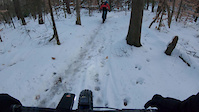
Photos of Hingham Mountain Bike
trail: C10-E18
8 |
Jun 14, 2022 @ 8:26am
Jun 14, 2022
trail: C10-E18
11 |
Jun 14, 2022 @ 8:25am
Jun 14, 2022
trail: Jump Line
37 |
May 22, 2022 @ 12:07pm
May 22, 2022
trail: Jump Line
28 |
May 22, 2022 @ 12:07pm
May 22, 2022
trail: S8-S9
9 |
May 22, 2022 @ 5:37am
May 22, 2022
trail: Ouch
76 |
Sep 25, 2021 @ 9:51am
Sep 25, 2021
trail: N23-N24
164 |
Jun 12, 2021 @ 7:07am
Jun 12, 2021Videos of Hingham Mountain Bike
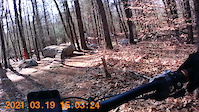
trail: S27 - S28
26 |
Oct 1, 2021
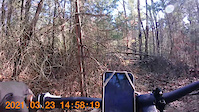
trail: Wompatuck Bikeway
73 |
Mar 23, 2021
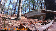
trail: Wompatuck Bikeway
34 |
Mar 23, 2021
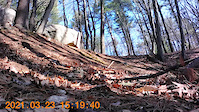
trail: Wompatuck Bikeway
27 |
Mar 23, 2021
trail: Wompatuck Bikeway
14 |
Mar 23, 2021
trail: Wompatuck Bikeway
41 |
Mar 23, 2021
trail: Wompatuck Bikeway
40 |
Mar 23, 2021
trail: Wompatuck Bikeway
36 |
Mar 23, 2021
Recent Trail Reports
| status | trail | date | condition | info | user |
|---|---|---|---|---|---|
| 8 - 12 | Jun 30, 2022 @ 10:48am Jun 30, 2022 | Dry | ajmat | ||
| C12-C16 | May 30, 2022 @ 10:01am May 30, 2022 | Dry | neonedge | ||
| N22-N32 | May 26, 2022 @ 11:51am May 26, 2022 | Dry | BenjaminfjWLY6 | ||
| NW5 Connector | May 5, 2022 @ 2:20pm May 5, 2022 | Variable | OttaCee BlueHills | ||
| W3-S1 | May 5, 2022 @ 2:20pm May 5, 2022 | Dry | OttaCee BlueHills | ||
| S1-S2 | May 5, 2022 @ 2:20pm May 5, 2022 | Variable | OttaCee BlueHills | ||
| S2-S3 | May 5, 2022 @ 2:20pm May 5, 2022 | Ideal | OttaCee BlueHills | ||
| S34-S10 | May 5, 2022 @ 2:20pm May 5, 2022 | Ideal | OttaCee BlueHills | ||
| Bird Trail | May 5, 2022 @ 2:20pm May 5, 2022 | Ideal | OttaCee BlueHills | ||
| S29-S32 | May 5, 2022 @ 2:20pm May 5, 2022 | Variable | OttaCee BlueHills |
Activity Feed
| username | action | type | title | date | |
|---|---|---|---|---|---|
 | dnuzzomueller | wishlist | route | Wompy Loop | Jul 3, 2022 @ 7:09pm 2 days |
 | bholtzman | wishlist | route | 2020 DIY Landmine - 25 Mile CAT 1/2 | Jul 3, 2022 @ 10:12am 3 days |
| amerk12 | wishlist | route | Wompy Loop | Jul 3, 2022 @ 9:13am 3 days |
| FrankRossi | wishlist | route | 2020 DIY Landmine - 10.2 Mile CAT 3 | Jul 1, 2022 @ 10:01am Jul 1, 2022 |
| ajmat | add | report | 8 - 12 | Jun 30, 2022 @ 10:48am Jun 30, 2022 |
Recent Comments
| username | type | title | comment | date | |
|---|---|---|---|---|---|
| trail | Fallen tree shortly after the link loop... | Apr 24, 2022 @ 1:03pm Apr 24, 2022 | ||
| report | Large tree down blocking trail. | Jan 25, 2022 @ 2:32pm Jan 25, 2022 | ||
| trail | It am a good trail | Jan 6, 2022 @ 7:42pm Jan 6, 2022 | ||
| trail | It am good | Jan 6, 2022 @ 7:41pm Jan 6, 2022 | ||
| trail | Trees down everywhere | Nov 7, 2021 @ 9:37am Nov 7, 2021 |
Local Badges
-

10 Black Trails399 awarded -

10 Blue Trails863 awarded -

10 Green Trails703 awarded -

Completionist0 awarded -

Big Ride 30k1,509 awarded -

Top 10 Trails73 awarded
Activity Type Stats
| activitytype | trails | distance | descent | descent distance | total vertical | rating | global rank | state rank | photos | reports | routes | ridelogs |
|---|---|---|---|---|---|---|---|---|---|---|---|---|
| Mountain Bike | 470 | 103 miles | 7,844 ft | 39 miles | 233 ft | #33 | #13 | 104 | 1,402 | 33 | 16,320 | |
| E-Bike | 16 | 4 miles | 66 ft | 4,934 ft | 43 ft | 808 | 87 | |||||
| Hike | 470 | 103 miles | 7,844 ft | 39 miles | 233 ft | #21 | #10 | 1 | 1,402 | 7 | 361 | |
| Trail Running | 470 | 103 miles | 7,844 ft | 39 miles | 233 ft | #21 | #10 | 1,402 | 8 | 434 | ||
| Horse | 16 | 4 miles | 66 ft | 4,934 ft | 43 ft | 122 | 2 | |||||
| Dirtbike/Moto | 12 | 3 miles | 23 ft | 2,710 ft | 30 ft | 122 | 3 | |||||
| Observed Trials | 12 | 3 miles | 23 ft | 2,710 ft | 30 ft | 2 | 15 | |||||
| ATV/ORV/OHV | 12 | 3 miles | 23 ft | 2,710 ft | 30 ft | 122 | 3 | |||||
| Snowshoe | 2 | 2,149 ft | 7 ft | 650 ft | 13 ft | 465 | 14 | |||||
| Backcountry Ski | 2 | 2,149 ft | 7 ft | 650 ft | 13 ft | 465 | 4 |
- By WillieJacobsz
 TRAILFORKS NEMBA & contributors
 - Admins: SEMASS NEMBA, FOW
- #14847 - 5,034 views
- hingham activity log | embed map of Hingham mountain bike trails | hingham mountain biking points of interest polygons
Downloading of trail gps tracks in kml & gpx formats is enabled for Hingham.
You must login to download files.