Trails Near Mountain View
change location
km
close
Trail Conditions
- Unknown
- Snow Groomed
- Snow Packed
- Snow Covered
- Snow Cover Inadequate
- Freeze/thaw Cycle
- Icy
- Prevalent Mud
- Wet
- Variable
- Ideal
- Dry
- Very Dry
Trail Flow (Ridden Direction)
Trailforks scans users ridelogs to determine the most popular direction each trail is ridden. A good flowing trail network will have most trails flowing in a single direction according to their intension.
The colour categories are based on what percentage of riders are riding a trail in its intended direction.
The colour categories are based on what percentage of riders are riding a trail in its intended direction.
- > 96%
- > 90%
- > 80%
- > 70%
- > 50%
- < 50%
- bi-directional trail
- no data
Trail Last Ridden
Trailforks scans ridelogs to determine the last time a trail was ridden.
- < 2 days
- < 1 week
- < 2 weeks
- < 1 month
- < 6 months
- > 6 months
Trail Ridden Direction
The intended direction a trail should be ridden.
- Downhill Only
- Downhill Primary
- Both Directions
- Uphill Primary
- Uphill Only
- One Direction
Contribute Details
Colors indicate trail is missing specified detail.
- Description
- Photos
- Description & Photos
- Videos
Trail Popularity ?
Trailforks scans ridelogs to determine which trails are ridden the most in the last 9 months.
Trails are compared with nearby trails in the same city region with a possible 25 colour shades.
Think of this as a heatmap, more rides = more kinetic energy = warmer colors.
- most popular
- popular
- less popular
- not popular
ATV/ORV/OHV Filter
Max Vehicle Width
inches
Radar Time
x
Activity Recordings
Trailforks users anonymized public ridelogs from the past 6 months.
- mountain biking recent
- mountain biking (>6 month)
- hiking (1 year)
- moto (1 year)
Activity Recordings
Trailforks users anonymized public skilogs from the past 12 months.
- Downhill Ski
- Backcountry Ski
- Nordic Ski
Jump Magnitude Heatmap
Heatmap of where riders jump on trails. Zoom in to see individual jumps, click circles to view jump details.
Trails Deemphasized
Trails are shown in grey.
Only show trails with NO bikes.
Save the current map location and zoom level as your default home location whenever this page is loaded.
SaveSave the current map location and zoom level as your default home location whenever this page is loaded.
SaveTrails
| title | riding area | completed | ||
|---|---|---|---|---|
| Oljon | 1034 | |||
| John Nicholas | 992 | |||
| Upper Creek Trail | 736 | |||
| Red Tail Connector | 710 | |||
| Saratoga Gap Trail | 689 | |||
| Finch Trail | 688 | |||
| Bay Area Ridge Trail | 679 | |||
| John Nicholas Trail | 630 | |||
| Turtle Rock | 625 | |||
| Canyon Creek Trail | 622 | |||
| Ridge 3 | 544 | |||
| Lower White Oak | 542 | |||
| Long Ridge Trail | 532 | |||
| Alpine Road | 526 | |||
| Ohlone Trail | 502 | |||
| Portola Pasture | 487 | |||
| Wild Rye | 485 | |||
| Steam Donkey | 483 | |||
| Acorn Trail | 479 | |||
| Bay Laurel Trail | 465 |
Displaying 1 - 20 of 219
view more trails »
Nearby Trail Warnings
Skill Parks Nearby
| title | rating | city | distance |
|---|---|---|---|
| Ladera Dirt Jump Park | Portola Valley | 7 km | |
| Calabazas BMX Park | San Jose | 8 km | |
| Bowl | Menlo Park | 13 km | |
| Shells Dirt Jumps | Foster City | 14 km |
Bike Shops Nearby
-
Trail Head Cyclery
![]()
-
Tread
![]()
-
Tread
-
Calabazas Cyclery
-
Cognition Cyclery | Mountain View
![]()
-
Sun Bike Shop
-
Mike's Bikes - Los Gatos
-
Evolution Bike Shop
-
Trek Bicycle Store
Local Clubs
Trail Networks Nearby
| name | ||||
|---|---|---|---|---|
| Rancho San Antonio Open Space Preserve 22 trails - 5 km away | 5 | |||
| Arastradero Preserve 24 trails - 5.6 km away | 19 | |||
| Fremont Older Open Space Preserve 16 trails - 8 km away | 13 | |||
| Fremont Older 3 trails - 8.3 km away | 2 | 1 | ||
| Coal Creek Open Space Preserve 1 trails - 8.6 km away | 1 |
Routes
| title | rating | distance |
|---|---|---|
| Waterdog Complete Loop | 7 miles | |
| Arastradero Sampler | 7 miles | |
| Skeggs Figure 8 Loop | 10 miles | |
| Skegg's Point 7 | 10 miles | |
| Skeggs 15 mile loop from new parking | 15 miles |
Photos
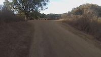
trail: Bowl Loop
31 |
Apr 1, 2022 @ 1:48pm
Apr 1, 2022New Videos
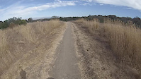
trail: Toyon Trail
1:25 |
467 |
Sep 29, 2015
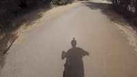
trail: Woodland Star Trail
1:35 |
153 |
Sep 29, 2015
trail: Bay Laurel Trail
3:00 |
96 |
Sep 29, 2015

43:27 |
36 |
May 4, 2022
Upcoming Nearby Events
- ip local: 35.215.191.84
- lat/lng: 37.404300689697, -122.07479858398
- country: US
- prov: CA
- city: Mountain View
- url location
- lat/lng: 37.404300689697, -122.07479858398
- country: United States
- prov: California
- city: Los Altos
- ip user: 35.215.191.84
- lat/lng: 37.404300689697, -122.07479858398
- country:
- prov:
- city: My City
- User session info:
- userid: 0
- username: Anonymous
- countryid: 0
- region: 0
- units:
- activitytype: 1
- aUserLocal: Array ( [countryid] => 0 [provid] => 0 [cityid] => 0 )
- User object info:
- userid: 0
- units: imperial
- activitytype: 1
- countryid: 0
- client: Array ( [REQUEST_URI] => /nearby/?lat=37.404300689697&lon=-122.07479858398&z=12 [HTTP_REFERER] => http://www.trailforks.com/routes/discover/ [HTTP_HOST] => www.trailforks.com [HTTP_USER_AGENT] => Mozilla/4.5 (compatible; HTTrack 3.0x; Windows 98) [HTTP_MODE] => http [REQUEST_URL] => http://www.trailforks.com/nearby/?lat=37.404300689697&lon=-122.07479858398&z=12 )