1.9 miles
Distance
368 ft
Climb
-379 ft
Descent
00:29:23
Avg time
Slickrock Details
-
Activities
- Mountain Bike
- E-Bike
- Hike
- Trail Running
- Dirtbike/Moto
-
Riding AreaSand Flats Recreation Area
Moab, Utah -
Difficulty Rating
-
Voted DifficultyBlack Diamond (1 vote)
-
Hiking SAC ScaleT2 Mountain Hiking
-
Trail TypeSingletrack
-
Bike TypeAM, XC
-
DirectionBoth Directions
-
Dogs AllowedYes
-
eBike AllowedYes up to Class 1
-
Global Ranking#241 in Mountain Biking [+]
- #428 in E-Biking
- #15572 in Trail Running
- #4849 in Hiking
- #953 in Dirtbiking
-
Local Popularity100 in Mountain Biking [+]
- 100 in E-Biking
- 95 in Trail Running
- 90 in Hiking
- 100 in Dirtbiking
-
Land ManagerBLM
This is the first part that takes you out to the main loop. Lots of ups and downs, with sandy transitions. This is part of the classic Slickrock Trail
Local Trail Association
-

-
Please consider joining or donating to the local trail association to supportdonate to earn trail karma!
trail development & maintenance.
Traditionally Indigenous Territory
More Stats for Slickrock mountain bike trail trail
-
Altitude change-11 ft
-
Altitude min4,497 ft
-
Altitude max4,661 ft
-
Altitude start4,624 ft
-
Altitude end4,613 ft
-
Grade-0.11%
-
Grade max-23.175%
-
Grade min20.864%
-
Distance climb1 mile
-
Distance down4,424 ft
-
Distance flat344 ft
-
Avg time00:29:23
-
Avg reverse time00:30:41
- view trail stats
close
Trail Conditions
- Unknown
- Snow Groomed
- Snow Packed
- Snow Covered
- Snow Cover Inadequate
- Freeze/thaw Cycle
- Icy
- Prevalent Mud
- Wet
- Variable
- Ideal
- Dry
- Very Dry
Trail Flow (Ridden Direction)
Trailforks scans users ridelogs to determine the most popular direction each trail is ridden. A good flowing trail network will have most trails flowing in a single direction according to their intension.
The colour categories are based on what percentage of riders are riding a trail in its intended direction.
The colour categories are based on what percentage of riders are riding a trail in its intended direction.
- > 96%
- > 90%
- > 80%
- > 70%
- > 50%
- < 50%
- bi-directional trail
- no data
Trail Last Ridden
Trailforks scans ridelogs to determine the last time a trail was ridden.
- < 2 days
- < 1 week
- < 2 weeks
- < 1 month
- < 6 months
- > 6 months
Trail Ridden Direction
The intended direction a trail should be ridden.
- Downhill Only
- Downhill Primary
- Both Directions
- Uphill Primary
- Uphill Only
- One Direction
Contribute Details
Colors indicate trail is missing specified detail.
- Description
- Photos
- Description & Photos
- Videos
Trail Popularity ?
Trailforks scans ridelogs to determine which trails are ridden the most in the last 9 months.
Trails are compared with nearby trails in the same city region with a possible 25 colour shades.
Think of this as a heatmap, more rides = more kinetic energy = warmer colors.
- most popular
- popular
- less popular
- not popular
ATV/ORV/OHV Filter
Max Vehicle Width
inches
Radar Time
x
Activity Recordings
Trailforks users anonymized public ridelogs from the past 6 months.
- mountain biking recent
- mountain biking (>6 month)
- hiking (1 year)
- moto (1 year)
Activity Recordings
Trailforks users anonymized public skilogs from the past 12 months.
- Downhill Ski
- Backcountry Ski
- Nordic Ski
Jump Magnitude Heatmap
Heatmap of where riders jump on trails. Zoom in to see individual jumps, click circles to view jump details.
Trails Deemphasized
Trails are shown in grey.
Only show trails with NO bikes.
Save the current map location and zoom level as your default home location whenever this page is loaded.
Save
Directions to slickrock-146055 trailhead
(38.581880, -109.519250)
update trails status or condition
Slickrock Trail Reports
view all reports »
Recent Ridelog Activity on Trail
Past Week
- 8 rides
- 11 miles avg distance
6 Months
- 683 rides
- 15 miles avg distance
All
- 4,256 rides
Photos
more »
Routes with this trail
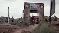
Videos
more »


Nearby Trails
- Kokopelli (sand Flats Rd) 2,336 ft
- Hell's Revenge 3,996 ft
- Slickrock (practice) 4,413 ft
- Slickrock Spur 4,459 ft
- Fins & Things (day Time) 1 mile
Sand Flats Recreation Area
- embed Slickrock trail on your website
- By markholloway
 Trailforks & contributors
 - #146055 - 4,486 views
- subscribe
- login to download gpx or kml files.