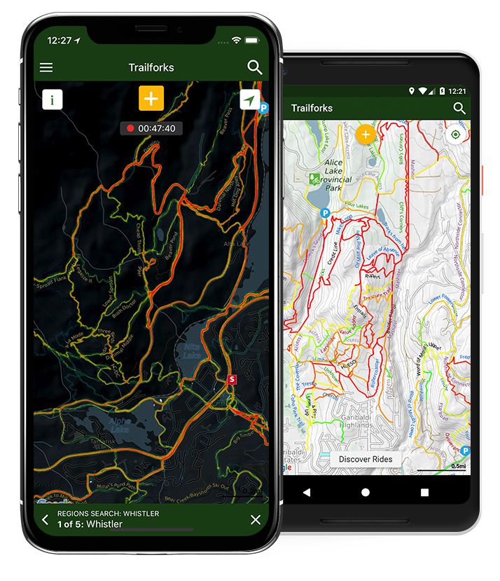
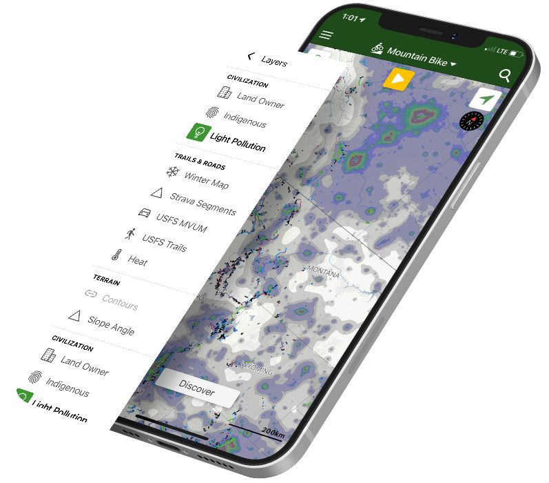
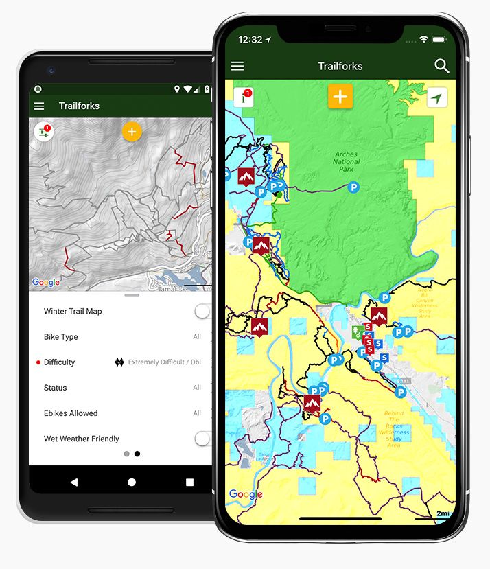
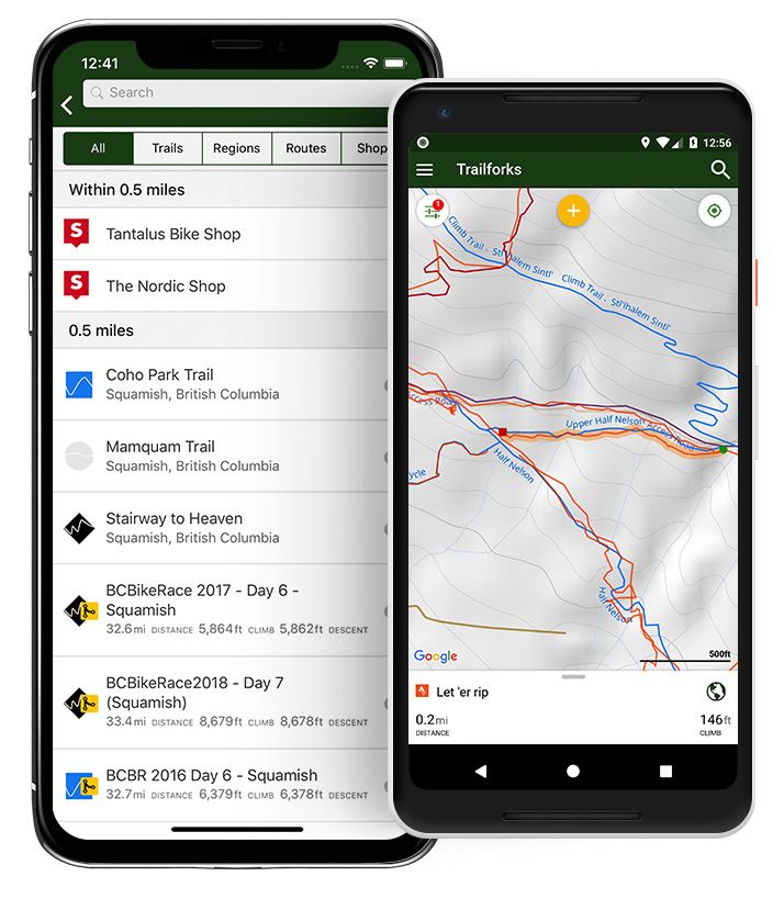
Trailforks app on iPhone 8

Trailforks App

Mountain Bike, Hiking, Moto, Horseback & Ski Trail Maps

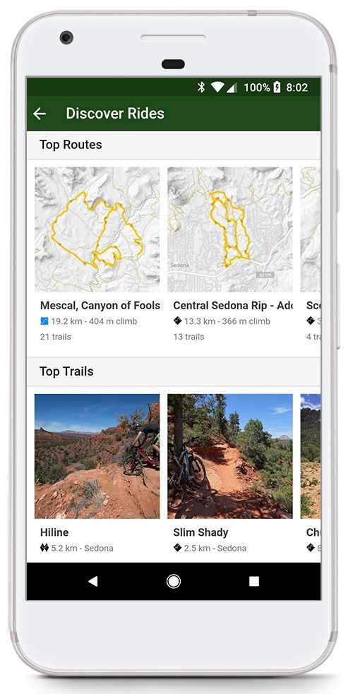
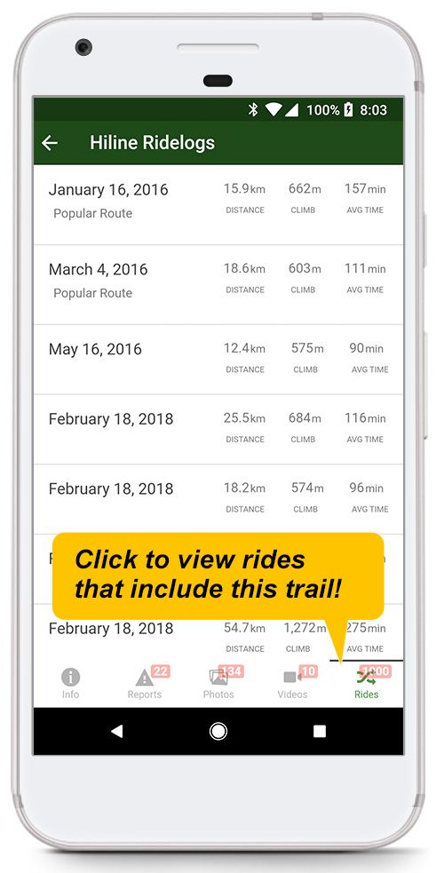
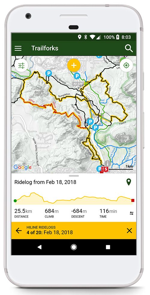
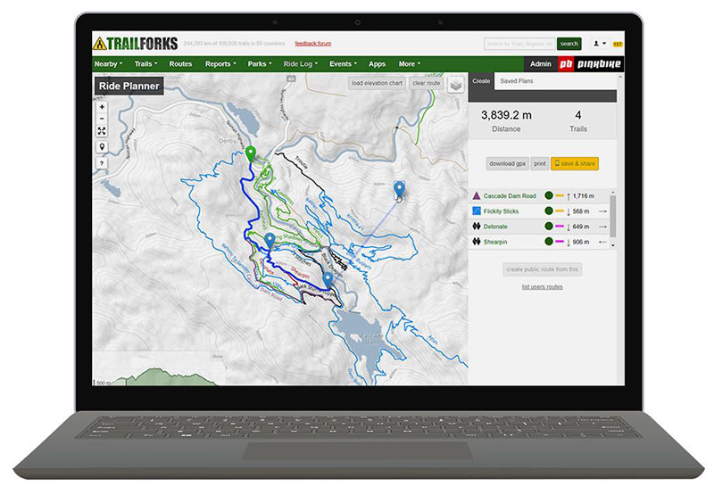
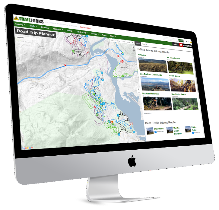
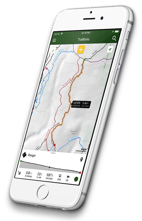
Your mobile companion to Trailforks.com. Download offline trail maps for your rides. Always have the latest trail info including trail status & conditions in your pocket!

Use the app free for the first 7 days of use and in your home region forever.
Upgrade to Pro to unlock unlimited access to world-wide trail maps.

Get Pro
offline topo trail maps

Trail Maps!

Trailforks is dedicated to giving you the best interactive trail maps, custom designed for your selected activity. 

Topographic layer, points of interest, trail popularity, heatmaps, routes, trail conditions, Strava segments, compass, gps tracking and so much more. Our Map empowers you with the info you need to navigate trail networks, so you won't be scared of getting lost.

Trailforks is world-wide with trails mapped in over 90 countries. Track your rides to contribute trail usage data back to the biking community.

The largest database of mountain bike trails in the world!

Now also mapping trails for other activity types such as hiking, dirtbiking, horseback, skiing & more.

452163

Trails to explore.

13000

Trail networks in 95 countries around the world to visit.

650000

Photos & videos to get you stoked to ride.

DISCOVER ROUTES

You have the trail map, now find the best ways to ride it

Discover popular nearby routes
Discover Routes

Our discover page lists the most popular routes, trails, rides & photos near where the map is centered. Find the best routes in a region.

Find rides that match a trail
List Routes for a Specific Trail

Or if you know a specific trail you want to ride, click it on the map or find in search. Then goto the "Rides" tab to view a list of the rides that include that trail.

Routes with elevation charts
View Routes on Map

When you click a ride you can view it on the map, along with it's elevation chart. Move your finger along the elevation to show that position on the map! Swipe left or right on the yellow bar to view other rides matching the selected trail.

Plan The Perfect Route

Take the uncertainty out of planning. Browse photos, videos, reviews, popularity, conditions & stats then plan a ride on detailed trail maps managed by locals & trail associations.

Route Planner

Use our unique Route Planner to drag & drop routes along mountain bike trails.
Save your plan then sync it in your app under "My Routes".

Route Finder

Our visual Route Finder helps you find routes on the map, filtered by the criteria you want. Also find popular curated routes and race courses.

We scan millions of user ridelogs to programmatically determine the most popular routes people ride in each area.

Share Routes

Send a route or rideplan URL to a friend, when they open the link on their phone it will load the route in their Trailforks app!

"Wishlist" a route to sync a route to your apps "My Routes".

Mobile ride planner
GPS tracking

GPS Navigation

Record your ride & keep a log of how many days a year you ride. View ride stats, leaderboards and share with friends.
  1. GPS Location - No cell service needed, the blue dot uses your phones GPS to show your current location on the map.
  2. Record Your Ride - Track your ride to see a pink line on the map showing where you've been, helping you navigate the map. Save your ride as a "Ridelog" after your done and optionally sync to Strava.
  3. Compass Direction - The blue dot has an arrow pointing in the direction you are holding your phone. At intersections point your phone down a trail to figure out which trail on the map it is. Press the "Locate Me" button on the map twice to toggle the map to "Compass Mode". This will rotate the map to the direction your facing.
  4. Share Your Location - Longpress on the map to see your current lat/lon and an option to share your location with a friend via a URL message. When your location URL is opened by a friend a marker is placed on their app.
  5. Emergency Help - The Emergency page is always close-by in the main menu. This page contains vital info to assist search & rescure or first responders of your location.
trail heatmap & popularity

Powerful Map Tools

Trailforks is much more than a map & trail guide. It's an entire trail management system for trail associations & builders.

Heatmap

Visually discover where people are riding the most.

Trail Popularity

We scan millions of ridelogs to calculate the most popular trails in each region. They are then color coded red to green on the popularity "trail style" layer.

map layers
Map Layers

Toggle a growing list of map layers to visualize more types of data for trip planning.

Motor Vehicle Use Map (MVUM) – The official trail data published by the US Forest Service indicating which trails are legal for motorized use. Explore forestry trails with confidence while out on your dirt bike or ATV.

USFS Trails – The US Forest Service trails are a good way to verify trails according to government official sources. This layer provides a way to verify trail names, trail reference numbers and to provide secondary trail source.

Gradient Slope – The gradient slope layer is a great layer to help visualize the difficulty of a path, and to provide a clearer view of mountain passes. As the slope colors transition from red to dark purple, the cliffs will be both impassable and most likely majestic to view while out on the trail.

Many more!

map filters and land owner overlay


US Land Owner Overlay

View major US & Canadian land owners overlayed on the map, such as USFS, BLM & Wilderness areas.

Map Filtering

Filter which trails are shown on the map, want to only see the easy trails, or trails you can ride on your eBike or adaptive bike,
no problem!

Toggle the "Winter Trail Map" for areas with seperate winter trail networks.

Powerful search & Strava segments


Powerful Search

Our search shows you the content closest to your map location. Click tabs to narrow your search results.

Search for upcoming local events or a race course route you want to practice.

Strava Segments

Explore Strava segments on the map, see where that local segment actually starts and ends on a trail map. So next time you go for a PR or KOM you know when to Giver!

You can connect your Strava account to Trailforks from within the Trailforks app. So you can start syncing your Strava rides with Trailforks.

Pinkbike photos & videos
Photos & Videos

View thousands of trail, POI & report photos.

Take your own photo and upload from the app.

trail photos & POV videos

View Pinkbike & Youtube videos of trails before you go ride.

Popular POV Youtuber videos are tagged and listed first!

Robust Trail Reporting Features

Trail Status & Conditions

trail status & conditions
View Trail Reports

View all nearby reports, or click a trails "reports" tab to view a history of that trails reports containing the status & conditions.

status board
Regional Status Board

View the status of all nearby trails or specify a region. Change the map "trail style" to color code the map based on trail conditions.

submit trail reports
Submit Reports

See a tree down, or broken structure, mud or snow on trail? Report conditions and problems on a trail. Optionally upload a photo with the report or log any work done on the trail.

Reports can be created while offline and will be saved for upload later.

trail planning tools

Already Have Our App?

Check out the powerful Trailforks website, with much more planning & trail management tools.

Anyone can help contribute data to Trailforks, map a new trail using our many tools, edit a trails details, add a POI or a beautiful photo.
Our local admins & trail association stewards will review your contribution.

trail karma donations

FREE?

Yes, the Trailforks app is free to install and use. You don't have to pay for region downloads. There are also no ad-networks used in the map app and we don't sell your user data. However after 7 days of use the map outside your free home area is greyed out. You can still view the trails for basic navigation but to view full detail you must subscribe to Trailforks Pro. The Trailforks website maps remain free.

We want to encourage and build the culture of giving small donations to the places you ride throughout the year using our Trail Karma program. The app does have some banners and buttons encouraging you to donate to support a particular trail or region. Your donation will go directly to the local trail association, Pinkbike/Trailforks takes no cut, there is only the PayPal processing fee.

Your donations are tracked and 'trail karma' points recorded on your profile.

Enjoy the best mountain biking trail map app, Trailforks!

WHAT OUR USERS SAY

4.6 Star rating in the app store!

Fantastic app. I've been riding for 15 years riding the same park the whole time and the sport became stale to me. I downloaded this app and couldn't believe how many new exciting trails there were just minutes away from me.

At last, I've found the best MTB trail map app. At every turn I expected a little message saying you can't do this or you can't do that. I've yet to be told that. And the beauty of Trailforks you can amend trails and send in reports in a 'Wiki' style, on the website.

The best trail app for finding trails, routes and knowing conditions of the trails. You don't really need anything else

An invaluable app for mountain bikers, it's been a huge help to me when exploring new MTB destinations.

Brilliant app for mountain bikers What a great platform to find and share routes, trail conditions, photos and videos. Top work Pinkbike!

LOOOVE IT!!!!!! Thanks Goodness for Trailforks! Nobody has a worse sense of direction than I do! Believe me! Since I have Trailforks I can go and explore... how wonderful. Thanks so much...

More Info

trail navigation app

- View detail about each trail, we collect over 70 meta data points
- View the average time it takes to ride a trail
- Offline trail maps & updates are incremental & fast, always have the latest info
- View nearby bike shops on the map & search
- Google driving directions to parking spots or trail heads
- Provide feedback on trails, rate them, add comments or mark them as ridden
- International language support, over 11 languages
- View race course routes including colored stage sections, & route specific POI
- Keep a wishlist of trails & routes you want to ride
- View nearby events, including races & trail days

We are always adding more video tutorials on how to use the app & website.
Check them out here.

© Copyright 2018 Trailforks - All Rights Reserved