close
Trail Conditions
- Unknown
- Snow Groomed
- Snow Packed
- Snow Covered
- Snow Cover Inadequate
- Freeze/thaw Cycle
- Icy
- Prevalent Mud
- Wet
- Variable
- Ideal
- Dry
- Very Dry
Trail Flow (Ridden Direction)
Trailforks scans users ridelogs to determine the most popular direction each trail is ridden. A good flowing trail network will have most trails flowing in a single direction according to their intension.
The colour categories are based on what percentage of riders are riding a trail in its intended direction.
The colour categories are based on what percentage of riders are riding a trail in its intended direction.
- > 96%
- > 90%
- > 80%
- > 70%
- > 50%
- < 50%
- bi-directional trail
- no data
Trail Last Ridden
Trailforks scans ridelogs to determine the last time a trail was ridden.
- < 2 days
- < 1 week
- < 2 weeks
- < 1 month
- < 6 months
- > 6 months
Trail Ridden Direction
The intended direction a trail should be ridden.
- Downhill Only
- Downhill Primary
- Both Directions
- Uphill Primary
- Uphill Only
- One Direction
Contribute Details
Colors indicate trail is missing specified detail.
- Description
- Photos
- Description & Photos
- Videos
Trail Popularity ?
Trailforks scans ridelogs to determine which trails are ridden the most in the last 9 months.
Trails are compared with nearby trails in the same city region with a possible 25 colour shades.
Think of this as a heatmap, more rides = more kinetic energy = warmer colors.
- most popular
- popular
- less popular
- not popular
ATV/ORV/OHV Filter
Max Vehicle Width
inches
Radar Time
x
Activity Recordings
Trailforks users anonymized public ridelogs from the past 6 months.
- mountain biking recent
- mountain biking (>6 month)
- hiking (1 year)
- moto (1 year)
Activity Recordings
Trailforks users anonymized public skilogs from the past 12 months.
- Downhill Ski
- Backcountry Ski
- Nordic Ski
Jump Magnitude Heatmap
Heatmap of where riders jump on trails. Zoom in to see individual jumps, click circles to view jump details.
Trails Deemphasized
Trails are shown in grey.
Only show trails with NO bikes.
Save the current map location and zoom level as your default home location whenever this page is loaded.
Save
No description for Uxbridge has been added yet!
Login or register to submit one.
Activities Click to view
- Mountain Bike
255 trails
- Hike
249 trails
- Trail Running
247 trails
- Horse
10 trails
- Snowshoe
112 trails
- Nordic Ski
40 trails
Region Details
- 36
- 33
- 80
- 81
- 16
- 7
Region Status
Open as of May 13, 2021Stats
- Avg Trail Rating
- Trails (view details)
- 285
- Trails Mountain Bike
- 255
- Trails E-Bike
- 177
- Trails Hike
- 249
- Trails Trail Running
- 247
- Trails Horse
- 10
- Trails Snowshoe
- 112
- Trails Downhill Ski
- 31
- Trails Backcountry Ski
- 6
- Trails Nordic Ski
- 40
- Total Distance
- 133 miles
- Total Descent
- 13,865 ft
- Total Vertical
- 495 ft
- Highest Trailhead
- 1,330 ft
- Reports
- 6,310
- Photos
- 330
- Ridden Counter
- 115,135
Sub Regions
-
Brock Tract
- 2
- 4
-
CountrySide Preserve
- 10
- 1
- 1
-
Dagmar North Trails
- 2
- 9
- 9
- 6
-
Durham Forest Main Tract
- 33
- 34
- 5
-
Durham Regional Forest - Brookdale Tract
- 3
- 1
- 1
-
Glen Major Forest
- 7
- 22
- 1
- 1
-
North Walkers Woods
- 2
-
Trail Hub
- 2
- 1
- 1
-
Walker Woods
- 1
- 29
- 5
Popular Uxbridge Mountain Biking Trails
Uxbridge Mountain Bike Routes
| title | rating | distance |
|---|---|---|
| Durham EPIC x H&L - Stage 2 - Queen Stage | 11 miles | |
| COVID Loop | 8 miles | |
| Full Single Track One Way with minimum backtrack | 9 miles | |
| 26KM OF THE BEST | 16 miles | |
| Maple Flame Around The World 2021 | 23 miles | |
| Durham Blue | 8 miles | |
| Cullano Durham to Dagmar | 17 miles | |
| Spike's Run | 10 miles | |
| Cullano Durham to Dagmar (minus tree falls) | 16 miles | |
| Dagmar Loop | 8 miles |
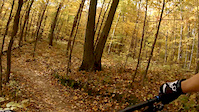
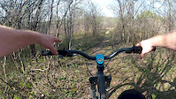
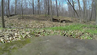
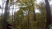
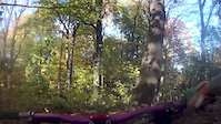
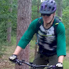
Photos of Uxbridge Mountain Bike
trail: Parking Lot Road
4 |
Jul 3, 2022 @ 7:27am
3 days
trail: Twist and Shout
2 |
Jun 19, 2022 @ 4:46am
Jun 19, 2022
trail: Garter Belt
4 |
Jun 19, 2022 @ 4:21am
Jun 19, 2022
trail: Garter Belt
2 |
Jun 19, 2022 @ 4:17am
Jun 19, 2022
trail: Garter Belt
2 |
Jun 19, 2022 @ 4:17am
Jun 19, 2022
trail: Garter Belt
12 |
Jun 19, 2022 @ 4:16am
Jun 19, 2022Videos of Uxbridge Mountain Bike

trail: Lunartic Way
0:49 |
217 |
Oct 19, 2019

trail: Superfly Alley
3:55 |
256 |
Oct 19, 2019
trail: Sliders Upper
1:31 |
318 |
Oct 20, 2018
trail: The Missing Link
0:23 |
448 |
May 7, 2015
trail: The Missing Link
0:10 |
188 |
Apr 30, 2015

trail: The Missing Link
0:34 |
198 |
Oct 26, 2014
trail: The Missing Link
0:39 |
100 |
Oct 26, 2014
trail: The Missing Link
0:36 |
217 |
Oct 23, 2014
Current Trail Warnings
| status | trail | date | condition | user | info |
|---|---|---|---|---|---|
| 3 Rocks Connector | Jun 26, 2022 @ 8:52am Jun 26, 2022 | Ideal | MapleFlame | Large tree down across trail, blocking... | |
| Timbers Tract - south/west loop | Jun 18, 2022 @ 3:37pm Jun 18, 2022 | Dry | jonathanthemedic | Multiple large trees down. Double and... | |
| Timbers Tract - North/East end - connector | Jun 18, 2022 @ 3:18pm Jun 18, 2022 | Dry | jonathanthemedic | Multiple large trees down on trail. Able... |
Recent Trail Reports
| status | trail | date | condition | info | user |
|---|---|---|---|---|---|
| Concession Rd 7 Access (Inbound Only Trail) | Jul 3, 2022 @ 10:01am 3 days | Ideal | turfjon | ||
| The Open Meadow | Jul 3, 2022 @ 10:01am 3 days | Ideal | turfjon | ||
| Granite Planet | Jul 3, 2022 @ 10:01am 3 days | Ideal | turfjon | ||
| Skin & Bones | Jul 3, 2022 @ 10:01am 3 days | Ideal | turfjon | ||
| DMBA Way | Jul 3, 2022 @ 10:01am 3 days | Ideal | turfjon | ||
| Double Cross | Jul 3, 2022 @ 10:01am 3 days | Ideal | turfjon | ||
| Twist and Shout | Jul 3, 2022 @ 10:01am 3 days | Ideal | turfjon | ||
| Cistern Hill | Jul 3, 2022 @ 10:01am 3 days | Ideal | turfjon | ||
| Seven | Jul 3, 2022 @ 10:01am 3 days | Ideal | turfjon | ||
| Zip Line | Jul 3, 2022 @ 10:01am 3 days | Ideal | turfjon |
Activity Feed
| username | action | type | title | date | |
|---|---|---|---|---|---|
 | turfjon | add | report | Fat Bike Ride and 10 more | Jul 3, 2022 @ 3:16pm 2 days |
| turfjon | add | report | Concession Rd 7 Access (Inbound Only Trail) and 12 more | Jul 3, 2022 @ 3:15pm 2 days |
 | Clarke12346 | wishlist | route | COVID Loop | Jul 3, 2022 @ 12:10pm 3 days |
 | triple-ggg | wishlist | route | Durham EPIC x H&L - Stage 2 - Queen Stage | Jul 3, 2022 @ 7:28am 3 days |
| AniArs | add | photo | in My City | Jul 3, 2022 @ 7:27am 3 days |
Recent Comments
| username | type | title | comment | date | |
|---|---|---|---|---|---|
 | report | It is likely connector back to main parking lot | Jun 4, 2022 @ 12:31pm Jun 4, 2022 | ||
 | report | The Chalk Lake Rd entrance trail remains... | Apr 18, 2022 @ 6:32am Apr 18, 2022 | ||
 | trail | There's been One Way and Do Not Enter signs at... | Mar 14, 2022 @ 1:15pm Mar 14, 2022 | ||
 | trail | Maybe some better signage is needed? | Mar 14, 2022 @ 10:24am Mar 14, 2022 | ||
| trail | Riders, and especially hikers, need to... | Mar 14, 2022 @ 7:38am Mar 14, 2022 |
Local Badges
-

Climbing 100k Badge6 awarded -

10 Blue Trails1,410 awarded -

10 Black Trails905 awarded -

10 Green Trails841 awarded -

Big Ride 30k4,531 awarded -

Completionist11 awarded
Local Mountain Biking Directory
-
Durham Mountain Biking AssociationTrail Association
![Durham Mountain Biking Association]()
Activity Type Stats
| activitytype | trails | distance | descent | descent distance | total vertical | rating | global rank | state rank | photos | reports | routes | ridelogs |
|---|---|---|---|---|---|---|---|---|---|---|---|---|
| Mountain Bike | 255 | 124 miles | 10,804 ft | 48 miles | 472 ft | #24 | #2 | 301 | 6,264 | 39 | 40,725 | |
| E-Bike | 177 | 90 miles | 5,436 ft | 32 miles | 472 ft | 2 | 5,182 | 7 | 274 | |||
| Hike | 249 | 125 miles | 10,482 ft | 48 miles | 472 ft | #18 | #2 | 27 | 6,210 | 10 | 1,198 | |
| Trail Running | 247 | 124 miles | 10,427 ft | 47 miles | 472 ft | #19 | #2 | 6,202 | 17 | 463 | ||
| Horse | 10 | 4 miles | 226 ft | 1 mile | 371 ft | #121 | #2 | 1,120 | 7 | |||
| Snowshoe | 112 | 50 miles | 2,976 ft | 16 miles | 472 ft | #1 | #1 | 278 | 4 | 118 | ||
| Downhill Ski | 31 | 6 miles | 2,900 ft | 5 miles | 420 ft | 46 | 97 | |||||
| Backcountry Ski | 6 | 3 miles | 157 ft | 1 mile | 190 ft | 49 | 11 | |||||
| Nordic Ski | 40 | 19 miles | 1,119 ft | 6 miles | 472 ft | #13 | #2 | 235 | 209 |
- By Red6 & contributors
- Admins: DMBA, ottovelominati
- #3280 - 22,118 views
- uxbridge activity log | embed map of Uxbridge mountain bike trails | uxbridge mountain biking points of interest polygons
Downloading of trail gps tracks in kml & gpx formats is enabled for Uxbridge.
You must login to download files.