1.2 miles
Distance
296 ft
Climb
-12 ft
Descent
00:13:05
Avg time
Supporters, Builders, Maintainers & Land Managers of Jacks Trail
Dream WizardsMaintainer
Jacks Details
-
Activities
- Mountain Bike
- E-Bike
- Hike
- Trail Running
- Observed Trials
-
Riding AreaAlice Lake & Highlands
Squamish, British Columbia -
Difficulty Rating
-
Trail TypeSingletrack
-
Bike TypeAM, XC
-
DirectionBoth DirectionsPopular direction shown
-
Climb DifficultyGreen
-
Physical RatingModerate
-
Seasonsummer
-
Dogs AllowedYes
-
eBike AllowedYes up to Class 1
-
Ride in RainYes
-
Global Ranking#93 in Mountain Biking [+]
- #1132 in E-Biking
- #236 in Trail Running
- #1686 in Hiking
- #206 in Observed Trials
-
Local Popularity100 in Mountain Biking [+]
- 95 in E-Biking
- 100 in Trail Running
- 95 in Hiking
- 5 in Observed Trials
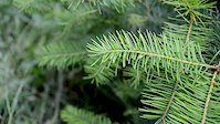
Lovely trail. Great for beginners. Fragrant forest. A couple of steep sections for those who like it or if not accustomed can walk bike Perfect little ride from Garibaldi Highlands to Alice Lake getting most of the climbing out of the way, go for a dip and back again.
Access Info
In Garibaldi Highlands go to end of Perth Rd. Go short way and at T intersection of trail turn left for the Garibaldi Access Road which takes you straight down to Jack's Trail. From below can access trail by a trailhead going up from Tantalus Road
Local Trail Association
-

-

-
Please consider joining or donating to the local trail association to supportdonate to earn trail karma!
trail development & maintenance.
Traditionally Indigenous Territory
More Stats for Jacks mountain bike trail trail
-
Altitude change282 ft
-
Altitude min384 ft
-
Altitude max667 ft
-
Altitude start384 ft
-
Altitude end666 ft
-
Grade4.3%
-
Grade max-4.5%
-
Grade min18.2%
-
Distance climb5,213 ft
-
Distance down781 ft
-
Distance flat502 ft
-
Avg time00:13:05
-
Avg reverse time00:10:20
- view trail stats
close
Trail Conditions
- Unknown
- Snow Groomed
- Snow Packed
- Snow Covered
- Snow Cover Inadequate
- Freeze/thaw Cycle
- Icy
- Prevalent Mud
- Wet
- Variable
- Ideal
- Dry
- Very Dry
Trail Flow (Ridden Direction)
Trailforks scans users ridelogs to determine the most popular direction each trail is ridden. A good flowing trail network will have most trails flowing in a single direction according to their intension.
The colour categories are based on what percentage of riders are riding a trail in its intended direction.
The colour categories are based on what percentage of riders are riding a trail in its intended direction.
- > 96%
- > 90%
- > 80%
- > 70%
- > 50%
- < 50%
- bi-directional trail
- no data
Trail Last Ridden
Trailforks scans ridelogs to determine the last time a trail was ridden.
- < 2 days
- < 1 week
- < 2 weeks
- < 1 month
- < 6 months
- > 6 months
Trail Ridden Direction
The intended direction a trail should be ridden.
- Downhill Only
- Downhill Primary
- Both Directions
- Uphill Primary
- Uphill Only
- One Direction
Contribute Details
Colors indicate trail is missing specified detail.
- Description
- Photos
- Description & Photos
- Videos
Trail Popularity ?
Trailforks scans ridelogs to determine which trails are ridden the most in the last 9 months.
Trails are compared with nearby trails in the same city region with a possible 25 colour shades.
Think of this as a heatmap, more rides = more kinetic energy = warmer colors.
- most popular
- popular
- less popular
- not popular
ATV/ORV/OHV Filter
Max Vehicle Width
inches
Radar Time
x
Activity Recordings
Trailforks users anonymized public ridelogs from the past 6 months.
- mountain biking recent
- mountain biking (>6 month)
- hiking (1 year)
- moto (1 year)
Activity Recordings
Trailforks users anonymized public skilogs from the past 12 months.
- Downhill Ski
- Backcountry Ski
- Nordic Ski
Jump Magnitude Heatmap
Heatmap of where riders jump on trails. Zoom in to see individual jumps, click circles to view jump details.
Trails Deemphasized
Trails are shown in grey.
Only show trails with NO bikes.
Save the current map location and zoom level as your default home location whenever this page is loaded.
Save
Directions to jacks trailhead
(49.758760, -123.126460)
update trails status or condition
Jacks Trail Reports
view all reports »
Recent Ridelog Activity on Trail
Past Week
- 58 rides
- 11 miles avg distance
6 Months
- 1,579 rides
- 11 miles avg distance
All
- 16,759 rides
Photos
more »
Trail Lists
-
 SQUAMISH Alice Lake13 trails
 -
SORCA 29 Trails
29 trails
Routes with this trail
more »
Trail Products
-
 SORCA Trail SupporterTrail Pass
Videos
more »


Nearby Trails
- Brackentrail 79 ft
- Access 5 344 ft
- Brackentrail Exit 797 ft
- Icy Hole - Original Exit 1,089 ft
- Rico 1,129 ft
Alice Lake & Highlands
- embed Jacks trail on your website
- By BCpov
 & contributors
 - #926 - 18,144 views
- subscribe
- login to download gpx or kml files.