close
Trail Conditions
- Unknown
- Snow Groomed
- Snow Packed
- Snow Covered
- Snow Cover Inadequate
- Freeze/thaw Cycle
- Icy
- Prevalent Mud
- Wet
- Variable
- Ideal
- Dry
- Very Dry
Trail Flow (Ridden Direction)
Trailforks scans users ridelogs to determine the most popular direction each trail is ridden. A good flowing trail network will have most trails flowing in a single direction according to their intension.
The colour categories are based on what percentage of riders are riding a trail in its intended direction.
The colour categories are based on what percentage of riders are riding a trail in its intended direction.
- > 96%
- > 90%
- > 80%
- > 70%
- > 50%
- < 50%
- bi-directional trail
- no data
Trail Last Ridden
Trailforks scans ridelogs to determine the last time a trail was ridden.
- < 2 days
- < 1 week
- < 2 weeks
- < 1 month
- < 6 months
- > 6 months
Trail Ridden Direction
The intended direction a trail should be ridden.
- Downhill Only
- Downhill Primary
- Both Directions
- Uphill Primary
- Uphill Only
- One Direction
Contribute Details
Colors indicate trail is missing specified detail.
- Description
- Photos
- Description & Photos
- Videos
Trail Popularity ?
Trailforks scans ridelogs to determine which trails are ridden the most in the last 9 months.
Trails are compared with nearby trails in the same city region with a possible 25 colour shades.
Think of this as a heatmap, more rides = more kinetic energy = warmer colors.
- most popular
- popular
- less popular
- not popular
ATV/ORV/OHV Filter
Max Vehicle Width
inches
Radar Time
x
Activity Recordings
Trailforks users anonymized public ridelogs from the past 6 months.
- mountain biking recent
- mountain biking (>6 month)
- hiking (1 year)
- moto (1 year)
Activity Recordings
Trailforks users anonymized public skilogs from the past 12 months.
- Downhill Ski
- Backcountry Ski
- Nordic Ski
Jump Magnitude Heatmap
Heatmap of where riders jump on trails. Zoom in to see individual jumps, click circles to view jump details.
Trails Deemphasized
Trails are shown in grey.
Only show trails with NO bikes.
Save the current map location and zoom level as your default home location whenever this page is loaded.
SavePopular Trail Networks
view all areas »
No description for Brisbane has been added yet!
Login or register to submit one.
Activities Click to view
- Mountain Bike
473 trails
- E-Bike
480 trails
- Hike
436 trails
- Trail Running
436 trails
- Horse
47 trails
- Dirtbike/Moto
32 trails
- ATV/ORV/OHV
30 trails
- Snowmobile
0 trails
- Snowshoe
0 trails
- Nordic Ski
0 trails
Region Details
- 306
- 8
- 60
- 78
- 19
Region Status
Caution as of Mar 15, 2022Stats
- Avg Trail Rating
- Trails (view details)
- 535
- Trails Mountain Bike
- 474
- Trails E-Bike
- 480
- Trails Hike
- 436
- Trails Trail Running
- 436
- Trails Horse
- 47
- Trails Dirtbike/Moto
- 32
- Trails Observed Trials
- 1
- Trails ATV/ORV/OHV
- 30
- Total Distance
- 602 miles
- Total Descent
- 91,827 ft
- Total Vertical
- 2,435 ft
- Highest Trailhead
- 2,439 ft
- Reports
- 6,857
- Photos
- 950
- Ridden Counter
- 203,312
Sub Regions
-
Banks Street Reserve
- 1
- 1
-
Belmont Hills Reserve
-
Bunyaville Conservation Park
- 3
- 13
- 2
-
Clear Mountain Conservation Park
- 1
- 2
- 1
-
Cornubia Forest Park
- 6
- 9
- 1
-
Daisy Hill
- 1
- 5
- 19
- 1
-
D’Aguilar National Park
-
Eildon Hill Reserve / Constitution
- 1
-
Gap Creek Reserve
- 6
- 17
- 4
-
Glasshouse Mountains Conservation Park
- 9
- 5
- 2
-
House Mountain
-
John Oxley Reserve
-
Karawatha Forest
- 5
-
Moggill Regional Park
- 2
- 3
- 5
-
Mount Coot-tha Forest
- 2
- 1
-
Mount Ommaney Bushland Reserve
- 1
-
Pooh Corner Bushland Reserve
-
Pullen Reach Bushland Reserve
-
Rocks Riverside Park
- 1
- 2
-
Samford Conservation Park
- 2
- 7
- 5
- 2
-
Sergeant Dan Stiller Memorial Reserve
- 1
-
Toohey Forest
-
Whites Hill Reserve
-
Wolston Creek Bushland Reserve
- 5
Popular Brisbane Mountain Biking Trails
Brisbane Mountain Bike Routes
| title | rating | distance |
|---|---|---|
| Daisy Hill Sampler | 6 miles | |
| Daisy Hill 2 Hr Loop | 10 miles | |
| Steam Train | 7 miles | |
| Bunya Express Loop | 6 miles | |
| Shimano MTB GP 2022 - Logan - QLD | 6 miles | |
| Bunya Tracks 3,2,1,8,9,10,1,4,5,6,7 | 13 miles | |
| Getting down and dirty at Daisy Hill | 17 miles | |
| Extended Daisy-Funderwood loop | 18 miles | |
| Epic Training 21km Loop | 13 miles | |
| Enoggera Dam Frog | 10 miles |
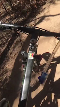
Photos of Brisbane Mountain Bike
trail: Wiry Panic
2 |
Jun 24, 2022 @ 3:38pm
Jun 24, 2022
trail: Wiry Panic
1 |
Jun 24, 2022 @ 3:37pm
Jun 24, 2022
trail: Wiry Panic
18 |
Jun 24, 2022 @ 3:36pm
Jun 24, 2022
trail: Joyners Ridge Road
205 |
Sep 11, 2020 @ 8:02pm
Sep 11, 2020
trail: Fat Controller Down
233 |
Nov 23, 2019 @ 6:48pm
Nov 23, 2019
trail: Rail Conductor
254 |
Jul 10, 2019 @ 9:28pm
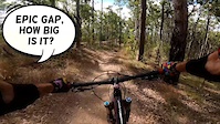
Jul 10, 2019Videos of Brisbane Mountain Bike
trail: Kombi (8)
288 |
Nov 29, 2021
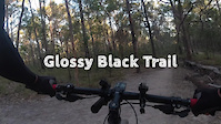
trail: Glossy Black
101 |
Aug 24, 2021
trail: Clear Mountain DH (Original)
179 |
May 28, 2021
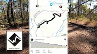
trail: Carnivore (6)
117 |
May 17, 2021

trail: Creek Track (4)
95 |
May 16, 2021
trail: Steps (7)
119 |
May 16, 2021

trail: Wallaby (1)
80 |
May 16, 2021
trail: Minivan (9)
69 |
May 11, 2021
Current Trail Warnings
| status | trail | date | condition | user | info |
|---|---|---|---|---|---|
| Rocket Frog Trail | Jun 30, 2022 @ 3:56pm Jun 30, 2022 | Prevalent Mud | mr-t-80 | The top section (inc. rocket frog link)... | |
| Ginger Gully | Jun 23, 2022 @ 1:01pm Jun 23, 2022 | Variable | Sneaky-Pete NTCA | Small tree down across trail | |
| Resurrection | Jun 23, 2022 @ 12:58pm Jun 23, 2022 | Variable | Sneaky-Pete NTCA | Large tree down across trail, blocking trail |
Recent Trail Reports
| status | trail | date | condition | info | user |
|---|---|---|---|---|---|
| South Boundary Road | Jul 3, 2022 @ 11:45am 3 days | Ideal | aviator99 | ||
| Bellbird Trail | Jul 3, 2022 @ 11:45am 3 days | Ideal | aviator99 | ||
| Bandicoot Byway | Jul 2, 2022 @ 9:38pm Jul 2, 2022 | Wet | RyanPqfBxW | ||
| Quail Trail | Jul 2, 2022 @ 1:22pm Jul 2, 2022 | Variable | ElKeano | ||
| Frog Link | Jun 30, 2022 @ 10:08pm Jun 30, 2022 | Ideal | mr-t-80 | ||
| Jurassic (2) | Jun 30, 2022 @ 5:04am Jun 30, 2022 | Dry | Dark-sider | ||
| Wallaby Mob | Jun 27, 2022 @ 7:17pm Jun 27, 2022 | Variable | aviator99 | ||
| Wacol Overlook | Jun 27, 2022 @ 1:59pm Jun 27, 2022 | Ideal | aviator99 | ||
| Swamp Bottom Trail | Jun 27, 2022 @ 1:59pm Jun 27, 2022 | Variable | aviator99 | ||
| Tomkins Drop | Jun 27, 2022 @ 1:59pm Jun 27, 2022 | Ideal | aviator99 |
Activity Feed
| username | action | type | title | date | |
|---|---|---|---|---|---|
 | aviator99 | add | report | South Boundary Road and 1 more | Jul 5, 2022 @ 3:27am 23 hours |
 | mr-t-80 | difficultyvote | trail | Rocket Frog Trail | Jul 4, 2022 @ 9:57pm 1 day |
| arnzzboi | ridden | trail | Gap Creek Circuit and 4 more | Jul 3, 2022 @ 7:39pm 2 days |
| aviator99 | add | trail | Jennifer | Jul 3, 2022 @ 5:35am 3 days |
| Swilliams73 | ridden | trail | Bandicoot Byway and 1 more | Jul 2, 2022 @ 10:19pm Jul 2, 2022 |
Recent Comments
| username | type | title | comment | date | |
|---|---|---|---|---|---|
| trail | Agree | Jun 19, 2022 @ 7:31pm Jun 19, 2022 | ||
| trail | Downhill is still fun very overgrown doesn’t... | May 9, 2022 @ 3:08am May 9, 2022 | ||
| trail | Ridden on 8/5/22, starting from Upper Kedron... | May 7, 2022 @ 10:14pm May 7, 2022 | ||
| trail | Lots of berms couple jumps amazing trail... | May 3, 2022 @ 5:53pm May 3, 2022 | ||
| trail | I think this should be the opposite direction | May 2, 2022 @ 10:42pm May 2, 2022 |
Local Badges
-

10 Blue Trails2,178 awarded -

10 Green Trails1,775 awarded -

Big Ride 30k43,781 awarded -

10 Black Trails664 awarded -

Epic Ride 50k16,596 awarded -

Climbing 10k Badge1,121 awarded
Bike & Skill Parks
| name | type | city | rating |
|---|---|---|---|
| Amazons Place Park Dirt Jumps | skill park | Brisbane | |
| BMX Bandits | skill park | Brisbane | |
| Brian Battersby Park Dirt Jumps | skill park | Brisbane | |
| Darra Pump Track (Monier Road BMX Facility) | skill park | Brisbane | |
| DM Henderson Park Pump Track | skill park | Brisbane |
Local Products

Local Trail Supporters
- Logan City Trail Alliance
![]()
Activity Type Stats
| activitytype | trails | distance | descent | descent distance | total vertical | rating | global rank | state rank | photos | reports | routes | ridelogs |
|---|---|---|---|---|---|---|---|---|---|---|---|---|
| Mountain Bike | 473 | 542 miles | 83,136 ft | 232 miles | 2,434 ft | #15 | #2 | 878 | 6,809 | 36 | 271,329 | |
| E-Bike | 480 | 559 miles | 86,171 ft | 234 miles | 2,434 ft | #6 | #1 | 30 | 6,107 | 13 | 12,695 | |
| Hike | 436 | 463 miles | 71,781 ft | 191 miles | 2,434 ft | #45 | #3 | 21 | 6,436 | 2 | 3,056 | |
| Trail Running | 436 | 463 miles | 71,781 ft | 191 miles | 2,434 ft | #46 | #4 | 21 | 6,439 | 15 | 4,755 | |
| Horse | 47 | 84 miles | 10,358 ft | 27 miles | 2,431 ft | #20 | #1 | 1,633 | 9 | |||
| Dirtbike/Moto | 32 | 76 miles | 10,472 ft | 35 miles | 1,906 ft | #12 | 1,595 | 1 | 60 | |||
| Observed Trials | 1 | 1 mile | 112 ft | 2,736 ft | 112 ft | 10 | 11 | |||||
| ATV/ORV/OHV | 30 | 75 miles | 10,269 ft | 35 miles | 1,890 ft | #8 | 1,597 | 35 |
- By brenthillier
 NSMBA TRAILFORKS & contributors
 - Admins: Jake-Hannah, Addzz, MTBA, BORRA
- #12581 - 68,426 views
- brisbane activity log | embed map of Brisbane mountain bike trails | brisbane mountain biking points of interest polygons
Downloading of trail gps tracks in kml & gpx formats is enabled for Brisbane.
You must login to download files.