Details
-
Activities
- Mountain Bike
- Hike
- Trail Running
-
Riding AreaGalbraith
Bellingham, Washington -
Difficulty Rating
-
Voted DifficultyBlue (3 votes)
-
Trail TypeSingletrack
-
Bike TypeAM
-
DirectionBoth Directions
-
Climb DifficultyBlue
-
Physical RatingModerate
-
Dogs AllowedYes
-
eBike Allowed
-
Ride in RainYes
-
Global Ranking
-
Local Popularity100 in Mountain Biking [+]
- 100 in Trail Running
- 100 in Hiking
The Ridge Trail is no longer a one-way trail as of 8/23/21, WMBC notice here: https://www.wmbcmtb.org/post/galbraith-mountain-trails-are-back-to-multi-directional
The Ridge Trail is the classic means of access to Galbraith from the north side. It is the primarily climbing route these days, with SST being the primary descent. If you do descend the Ridge, keep in mind that you will most likely be encountering tons of uphill bike traffic. There are numerous places to jump on and off the access road from the single track on the way up - keep to the right for the more difficult singletrack route. With its unrelenting grade and numerous rock/root sections, the Ridge will test your fitness level. There is a fantastic view spot overlooking Bellingham about 2/3 of the way up.
Disclaimer
Ridge Trail Temporarily ONE WAY ONLY!
Local Trail Association
-

-
Please consider joining or donating to the local trail association to supportdonate to earn trail karma!
trail development & maintenance.
Traditionally Indigenous Territory
More Stats for Ridge Trail (from Viewpoint North) mountain bike trail trail
-
Altitude change389 ft
-
Altitude min454 ft
-
Altitude max843 ft
-
Altitude start454 ft
-
Altitude end843 ft
-
Grade8.3%
-
Grade max1.7%
-
Grade min32.6%
-
Distance climb4,708 ft
-
Avg time00:12:58
-
Avg reverse time00:11:27
- view trail stats
- Unknown
- Snow Groomed
- Snow Packed
- Snow Covered
- Snow Cover Inadequate
- Freeze/thaw Cycle
- Icy
- Prevalent Mud
- Wet
- Variable
- Ideal
- Dry
- Very Dry
The colour categories are based on what percentage of riders are riding a trail in its intended direction.
- > 96%
- > 90%
- > 80%
- > 70%
- > 50%
- < 50%
- bi-directional trail
- no data
- < 2 days
- < 1 week
- < 2 weeks
- < 1 month
- < 6 months
- > 6 months
- Downhill Only
- Downhill Primary
- Both Directions
- Uphill Primary
- Uphill Only
- One Direction
- Description
- Photos
- Description & Photos
- Videos
- most popular
- popular
- less popular
- not popular
- mountain biking recent
- mountain biking (>6 month)
- hiking (1 year)
- moto (1 year)
- Downhill Ski
- Backcountry Ski
- Nordic Ski
Save the current map location and zoom level as your default home location whenever this page is loaded.
SaveRidge Trail... Trail Reports
Recent Ridelog Activity on Trail
Past Week
- 94 rides
- 11 miles avg distance
6 Months
- 2,537 rides
- 11 miles avg distance
All
- 20,894 rides
Photos
Routes with this trail
Trail Products

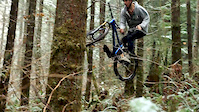
Videos


Nearby Trails
- Dj Access 299 ft
- Fancy Switchback 1,302 ft
- Dj Trail 1,532 ft
- Connector 1,535 ft
- Up 2 Something 1,663 ft
- embed Ridge Trail (from Viewpoint North) trail on your website
- By kyleyoungtransition & contributors
- #8496 - 7,576 views
- subscribe
- login to download gpx or kml files.