2,287 ft
Distance
23 ft
Climb
-196 ft
Descent
00:02:48
Avg time
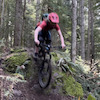
Poppin' Tops Upper Details
-
Activities
- Mountain Bike
-
Riding AreaRaging River State Forest
Snoqualmie, Washington -
Difficulty Rating
-
Voted DifficultyBlue (8 votes)
-
Trail TypeSingletrack
-
Bike TypeDH, AM, XC
-
DirectionDownhill OnlyPopular direction shown
-
Physical RatingHard
-
Trail VisibilityAlways easy to follow
-
Family FriendlyYes
-
Dogs AllowedYes
-
eBike Allowed
-
TTFs on TrailBerm, Drop, Jump
-
Global Ranking#152 in Mountain Biking
-
Local Popularity95 in Mountain Biking
-
Land ManagerDepartment of Natural Resources
Trail Open
An descending only trail for advanced riders only. This trail is much more challenging than lower Poppin' Tops & Flow State Trails. The progression is intentional, allowing riders to literally and figuratively "work their way up the mountain.
Local Trail Association
-

-
Please consider joining or donating to the local trail association to supportdonate to earn trail karma!
trail development & maintenance.
Traditionally Indigenous Territory
More Stats for Poppin' Tops Upper mountain bike trail trail
-
Altitude change-173 ft
-
Altitude min1,885 ft
-
Altitude max2,058 ft
-
Altitude start2,058 ft
-
Altitude end1,886 ft
-
Grade-7.5%
-
Grade max-43.4%
-
Grade min14.5%
-
Distance climb413 ft
-
Distance down1,873 ft
-
Avg time00:02:48
-
Avg reverse time00:01:30
- view trail stats
close
Trail Conditions
- Unknown
- Snow Groomed
- Snow Packed
- Snow Covered
- Snow Cover Inadequate
- Freeze/thaw Cycle
- Icy
- Prevalent Mud
- Wet
- Variable
- Ideal
- Dry
- Very Dry
Trail Flow (Ridden Direction)
Trailforks scans users ridelogs to determine the most popular direction each trail is ridden. A good flowing trail network will have most trails flowing in a single direction according to their intension.
The colour categories are based on what percentage of riders are riding a trail in its intended direction.
The colour categories are based on what percentage of riders are riding a trail in its intended direction.
- > 96%
- > 90%
- > 80%
- > 70%
- > 50%
- < 50%
- bi-directional trail
- no data
Trail Last Ridden
Trailforks scans ridelogs to determine the last time a trail was ridden.
- < 2 days
- < 1 week
- < 2 weeks
- < 1 month
- < 6 months
- > 6 months
Trail Ridden Direction
The intended direction a trail should be ridden.
- Downhill Only
- Downhill Primary
- Both Directions
- Uphill Primary
- Uphill Only
- One Direction
Contribute Details
Colors indicate trail is missing specified detail.
- Description
- Photos
- Description & Photos
- Videos
Trail Popularity ?
Trailforks scans ridelogs to determine which trails are ridden the most in the last 9 months.
Trails are compared with nearby trails in the same city region with a possible 25 colour shades.
Think of this as a heatmap, more rides = more kinetic energy = warmer colors.
- most popular
- popular
- less popular
- not popular
ATV/ORV/OHV Filter
Max Vehicle Width
inches
Radar Time
x
Activity Recordings
Trailforks users anonymized public ridelogs from the past 6 months.
- mountain biking recent
- mountain biking (>6 month)
- hiking (1 year)
- moto (1 year)
Activity Recordings
Trailforks users anonymized public skilogs from the past 12 months.
- Downhill Ski
- Backcountry Ski
- Nordic Ski
Jump Magnitude Heatmap
Heatmap of where riders jump on trails. Zoom in to see individual jumps, click circles to view jump details.
Trails Deemphasized
Trails are shown in grey.
Only show trails with NO bikes.
Save the current map location and zoom level as your default home location whenever this page is loaded.
Save
Directions to poppin--tops-upper-129882 trailhead
(47.492910, -121.833770)
update trails status or condition
Poppin' Tops Upper Trail Reports
view all reports »
Recent Ridelog Activity on Trail
Past Week
- 135 rides
- 9 miles avg distance
6 Months
- 951 rides
- 9 miles avg distance
All
- 14,262 rides


Photos
more »
Routes with this trail
more »
Trail Products

-
+ 0
 AnjaBerg
open today!! upper poppin tops is essentially the same but lower rides so different
[Reply]


KirkWernertSM
(Apr 20, 2022 at 21:52)
Still closed, except for the two asshats who rode it on April 17th
[Reply]
photodog
 (Feb 16, 2021 at 8:15)
I think the black diamond rating on this trail is responsible for the amount of complaints about CCDH being a blue. But just like CCDH, trail ratings are subjective so all anyone needs to know is that all the more difficult features are optional so it can be ridden as an intermediate if you choose. There's great sight-lines so even on a first run you'll know what you're in for. It's a great way to end your ride after hitting up the rest of the mountain.
[Reply]
jakemannix
(Oct 14, 2020 at 7:23)
If you take this slow, it’s totally doable for a more intermediate rider. You won’t have the fun of those great tabletop jumps, but you’ll manage just fine. Very flowy and fast (if you let it), but less technical than say Joyride in Tiger (which is just a blue)
[Reply]
bryanbb
(May 5, 2020 at 16:35)
Open and running well. Massive berm at the top and some root drops. Pay attention!
[Reply]
bryanbb
(May 5, 2020 at 16:33)
Open and running well. Massive berm right at the top, some technical root drops as well. Pay attention!
[Reply]
Videos
more »

2:54 |
86 |
Jun 14, 2022 , Snoqualmie

6:54 |
106 |
May 15, 2022 , Snoqualmie

3:36 |
130 |
Nov 4, 2021 , Snoqualmie

6:49 |
438 |
Jun 14, 2021 , Snoqualmie
Nearby Trails
- Crossover Connection- Stan's Overlook 0 ft
- Raging Ridge 469 ft
- Poppin' Tops Lower 1,683 ft
- Connector 2,677 ft
- Dash 2,759 ft
Raging River State Forest
- embed Poppin' Tops Upper trail on your website
- By boxxerace TRAILFORKS J-GULCH & contributors
- #129882 - 13,978 views
- subscribe
- login to download gpx or kml files.